MyTopo
Mount Gilead East North Carolina US Topo Map
Couldn't load pickup availability
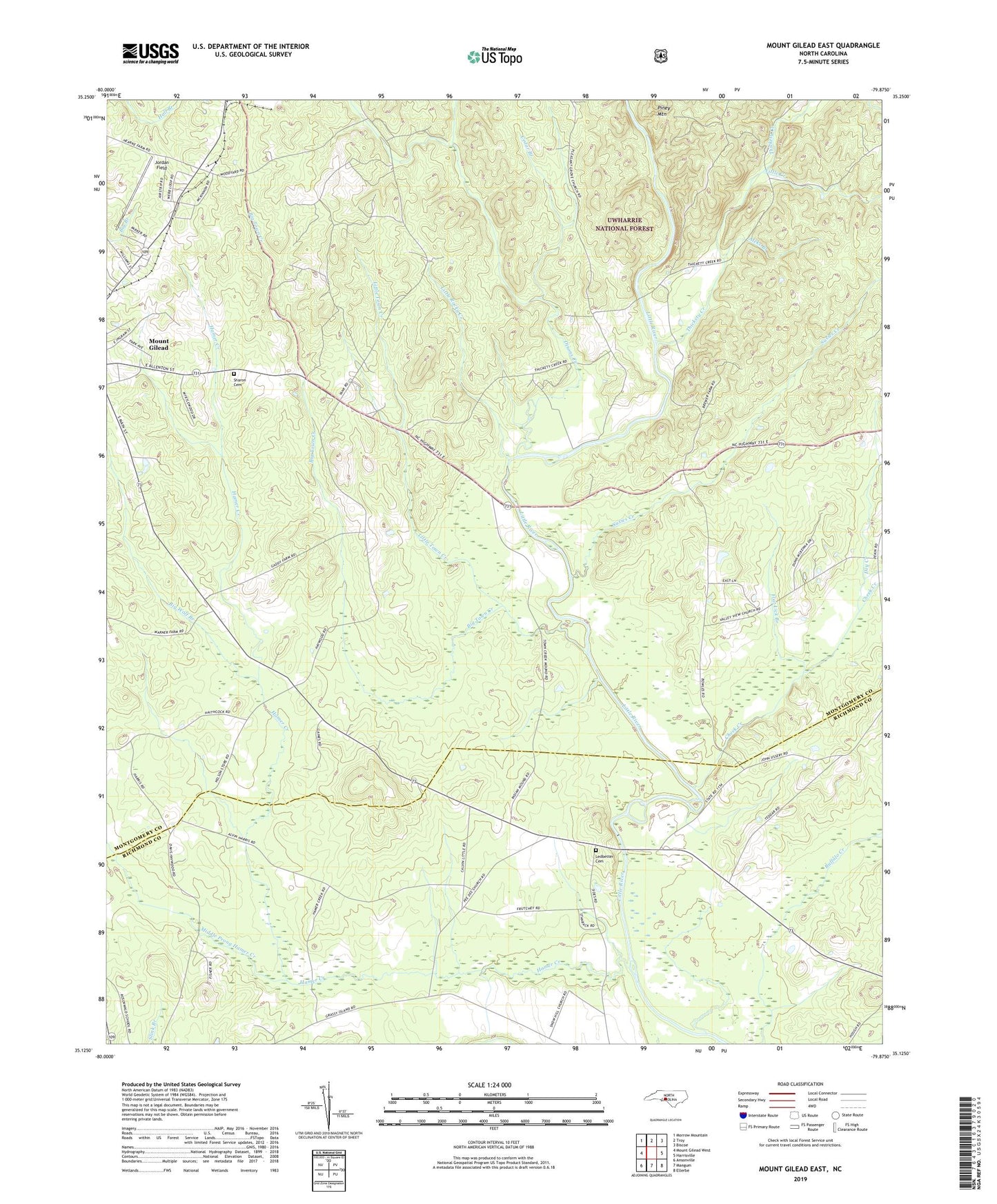
2019 topographic map quadrangle Mount Gilead East in the state of North Carolina. Scale: 1:24000. Based on the newly updated USGS 7.5' US Topo map series, this map is in the following counties: Montgomery, Richmond. The map contains contour data, water features, and other items you are used to seeing on USGS maps, but also has updated roads and other features. This is the next generation of topographic maps. Printed on high-quality waterproof paper with UV fade-resistant inks.
Quads adjacent to this one:
West: Mount Gilead West
Northwest: Morrow Mountain
North: Troy
Northeast: Biscoe
East: Harrisville
Southeast: Ellerbe
South: Mangum
Southwest: Ansonville
Contains the following named places: Aleks Branch, Big Town Creek, Big Wolf Branch, Cedar Branch, Cheek Creek, Disons Creek, Dry Creek, Flat Lick Branch, Hamer Creek, Highland Middle School, Holly Mount Church, Ingram Chapel, Jordan Field, Ledbetter Cemetery, Little Creek, Little River Church, Little Rocky Creek, Little Town Creek, Littles Mill, Middle Prong Hamer Creek, Mount Airy Church, Mountain Grove Church, North Carolina State Reservation, Oak Ridge Church, Olive Grove Church, Pee Dee Church, Pleasant Grove Church, Sharon Cemetery, Snow Hill Church, Stanback Park, Susies Creek, Thickety Creek, Town Creek Indian Mound, Town Creek Indian Mound State Historic Site, Township of Cheek Creek, Township of Mount Gilead, Township of Steeles, Uwbarrie Game Land, Uwharrie Game Land, ZIP Code: 27306