MyTopo
Swansboro North Carolina US Topo Map
Couldn't load pickup availability
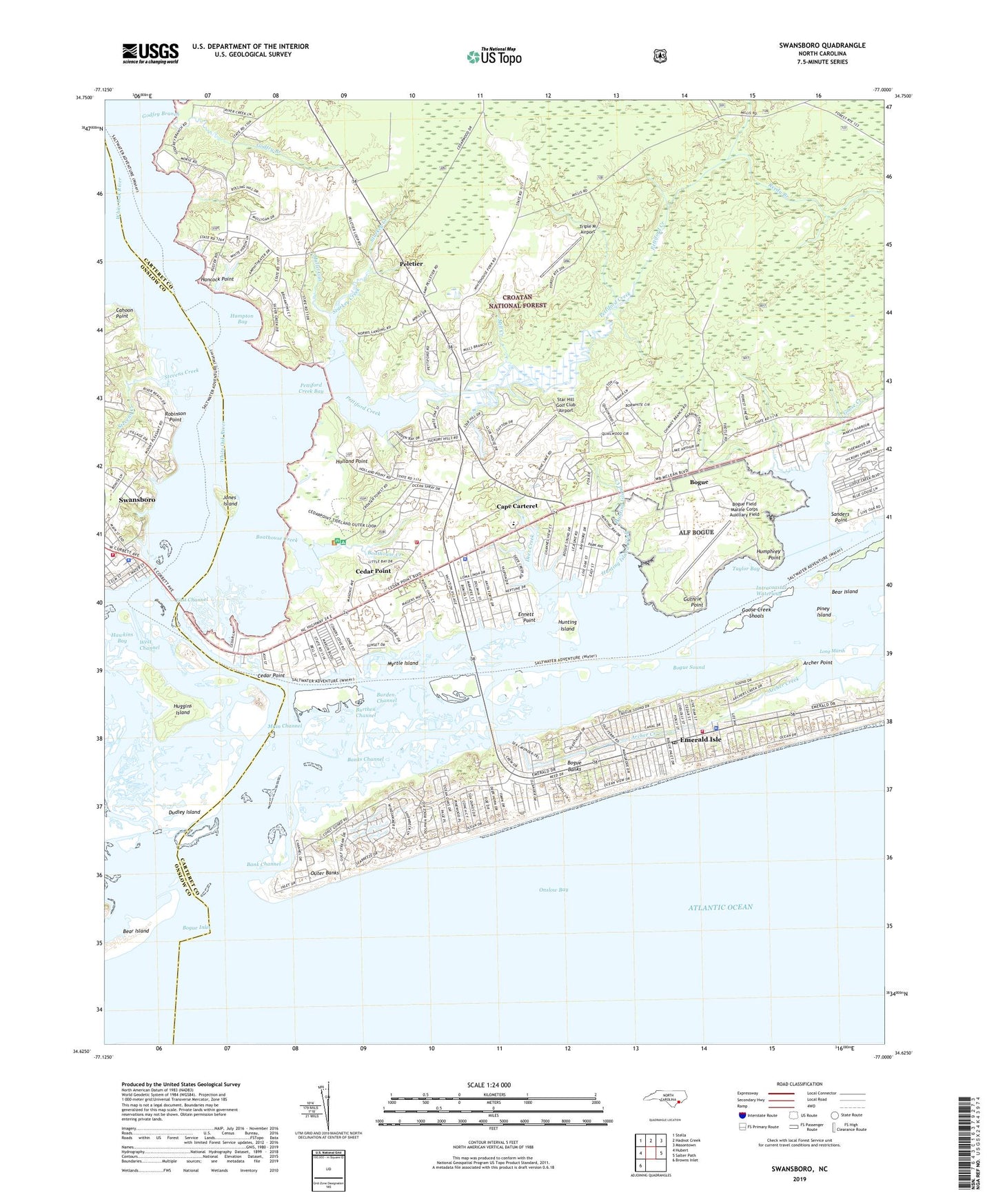
2019 topographic map quadrangle Swansboro in the state of North Carolina. Scale: 1:24000. Based on the newly updated USGS 7.5' US Topo map series, this map is in the following counties: Carteret, Onslow. The map contains contour data, water features, and other items you are used to seeing on USGS maps, but also has updated roads and other features. This is the next generation of topographic maps. Printed on high-quality waterproof paper with UV fade-resistant inks.
Quads adjacent to this one:
West: Hubert
Northwest: Stella
North: Hadnot Creek
Northeast: Masontown
East: Salter Path
Southwest: Browns Inlet
Contains the following named places: Archer Creek, Archer Point, Bank Channel, Banks Channel, Bayshore Park, Bear Island, Boathouse Creek, Bogue, Bogue Field Marine Corps Auxiliary Field, Bogue Inlet, Bogue Inlet Pier, Bogue School, Bucks Corner, Burden Channel, Burthen Channel, Cahoon Point, Cape Carteret, Cape Carteret Police Department, Caspers Marina, Cedar Point, Cedar Point Recreation Site, Country Club Point, Deer Creek, Dubling Creek, Dudley Island, East Channel, Emerald Isle Emergency Medical Services, Emerald Isle Fire Department Station 1 Headquarters, Emerald Isle Police Department, Emerald Isle Post Office, Ennett Point, Godfry Branch, Goose Creek, Goose Creek Shoals, Guthrie Point, Hampton Bay, Hancock Point, Hawkins Bay, Holland Point, Huggins Island, Humphrey Point, Hunting Island, Hunting Island Creek, Island Harbor Marina, Jones Island, Lands End, Long Marsh, Main Channel, Mill Creek, Mullet Gut, Myrtle Island, New Visitors Center, Ocean Crest, Ocean Spray Mobile Home Estates, Pages Mobile Home Park, Pebble Beach, Peletier, Peletier Fire Tower, Pettiford Creek, Pettiford Creek Bay, Piney Creek, Piney Island, Point Emerald Villas, Queens Court, Reedy Branch, Robinson Point, Sanders Creek, Sanders Point, Sound of the Sea, South Lees, Star Hill Golf and Country Club, Star Hill Golf Club Airport, Starkey Creek, Stevens Creek, Swansboro, Swansboro Fire Department, Swansboro Police Department, Taylor Bay, Town of Bogue, Town of Cape Carteret, Town of Cedar Point, Town of Emerald Isle, Town of Peletier, Township of White Oak, Triple M Airport, United States Coast Guard - Emerald Isle Station, West Channel, Western Carteret Fire Department and Emergency Medical Services, White Oak River, Whitehouse Forks, ZIP Code: 28584