MyTopo
Wayah Bald North Carolina US Topo Map
Couldn't load pickup availability
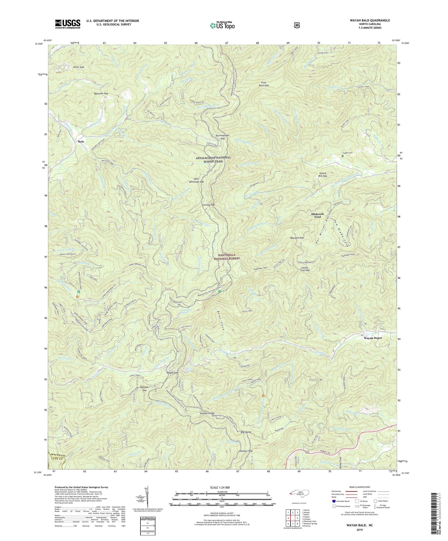
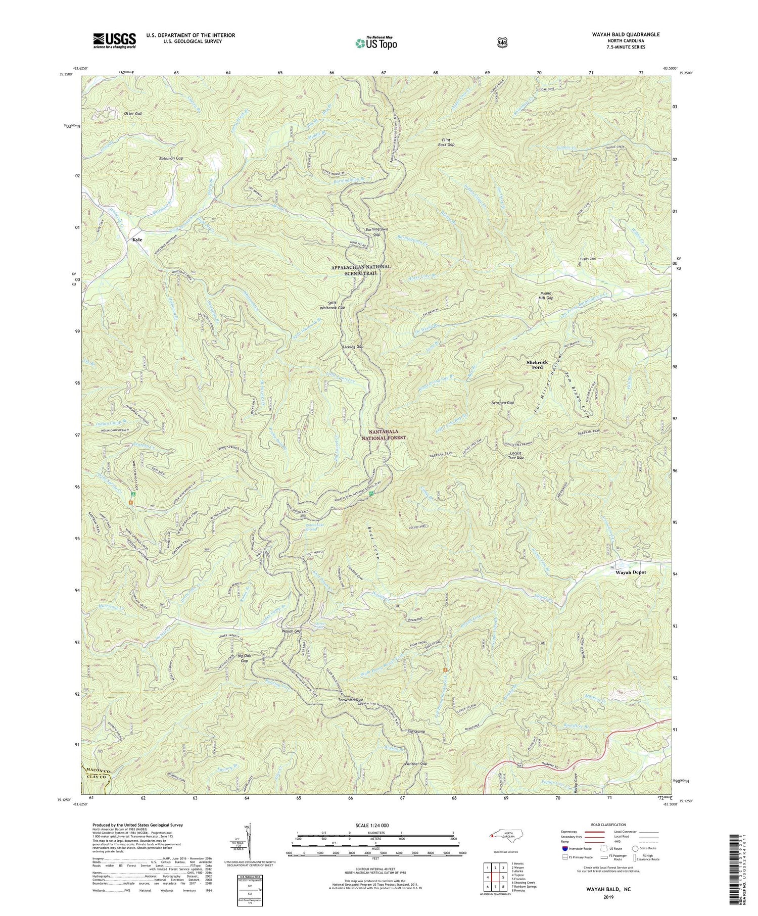
2019 topographic map quadrangle Wayah Bald in the state of North Carolina. Scale: 1:24000. Based on the newly updated USGS 7.5' US Topo map series, this map is in the following counties: Macon, Clay. The map contains contour data, water features, and other items you are used to seeing on USGS maps, but also has updated roads and other features. This is the next generation of topographic maps. Printed on high-quality waterproof paper with UV fade-resistant inks.
Quads adjacent to this one:
West: Topton
Northwest: Hewitt
North: Wesser
Northeast: Alarka
East: Franklin
Southeast: Prentiss
South: Rainbow Springs
Southwest: Shooting Creek
Contains the following named places: Arrowwood Creek, Arrowwood Glade Picnic Area, Arrowwood Glade Rearing Pools, Bateman Branch, Bateman Gap, Batey Branch, Bear Cove, Bearpen Creek, Bearpen Gap, Ben Creek, Berties Falls, Big Branch, Big Laurel Creek, Big Oak Gap, Big Stamp, Black Bald, Boardtree Branch, Bridge Branch, Brushy Branch, Buck Mountain, Burningtown Bald, Burningtown Branch, Burningtown Gap, Camp Branch, Chestnut Knob, Cold Spring Appalachian Trail Shelter, Cold Spring Creek, Colts Ridge, Conley Camp Branch, Copper Knob, Copper Ridge, Copper Ridge Bald, Crawford Cove, De Weese Branch, Dirty John Creek, Dry Branch, Fall Branch, Fire Gap Ridge, Flat Knob, Flint Rock Gap, Goat Bald, Gold Pit Creek, Grape Cove Branch, Holloway Branch, Horse Cove Branch, Horse Ridge, Indian Camp Creek, Jarrett Bald, Joe Dave Branch, Kit Spring Branch, Kyle, Larry Brush Branch, Left Prong Burningtown Creek, Left Prong Ray Branch, Left Prong Rough Fork, Licklog Gap, Little Laurel Creek, Locust Tree Branch, Locust Tree Gap, Long Branch, Mc Donald Ridge, Middle Branch, Middle Ridge, Milksick Knob, Mount Sinai Church, Muskrat Ridge, Nantahala Mountains, Nantahala National Forest, NC Noname One-Hundred Thirty-Nine Dam, Oakdale Church, Otter Gap, Otter Mountain, Panther Gap, Panther Knob, Pol Miller Hollow, Pound Mill Gap, Rartram Trail, Rattlesnake Knob, Rattlesnake Spring, Ray Branch, Right Prong Ray Branch, Right Prong Rough Fork, Roaring Fork, Roaring Fork Ridge, Robin Branch, Rocky Bald, Rocky Bald Branch, Rocky Bald Ridge, Rocky Cove, Rocky Knob, Roper Knob, Rough Fork, Rufus Morgan Trail, Sally Cove, Sassafras Branch, Sheep Knob, Shot Pouch Creek, Siler Bald, Siler Bald Shelter, Slickrock Ford, Snowbird Gap, Split Whiteoak Branch, Split Whiteoak Gap, Split Whiteoak Ridge, Tellico Bald, Thorn Mountain, Thorn Mountain Trail, Tippet Cemetery, Tom Bryan Cove, Township of Burningtown, Trail Ridge, Trimont Ridge, Wayah Bald, Wayah Bald Recreation Site, Wayah Crest Camp Ground, Wayah Depot, Wayah Gap, Whiteoak Flats Church, Wildes Knob, Wilson Lick Ranger Station, Wine Spring Bald