MyTopo
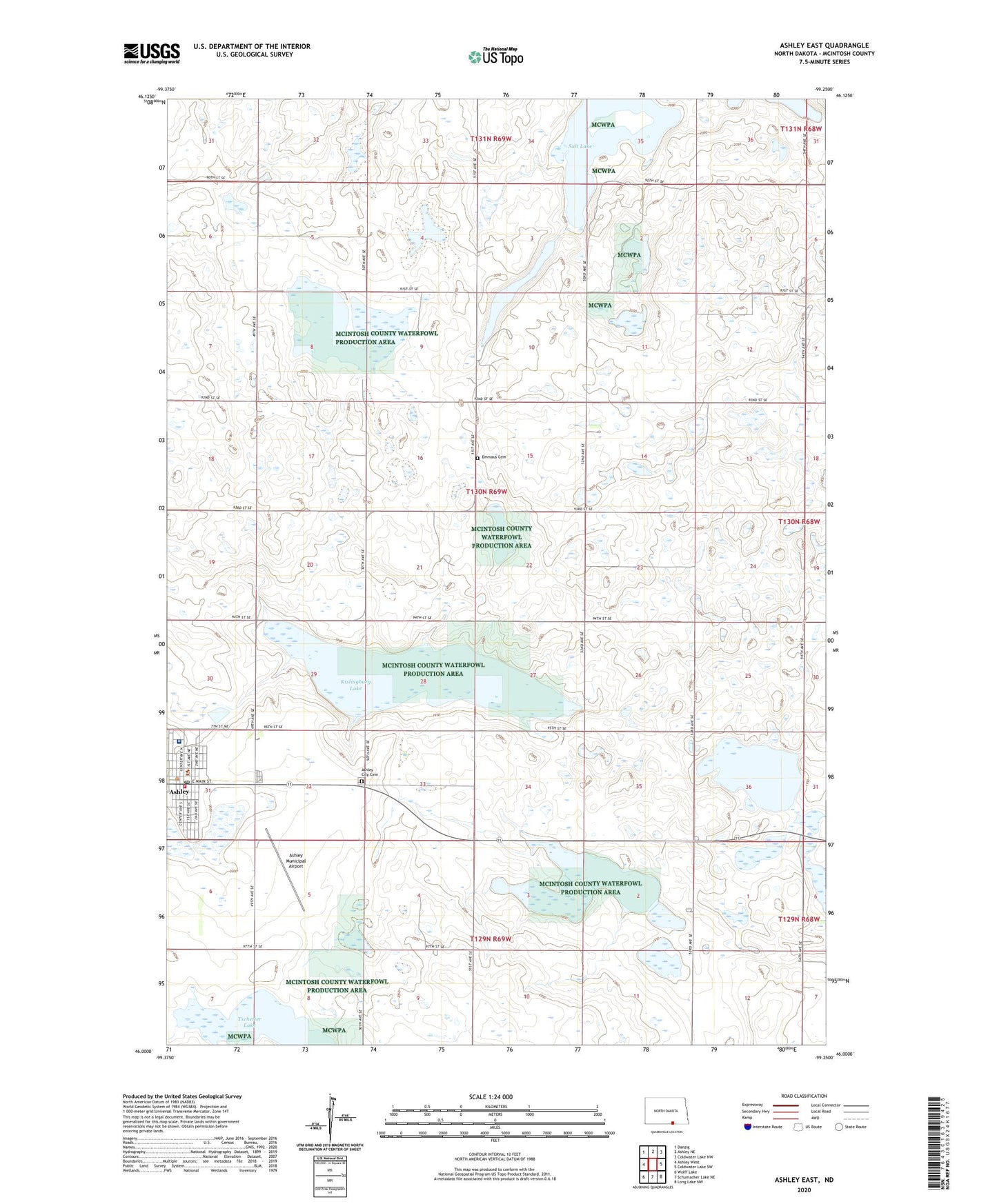
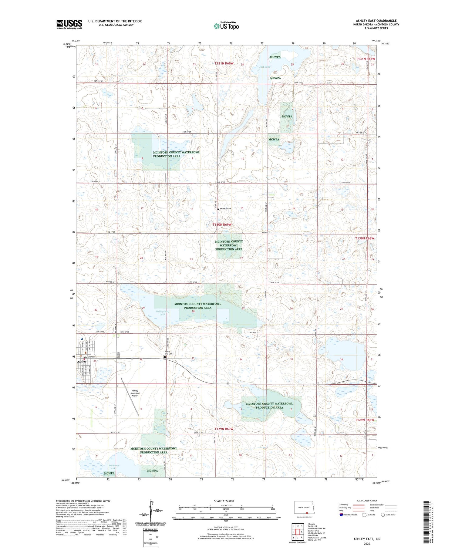
Ashley East North Dakota US Topo Map
Couldn't load pickup availability
2020 topographic map quadrangle Ashley East in the state of North Dakota. Scale: 1:24000. Based on the newly updated USGS 7.5' US Topo map series, this map is in the following counties: McIntosh. The map contains contour data, water features, and other items you are used to seeing on USGS maps, but also has updated roads and other features. This is the next generation of topographic maps. Printed on high-quality waterproof paper with UV fade-resistant inks.
Quads adjacent to this one:
West: Ashley West
Northwest: Danzig
North: Ashley NE
Northeast: Coldwater Lake NW
East: Coldwater Lake SW
Southeast: Long Lake NW
South: Schumacher Lake NE
Southwest: Wolff Lake
Contains the following named places: Ashley, Ashley Ambulance Service, Ashley City Cemetery, Ashley City Police Department, Ashley Medical Center, Ashley Medical Center Nursing Facility, Ashley Municipal Airport, Ashley Municipal Building, Ashley Post Office, Ashley Public Library, Ashley Rural Fire Department, Ashley State Game Management Area, City of Ashley, Emmaus Cemetery, Kislingburg Lake, Kislingbury Lake State Game Management Area, McIntosh County Courthouse, McIntosh County Heritage Center, McIntosh County Sheriff's Office, Salt Lake, Tschetter Lake, ZIP Code: 58413