MyTopo
Bathgate NE North Dakota US Topo Map
Couldn't load pickup availability
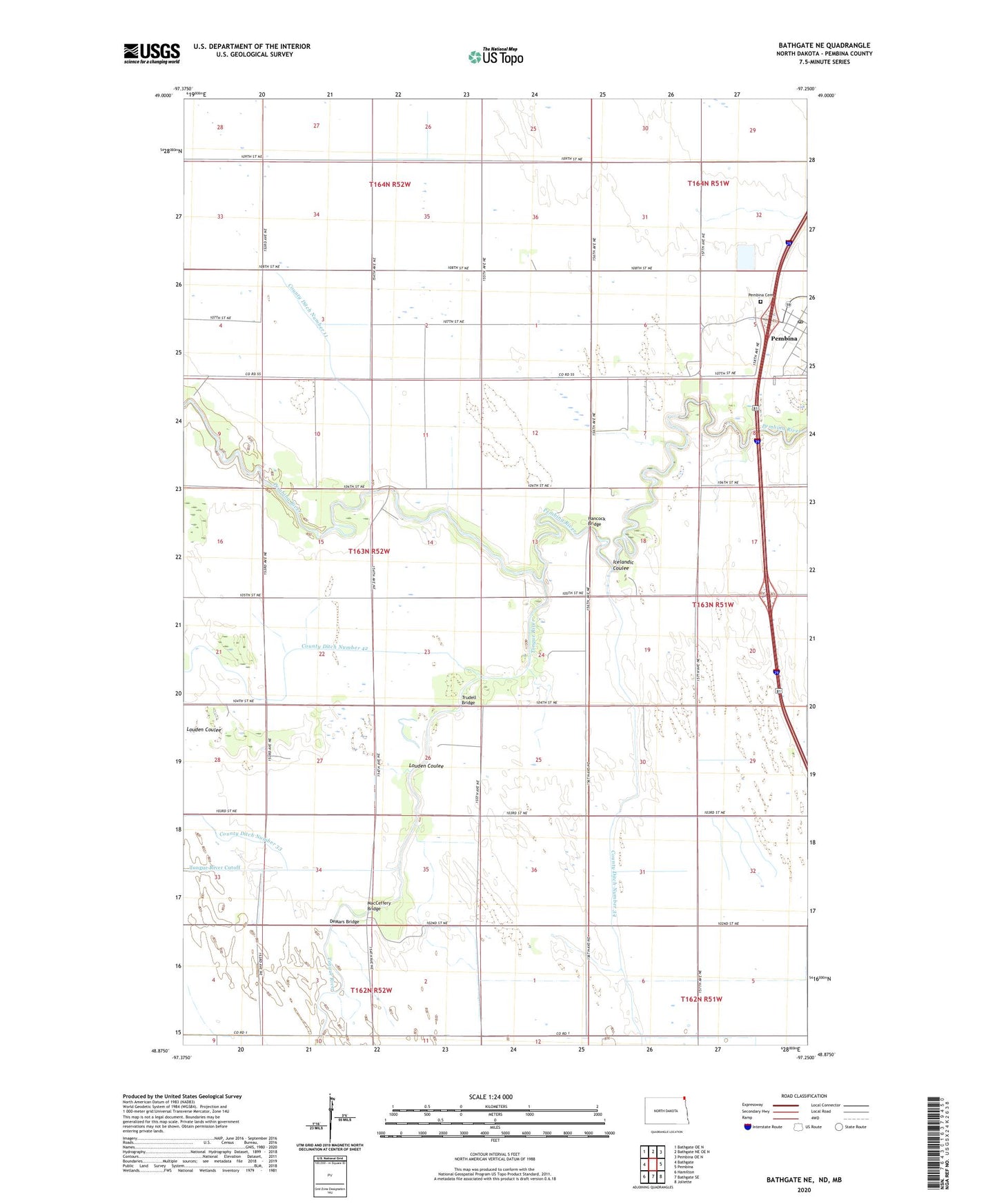
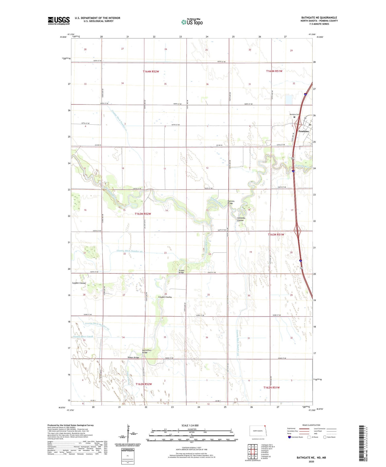
2020 topographic map quadrangle Bathgate NE in the state of North Dakota. Scale: 1:24000. Based on the newly updated USGS 7.5' US Topo map series, this map is in the following counties: Pembina. The map contains contour data, water features, and other items you are used to seeing on USGS maps, but also has updated roads and other features. This is the next generation of topographic maps. Printed on high-quality waterproof paper with UV fade-resistant inks.
Quads adjacent to this one:
West: Bathgate
Northwest: Bathgate OE N
North: Bathgate NE OE N
Northeast: Pembina OE N
East: Pembina
Southeast: Joliette
South: Bathgate SE
Southwest: Hamilton
Contains the following named places: County Ditch Number 11, County Ditch Number 33, County Ditch Number 34, DeMars Bridge, Hancock Bridge, Icelandic Coulee, Louden Coulee, MacCeffery Bridge, Pembina Cemetery, Pembina Post Office, Pembina State Museum, Tongue River, Township of Pembina, Trudell Bridge, ZIP Code: 58271