
MyTopo
Dahlen North Dakota US Topo Map
Couldn't load pickup availability
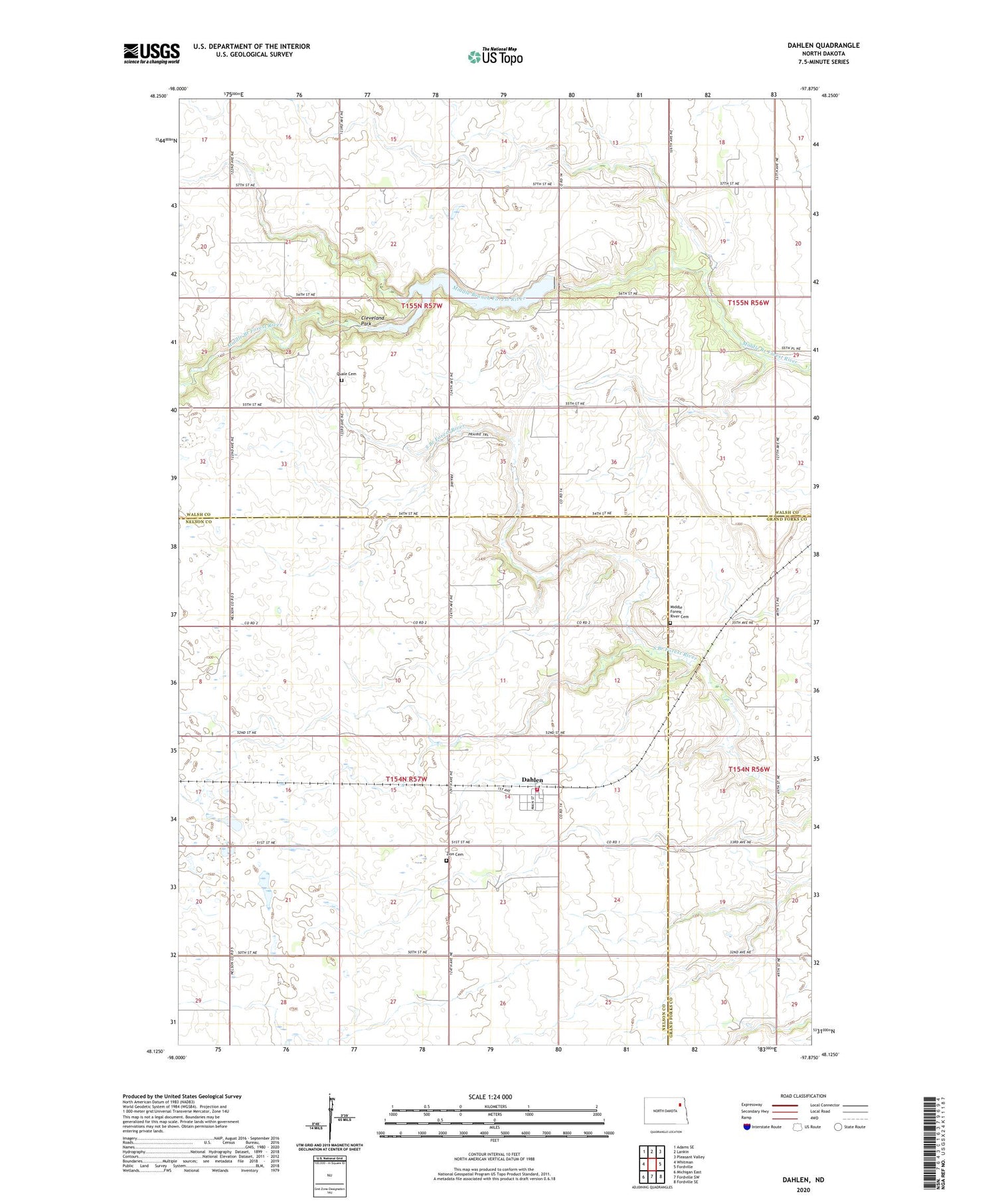
2020 topographic map quadrangle Dahlen in the state of North Dakota. Scale: 1:24000. Based on the newly updated USGS 7.5' US Topo map series, this map is in the following counties: Nelson, Walsh, Grand Forks. The map contains contour data, water features, and other items you are used to seeing on USGS maps, but also has updated roads and other features. This is the next generation of topographic maps. Printed on high-quality waterproof paper with UV fade-resistant inks.
Quads adjacent to this one:
West: Whitman
Northwest: Adams SE
North: Lankin
Northeast: Pleasant Valley
East: Fordville
Southeast: Fordville SE
South: Fordville SW
Southwest: Michigan East
Contains the following named places: Cleveland Park, Dahlen, Dahlen Census Designated Place, Dahlen Rural Fire Department, KGFE-TV (Grand Forks), Matecjek Dam, Middle Forest River Cemetery, Middle South Branch Forest River Number 1 Dam, Praha, Quale Cemetery, Quale Church, Township of Cleveland, Township of Dahlen, WDAZ-TV (Devils Lake), Zion Cemetery, ZIP Code: 58224


