MyTopo
Forman North Dakota US Topo Map
Couldn't load pickup availability
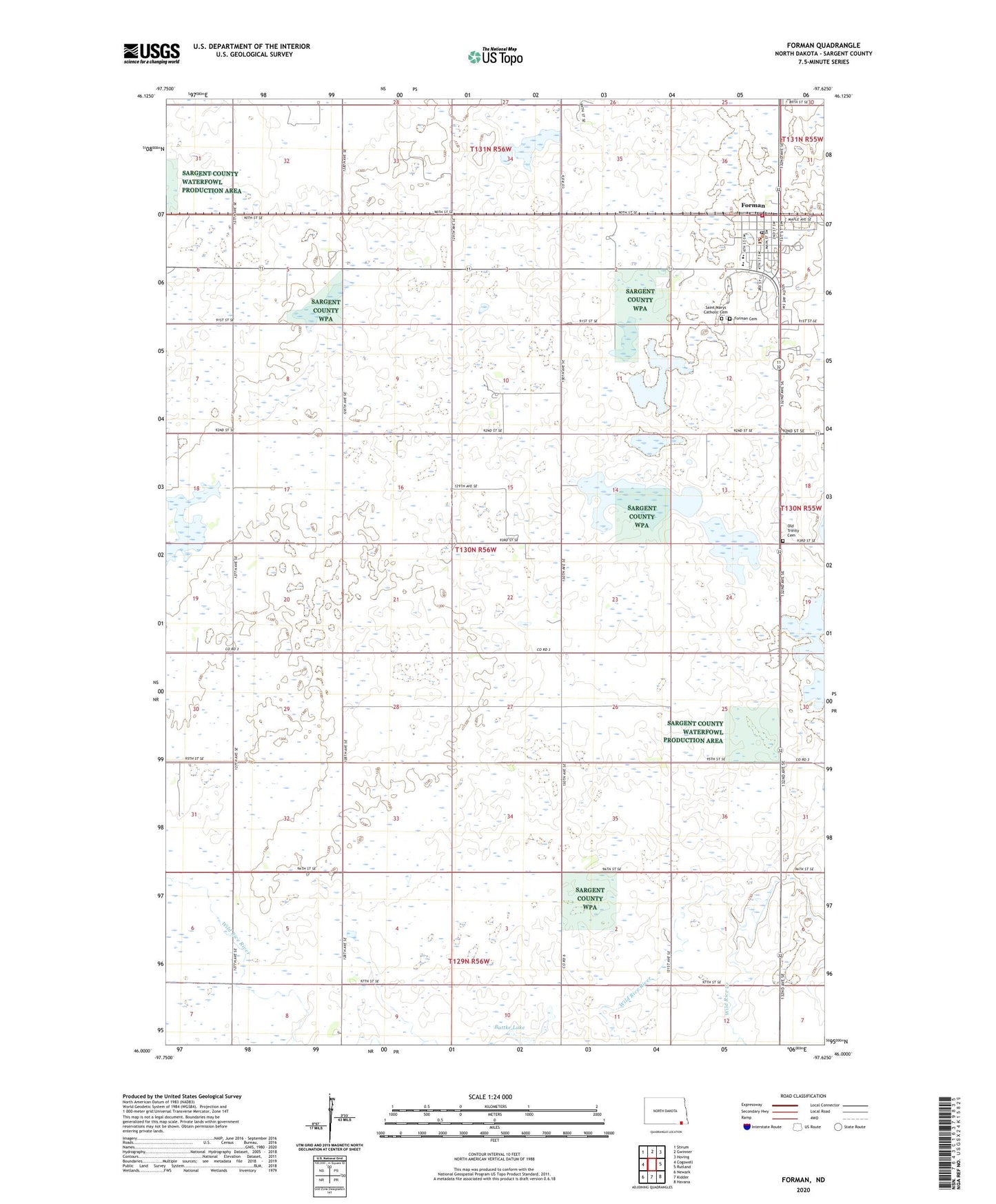
2020 topographic map quadrangle Forman in the state of North Dakota. Scale: 1:24000. Based on the newly updated USGS 7.5' US Topo map series, this map is in the following counties: Sargent. The map contains contour data, water features, and other items you are used to seeing on USGS maps, but also has updated roads and other features. This is the next generation of topographic maps. Printed on high-quality waterproof paper with UV fade-resistant inks.
Quads adjacent to this one:
West: Cogswell
Northwest: Stirum
North: Gwinner
Northeast: Hoving
East: Rutland
Southeast: Havana
Contains the following named places: Buttke Lake, City of Forman, Forman, Forman Cemetery, Forman City Hall, Forman Fire Department Station 2, Forman Post Office, Forman Public Library, Four Seasons Health Care Center, Old Trinity Cemetery, Saint Marys Catholic Cemetery, Sargent Central Public School, Sargent County, Sargent County Ambulance Service - Forman, Sargent County Courthouse, Sargent County Museum, Sargent County Sheriff's Office, School Number 2, School Number 4, Township of Forman, Wild Rice Creek, ZIP Code: 58032