MyTopo
Fort Yates NE North Dakota US Topo Map
Couldn't load pickup availability
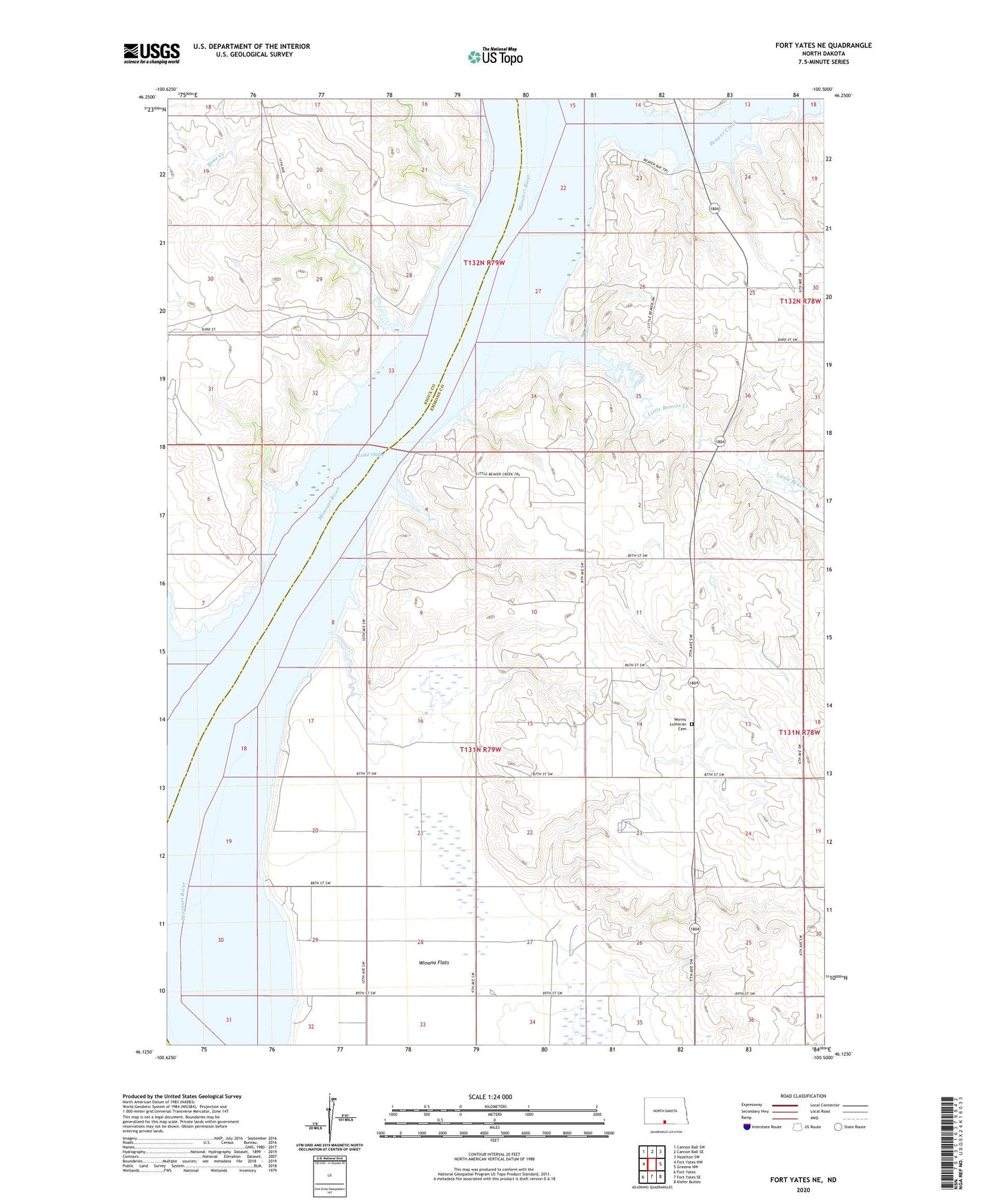
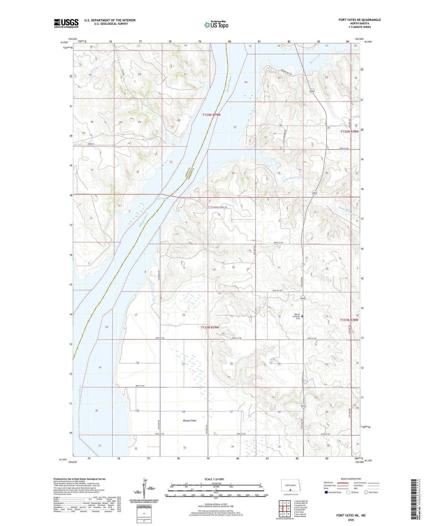
2020 topographic map quadrangle Fort Yates NE in the state of North Dakota. Scale: 1:24000. Based on the newly updated USGS 7.5' US Topo map series, this map is in the following counties: Emmons, Sioux. The map contains contour data, water features, and other items you are used to seeing on USGS maps, but also has updated roads and other features. This is the next generation of topographic maps. Printed on high-quality waterproof paper with UV fade-resistant inks.
Quads adjacent to this one:
West: Fort Yates NW
Northwest: Cannon Ball SW
North: Cannon Ball SE
Northeast: Hazelton SW
East: Grassna NW
Southeast: Kiefer Buttes
South: Fort Yates SE
Southwest: Fort Yates
Contains the following named places: Beaver Creek, Beaver Creek Public Use Area, Beaver River Reaches, Bone Creek, Little Beaver Creek, North Dakota Fisheries Management Area, White Springs Ranch, Winona Flats, Worms Lutheran Cemetery