
MyTopo
Garrison Dam South North Dakota US Topo Map
Couldn't load pickup availability
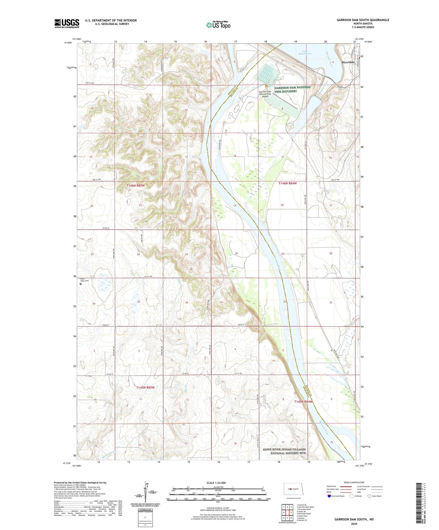
2020 topographic map quadrangle Garrison Dam South in the state of North Dakota. Scale: 1:24000. Based on the newly updated USGS 7.5' US Topo map series, this map is in the following counties: Mercer, McLean. The map contains contour data, water features, and other items you are used to seeing on USGS maps, but also has updated roads and other features. This is the next generation of topographic maps. Printed on high-quality waterproof paper with UV fade-resistant inks.
Quads adjacent to this one:
West: Hazen NE
Northwest: Emmet SE
North: Garrison Dam North
Northeast: Riverdale North
East: Riverdale South
Southeast: Stanton SE
South: Stanton
Southwest: Hazen East
Contains the following named places: Garrison Dam, Garrison Dam National Fish Hatchery, Garrison Dam Recreational Airpark, Riverdale State Game Management Area, Saint Pauls Cemetery, Saint Pauls Church, Winston Landing


