
MyTopo
Hanks Gully North Dakota US Topo Map
Couldn't load pickup availability
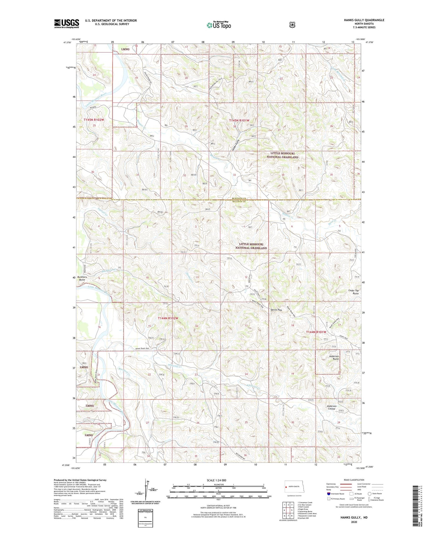
2020 topographic map quadrangle Hanks Gully in the state of North Dakota. Scale: 1:24000. Based on the newly updated USGS 7.5' US Topo map series, this map is in the following counties: Billings, McKenzie. The map contains contour data, water features, and other items you are used to seeing on USGS maps, but also has updated roads and other features. This is the next generation of topographic maps. Printed on high-quality waterproof paper with UV fade-resistant inks.
Quads adjacent to this one:
West: Eagle Draw
Northwest: Cinnamon Creek
North: Ice Box Canyon
Northeast: Wolf Coulee
East: Squaretop Butte
Southeast: Gorham NW
South: Roosevelt Creek East
Southwest: Roosevelt Creek West
Contains the following named places: Anderson Butte, Anderson Coulee, Blacktail Creek, Buckhorn Butte, Buckhorn Oil Field, Cedar Top Butte, Devils Pass, Devils Pass Oil Field, Elkhorn Ranch Oil Field, Elkhorn Ranch State Historic Site, Hanks Gully, J Tescher Ranch, L Connell Ranch, Magpie Creek, Rough Rider Oilfield, Roughrider Substation, Sand Creek, Whitetail Creek


