MyTopo
Red Mike Hill North Dakota US Topo Map
Couldn't load pickup availability
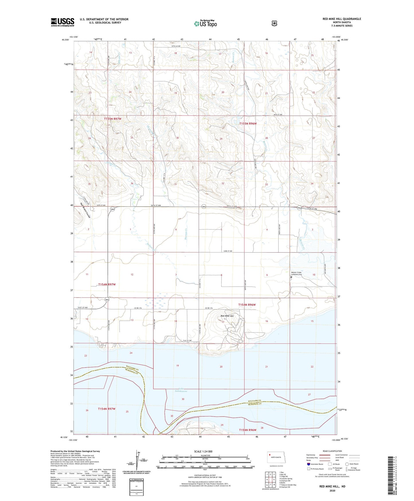
2020 topographic map quadrangle Red Mike Hill in the state of North Dakota. Scale: 1:24000. Based on the newly updated USGS 7.5' US Topo map series, this map is in the following counties: Williams, McKenzie. The map contains contour data, water features, and other items you are used to seeing on USGS maps, but also has updated roads and other features. This is the next generation of topographic maps. Printed on high-quality waterproof paper with UV fade-resistant inks.
Quads adjacent to this one:
West: Cussicks Spring
Northwest: Ray
North: Ray SE
Northeast: Tioga SW
East: Charlson NW
Southeast: Charlson SW
South: Tobacco Garden Bay
Southwest: Banks
Contains the following named places: Bear Island, Beaver Creek Church, Beaver Creek Lutheran Cemetery, Half Breed Coulee, Hofflund School, Hofflund State Game Management Area, Nelson Creek, Red Mike Hill, Thorsen Creek, Tobacco Garden, Township of Farmvale, Unorganized Territory of Southeast Williams