MyTopo
Richardton North Dakota US Topo Map
Couldn't load pickup availability
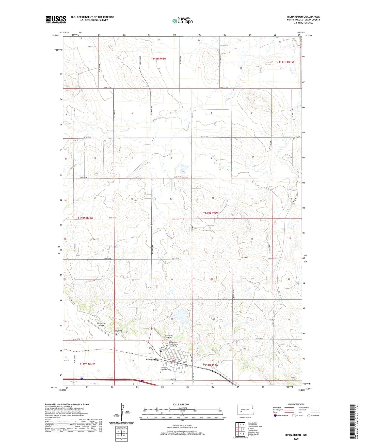
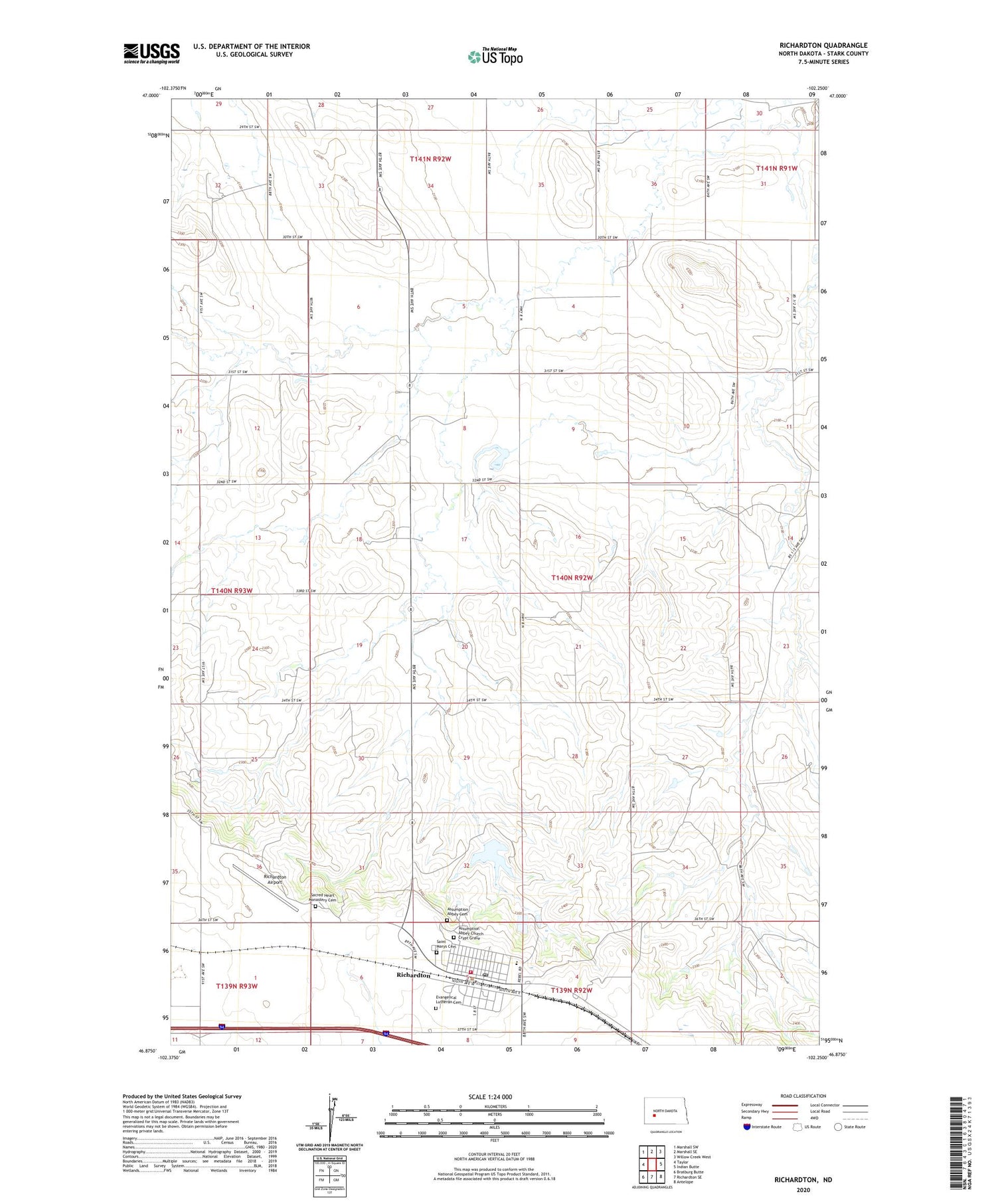
2020 topographic map quadrangle Richardton in the state of North Dakota. Scale: 1:24000. Based on the newly updated USGS 7.5' US Topo map series, this map is in the following counties: Stark. The map contains contour data, water features, and other items you are used to seeing on USGS maps, but also has updated roads and other features. This is the next generation of topographic maps. Printed on high-quality waterproof paper with UV fade-resistant inks.
Quads adjacent to this one:
West: Taylor
Northwest: Marshall SW
North: Marshall SE
Northeast: Willow Creek West
East: Indian Butte
Southeast: Antelope
South: Richardton SE
Southwest: Bratburg Butte
Contains the following named places: Abbey Lake, Assumption Abbey, Assumption Abbey Cemetery, Assumption Abbey Church Crypt Grave, Assumption Abbey Dam, City of Richardton, Evangelical Lutheran Cemetery, Richardton, Richardton - Taylor Ambulance Service, Richardton Airport, Richardton City Hall, Richardton Health Center, Richardton Memorial Hospital, Richardton Post Office, Richardton Rural and City Fire Department, Richardton-Taylor High School, Sacred Heart Monastery Cemetery, Sacred Heart Priory, Saint Marys Cemetery