MyTopo
Robinson North Dakota US Topo Map
Couldn't load pickup availability
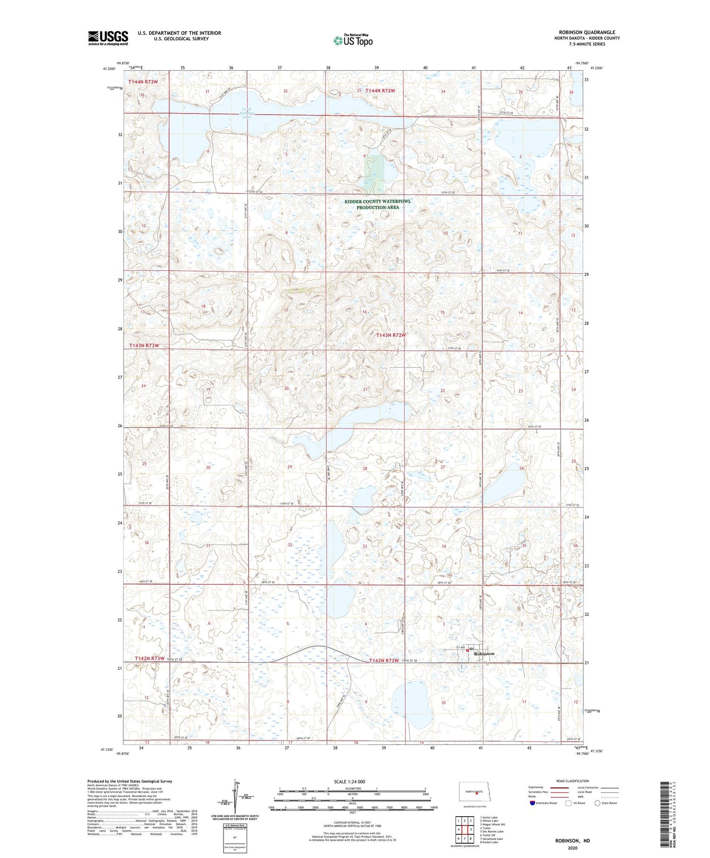
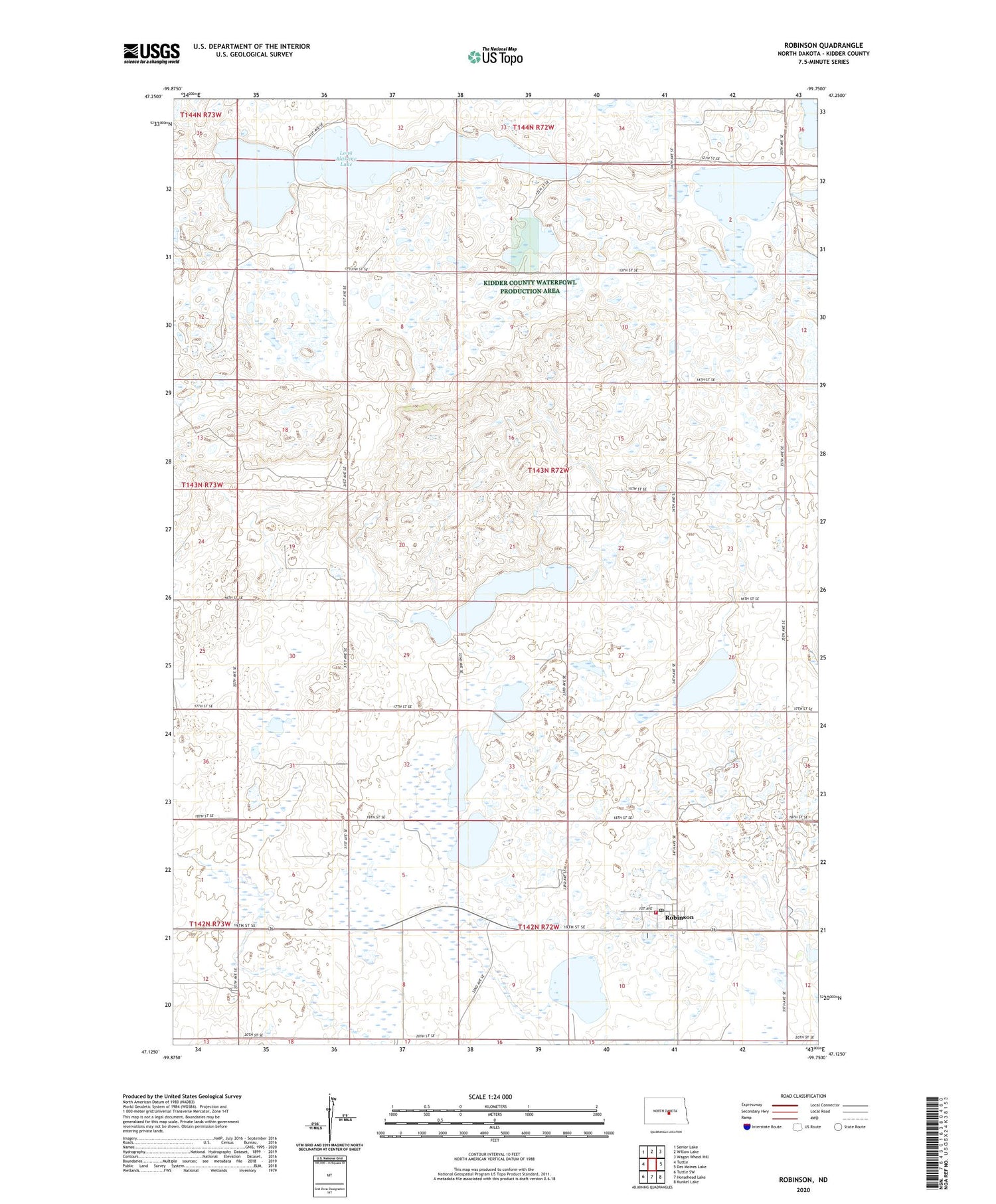
2020 topographic map quadrangle Robinson in the state of North Dakota. Scale: 1:24000. Based on the newly updated USGS 7.5' US Topo map series, this map is in the following counties: Kidder. The map contains contour data, water features, and other items you are used to seeing on USGS maps, but also has updated roads and other features. This is the next generation of topographic maps. Printed on high-quality waterproof paper with UV fade-resistant inks.
Quads adjacent to this one:
West: Tuttle
Northwest: Senior Lake
North: Willow Lake
Northeast: Wagon Wheel Hill
East: Des Moines Lake
Southeast: Kunkel Lake
South: Horsehead Lake
Southwest: Tuttle SW
Contains the following named places: City of Robinson, James Whitman Landing Strip, Long Alakline Lake, Robinson, Robinson Elementary School, Robinson Fire Department, Robinson Post Office, Township of Merkel