MyTopo
Tilden North Dakota US Topo Map
Couldn't load pickup availability
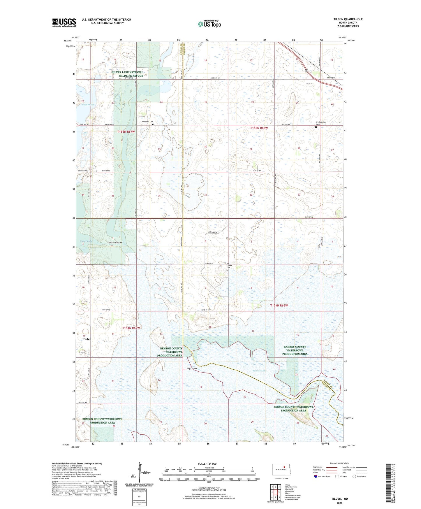
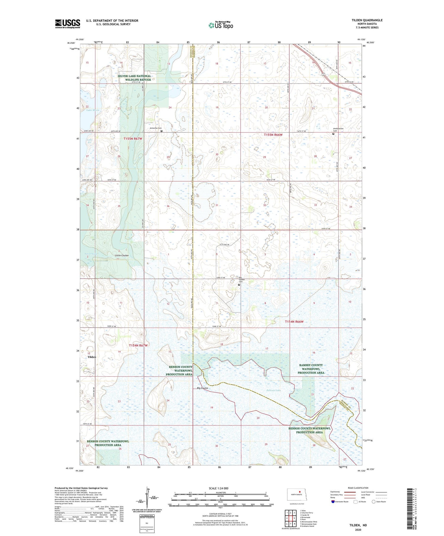
2020 topographic map quadrangle Tilden in the state of North Dakota. Scale: 1:24000. Based on the newly updated USGS 7.5' US Topo map series, this map is in the following counties: Ramsey, Benson. The map contains contour data, water features, and other items you are used to seeing on USGS maps, but also has updated roads and other features. This is the next generation of topographic maps. Printed on high-quality waterproof paper with UV fade-resistant inks.
Quads adjacent to this one:
West: Brinsmade
Northwest: Niles
North: Churchs Ferry
Northeast: Cando SE
East: Penn
Southeast: Grahams Island
South: Minnewaukan East
Southwest: Minnewaukan West
Contains the following named places: Antiochia Cemetery, Antiochia Church, Big Coulee, Big Coulee Cemetery, Big Coulee Church, Lake Murie, Lake Yri, Little Coulee, Pelican Lake, Presbyterian Cemetery, School Number 5, School Number 6, School Number 7, Silver Lake National Wildlife Refuge, Stink Lake, Tilden, Township of Coulee, Township of Pelican, Township of Riggin