MyTopo
Tobacco Garden Bay North Dakota US Topo Map
Couldn't load pickup availability
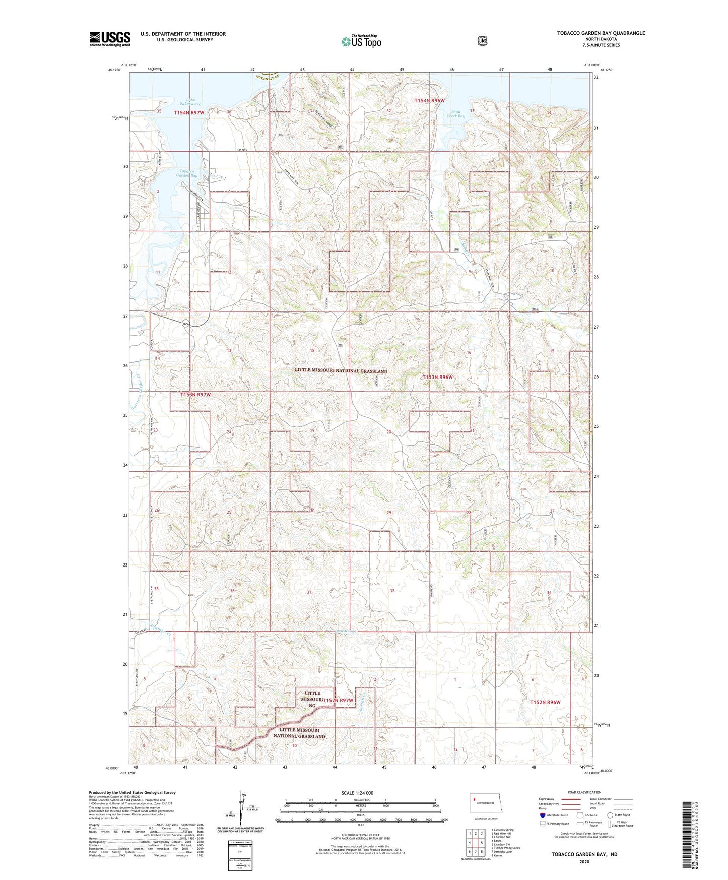
2020 topographic map quadrangle Tobacco Garden Bay in the state of North Dakota. Scale: 1:24000. Based on the newly updated USGS 7.5' US Topo map series, this map is in the following counties: McKenzie, Williams. The map contains contour data, water features, and other items you are used to seeing on USGS maps, but also has updated roads and other features. This is the next generation of topographic maps. Printed on high-quality waterproof paper with UV fade-resistant inks.
Quads adjacent to this one:
West: Banks
Northwest: Cussicks Spring
North: Red Mike Hill
Northeast: Charlson NW
East: Charlson SW
Southeast: Keene
South: Demicks Lake
Southwest: Timber Prong Creek
Contains the following named places: D Roehm Ranch, Grantier Creek, Sand Creek, Sand Creek Bay, Sorenson Ranch, Tobacco Garden Bay, Tobacco Garden Creek, Tobacco Garden Creek Recreation Area, Tobacco Garden Creek State Game Management Area