MyTopo
Twin Buttes North Dakota US Topo Map
Couldn't load pickup availability
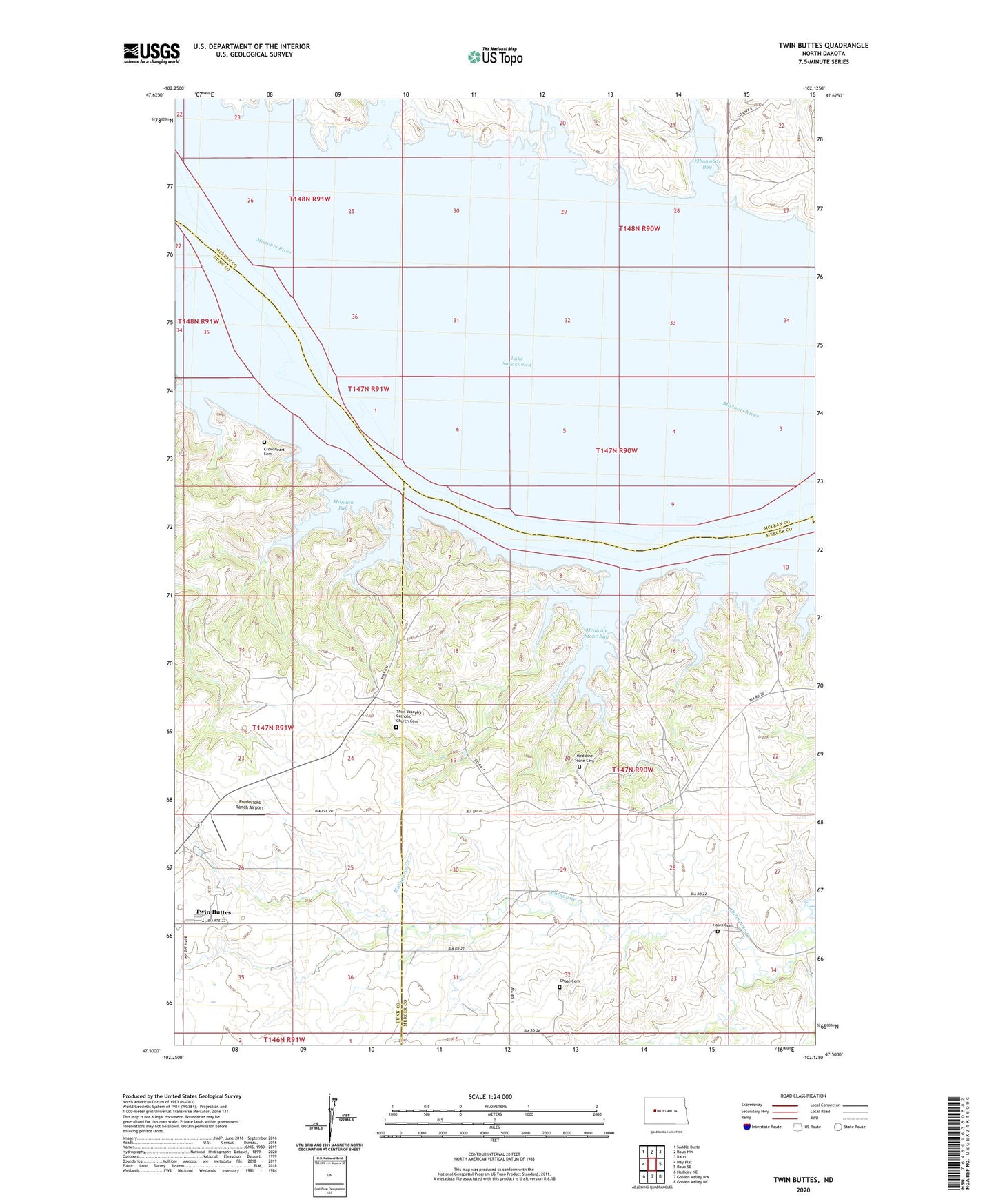
2020 topographic map quadrangle Twin Buttes in the state of North Dakota. Scale: 1:24000. Based on the newly updated USGS 7.5' US Topo map series, this map is in the following counties: Mercer, McLean, Dunn. The map contains contour data, water features, and other items you are used to seeing on USGS maps, but also has updated roads and other features. This is the next generation of topographic maps. Printed on high-quality waterproof paper with UV fade-resistant inks.
Quads adjacent to this one:
West: Hay Flat
Northwest: Saddle Butte
North: Raub NW
Northeast: Raub
East: Raub SE
Southeast: Golden Valley NE
South: Golden Valley NW
Southwest: Halliday NE
Contains the following named places: Chase Cemetery, Crowsheart Cemetery, Elbowoods, Elbowoods Bay, Fredericks Ranch Airport, Holen Cemetery, Little Missouri Bend, Mandan Bay, Medicine Stone Bay, Medicine Stone Cemetery, Medicine Stone Public Use Area, Saint Joseph Church, Saint Joseph's Catholic Church Cemetery, Twin Buttes, Twin Buttes Elementary School, Twin Buttes Segment