
MyTopo
Underwood North Dakota US Topo Map
Couldn't load pickup availability
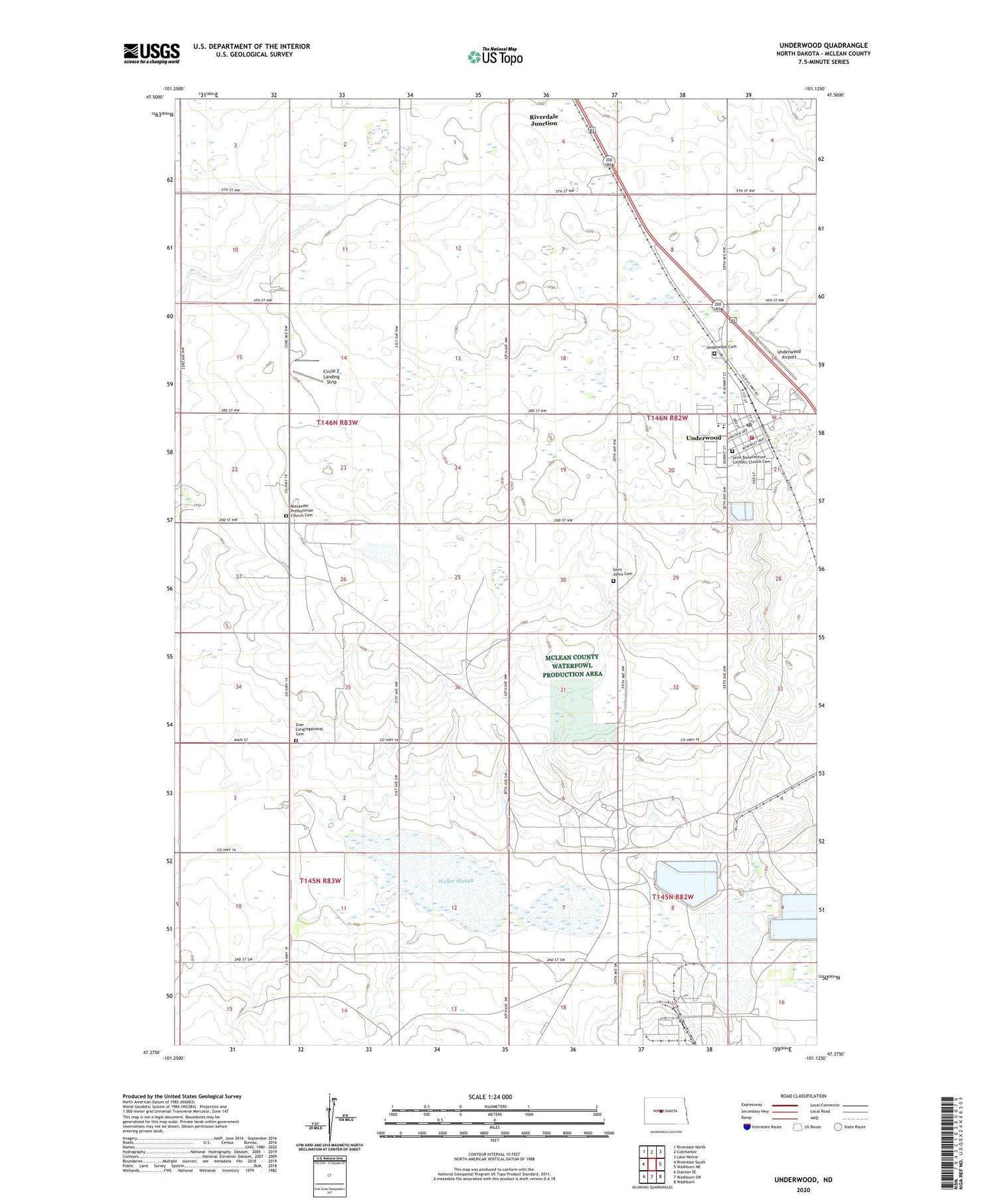
2020 topographic map quadrangle Underwood in the state of North Dakota. Scale: 1:24000. Based on the newly updated USGS 7.5' US Topo map series, this map is in the following counties: McLean. The map contains contour data, water features, and other items you are used to seeing on USGS maps, but also has updated roads and other features. This is the next generation of topographic maps. Printed on high-quality waterproof paper with UV fade-resistant inks.
Quads adjacent to this one:
West: Riverdale South
Northwest: Riverdale North
North: Coleharbor
Northeast: Lake Nettie
East: Washburn NE
Southeast: Washburn
South: Washburn SW
Southwest: Stanton SE
Contains the following named places: Alexander Presbyterian Church Cemetery, Bible Church, Circle Z Landing Strip, City of Underwood, Falkirk Mine, Great River Energy Ambulance Service, McLean County Speedway, Riverdale Junction, Saint Bonaventure Catholic Church Cemetery, Saint Johns Cemetery, The Falkirk Mine Ambulance Service, Township of Longfellow, Underwood, Underwood Airport, Underwood Ambulance Service, Underwood Cemetery, Underwood City Hall, Underwood Fire Protection District, Underwood Post Office, Underwood Public Library, Underwood Public School, Weller Slough, Zoar Congregational Cemetery, ZIP Code: 58576


