MyTopo
Wing North Dakota US Topo Map
Couldn't load pickup availability
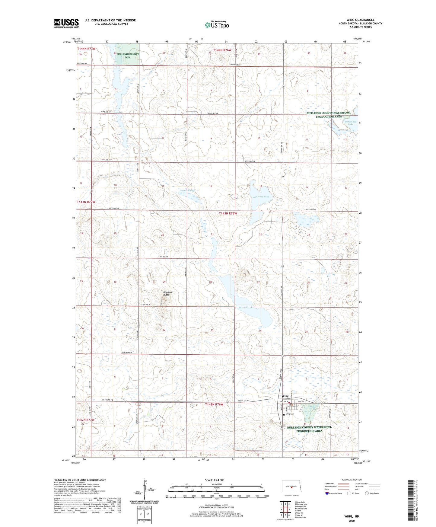
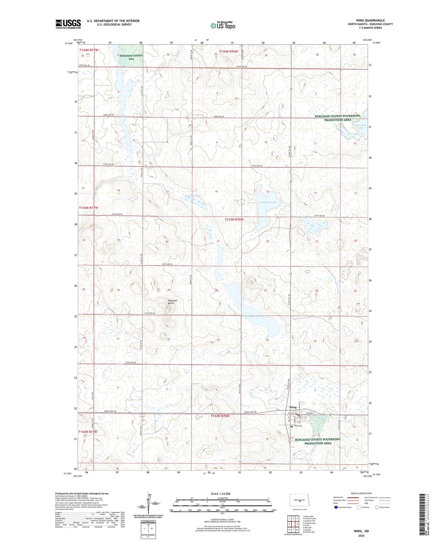
2020 topographic map quadrangle Wing in the state of North Dakota. Scale: 1:24000. Based on the newly updated USGS 7.5' US Topo map series, this map is in the following counties: Burleigh. The map contains contour data, water features, and other items you are used to seeing on USGS maps, but also has updated roads and other features. This is the next generation of topographic maps. Printed on high-quality waterproof paper with UV fade-resistant inks.
Quads adjacent to this one:
West: Canfield Lake
Northwest: Horse Lake
North: Florence Lake
Northeast: Goodrich SW
East: Arena
Southeast: Harriet Lake
South: Wing SE
Southwest: Wing SW
Contains the following named places: Bunker Lake State Game Management Area, Camel Slough, City of Wing, Haystack Butte, Horseshoe Lake, Lonetree Lake, Mitchell Lake, Patterson Hereford Ranch Landing Field, Township of Richmond, Township of Summit, Wing, Wing Cemetery, Wing Post Office, Wing Public School, Wing Rural Fire Station, ZIP Code: 58494