MyTopo
Wishek North Dakota US Topo Map
Couldn't load pickup availability
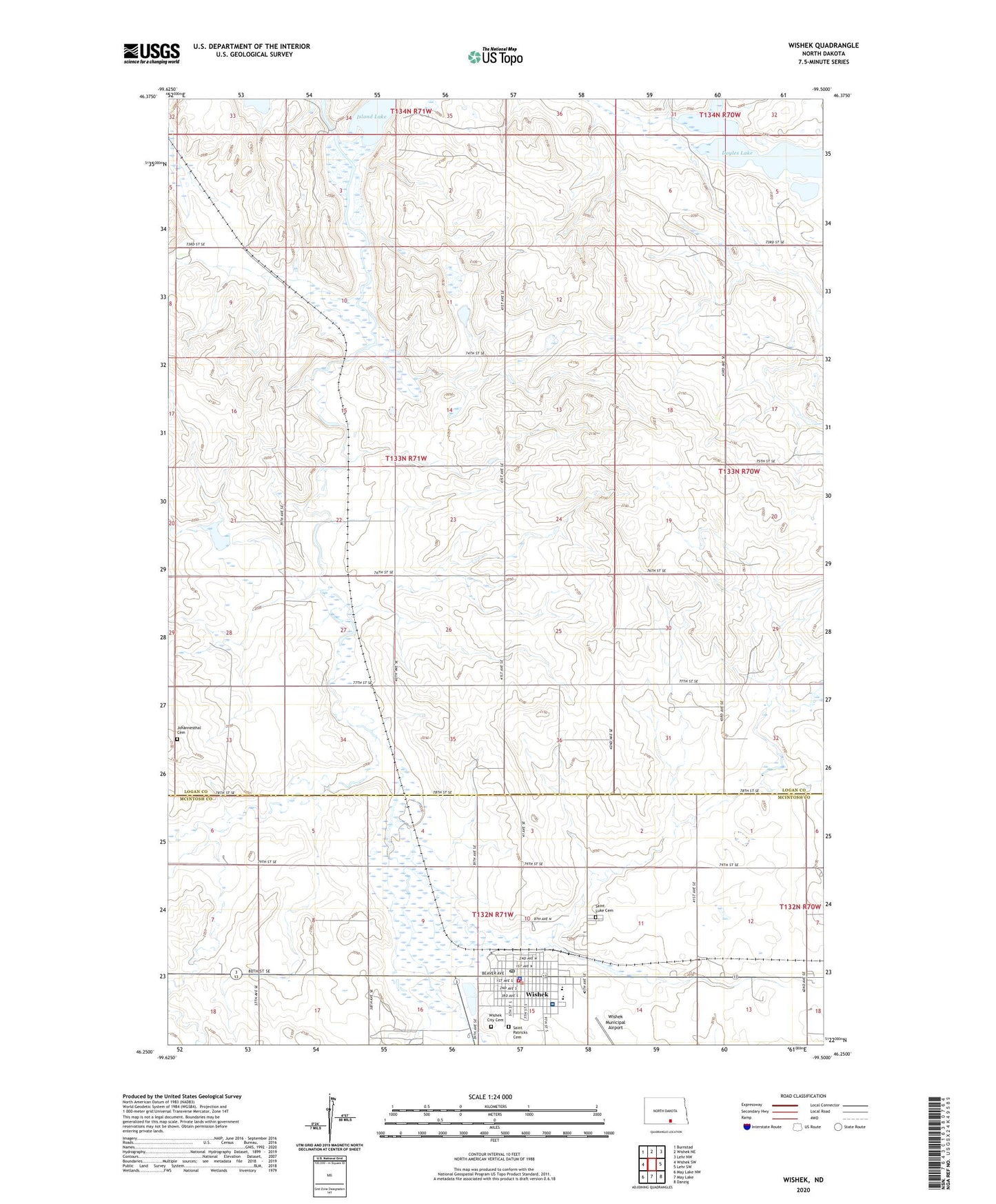
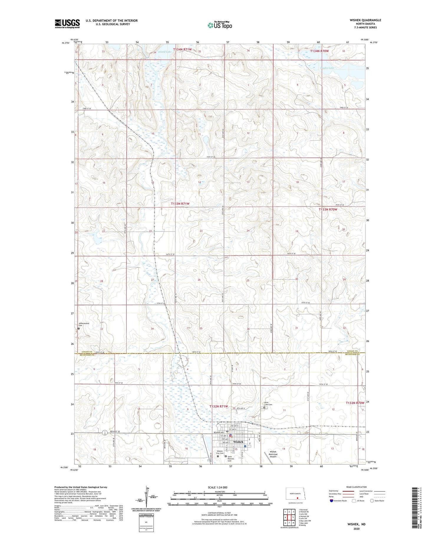
2020 topographic map quadrangle Wishek in the state of North Dakota. Scale: 1:24000. Based on the newly updated USGS 7.5' US Topo map series, this map is in the following counties: Logan, McIntosh. The map contains contour data, water features, and other items you are used to seeing on USGS maps, but also has updated roads and other features. This is the next generation of topographic maps. Printed on high-quality waterproof paper with UV fade-resistant inks.
Quads adjacent to this one:
West: Wishek SW
Northwest: Burnstad
North: Wishek NE
Northeast: Lehr NW
East: Lehr SW
Southeast: Danzig
South: May Lake
Southwest: May Lake NW
Contains the following named places: City of Wishek, Doyles Lake, Hildebrand Dam, Johannesthal Cemetery, KWSK-AM (Wishek), Saint Luke Cemetery, Saint Patricks Cemetery, Tri-County Speedway, Wishek, Wishek City Cemetery, Wishek City Hall, Wishek Community Hospital, Wishek Fairground, Wishek Fire Protection District, Wishek Living Center, Wishek Municipal Airport, Wishek Police Department, Wishek Post Office, Wishek Public School, Wishek School and Public Library, ZIP Code: 58495