
MyTopo
Burton Ohio US Topo Map
Couldn't load pickup availability
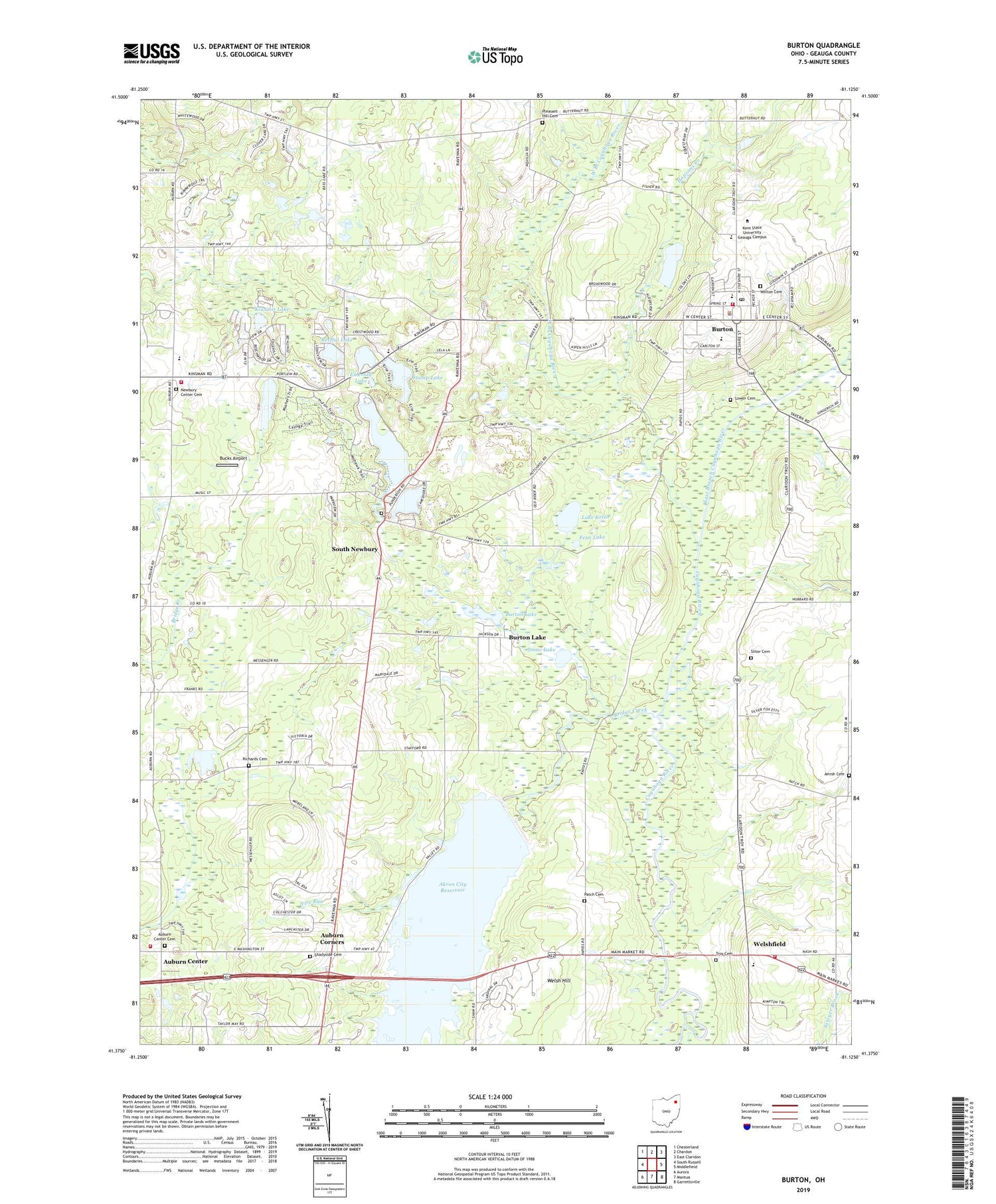
2019 topographic map quadrangle Burton in the state of Ohio. Scale: 1:24000. Based on the newly updated USGS 7.5' US Topo map series, this map is in the following counties: Geauga. The map contains contour data, water features, and other items you are used to seeing on USGS maps, but also has updated roads and other features. This is the next generation of topographic maps. Printed on high-quality waterproof paper with UV fade-resistant inks.
Quads adjacent to this one:
West: South Russell
Northwest: Chesterland
North: Chardon
Northeast: East Claridon
East: Middlefield
Southeast: Garrettsville
South: Mantua
Southwest: Aurora
Contains the following named places: Akron City Reservoir, Amish Cemetery, Auburn Center, Auburn Corners, Auburn Elementary School, Auburn State Wildlife Area, Auburn Volunteer Fire Department, Beach Trail, Berkshire High School, Blue Jay Orchard, Brannon Field, Bridge Creek, Bridge Creek Dam, Bucks Airport, Burton, Burton County Wetlands, Burton Elementary School, Burton Lake, Burton Police Department, Burton Post Office, Burton Village Historic District, Burton Volunteer Fire Department, Deer Lake Mobile Park, East Branch Cuyahoga River, Emerald Lake, Erie Trail, Fern Lake, Fire Run, Free Will Baptist Church of Auburn, Geauga County, Great Lakes Industrial Park, Greens Crossing, Hopsons Creek, Iroquois Trail, Kiwanis Lake, Lake Kelso, Little Punderson Lake, Lower Cemetery, Maple Shade Cemetery, Mohawk Trail, Mushers Trail, Newbury Business Park, Newbury Center, Newbury Center Cemetery, Newbury Fire Department and Emergency Medical Services Department, Newbury High School, Patch Cemetery, Pine Lake, Pleasant Hill Cemetery, Pleasant Hill Church, Popes Corners, Punderson Golf Course, Punderson Lake, Punderson Manor House, Punderson State Park, Restful Lake, Richards Cemetery, Russell County Park, Saint Helens School, Sawyer Brook, Shadyside Cemetery, Slitor Cemetery, Smith Crossing, Snow Lake, South Newbury, South Newbury Cemetery, South Newbury Post Office, Steele Crossing, Stump Lake, Township of Auburn, Township of Burton, Township of Newbury, Township of Troy, Troy Cemetery, Troy Elementary School, Troy Fire Department and Emergency Medical Services Department, Troy Oaks Homes, United Community Church, Village of Burton, Webster Crossing, Welsh Hill, Welshfield, Welton Cemetery, West Branch Cuyahoga River, ZIP Codes: 44021, 44065


