MyTopo
Byesville Ohio US Topo Map
Couldn't load pickup availability
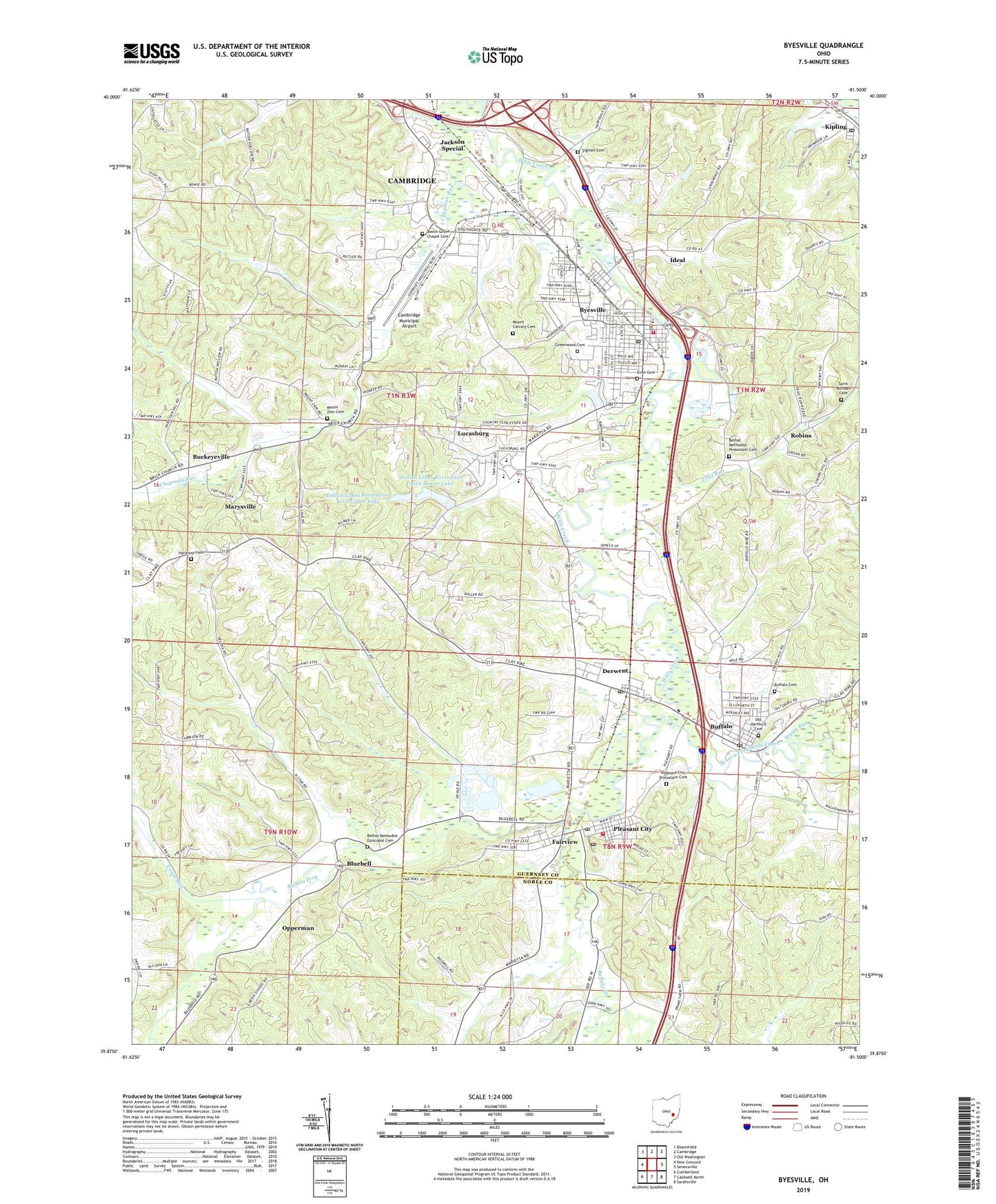
2019 topographic map quadrangle Byesville in the state of Ohio. Scale: 1:24000. Based on the newly updated USGS 7.5' US Topo map series, this map is in the following counties: Guernsey, Noble. The map contains contour data, water features, and other items you are used to seeing on USGS maps, but also has updated roads and other features. This is the next generation of topographic maps. Printed on high-quality waterproof paper with UV fade-resistant inks.
Quads adjacent to this one:
West: New Concord
Northwest: Bloomfield
North: Cambridge
Northeast: Old Washington
East: Senecaville
Southeast: Sarahsville
South: Caldwell North
Southwest: Cumberland
Contains the following named places: Beech Grove Chapel, Beech Grove Chapel Cemetery, Beech Grove Elementary School, Bethel Church, Bethel Methodist Episcopal Cemetery, Bethel Methodist Protestant Cemetery, Bethlehem Church, Blue Bell Post Office, Bluebell, Buckeyeville, Buffalo, Buffalo Cemetery, Buffalo Census Designated Place, Buffalo Creek, Buffalo Fork, Buffalo Post Office, Byesville, Byesville Branch Library, Byesville Elementary School, Byesville Police Department, Byesville Post Office, Byesville Volunteer Fire Department, Cambridge Country Club, Cambridge Municipal Airport, Cambridge Scales, Cambridge-Byesville Industrial Park, Chapman Run, Christian Hill School, Conquer Hill School, Country Court Mobile Home Park, Crane Run, Derwent, Derwent Post Office, Enon Cemetery, Fairview, Fairview Post Office, Glenwood School, Greendale School, Greenwood Cemetery, Greenwood Mobile Home Park, Guernsey-Noble Vocational School, Harmony Cemetery, Harmony Church, Harmony School, Helena, Holy Trinity Catholic Church, Holy Trinity School, Ideal, Indian Lakes Recreation Area Lower Lake, Indian Lakes Recreation Area Upper Lake, Jackson Special, Kipling, Kipling Post Office, Lucasburg, Lucasburg Post Office, Marysville, Meadowbrook High School, Mount Calvary Cemetery, Mount Zion Cemetery, Mount Zion School, North Star School, Oakwood, Old Hartford Cemetery, Opperman, Opperman Post Office, Pleasant City, Pleasant City Post Office, Pleasant City Protestant Cemetery, Pleasant City Volunteer Fire Department, Robins, Robins Post Office, Saint Michael Cemetery, Seneca Fork Wills Creek, Sigman Cemetery, Soggy Run, Spring Valley, Township of Jackson, Township of Valley, Trail Run, Village of Byesville, Village of Pleasant City, West Point School, Yoker Creek, ZIP Codes: 43722, 43723, 43733, 43750, 43772