MyTopo
Castalia Ohio US Topo Map
Couldn't load pickup availability
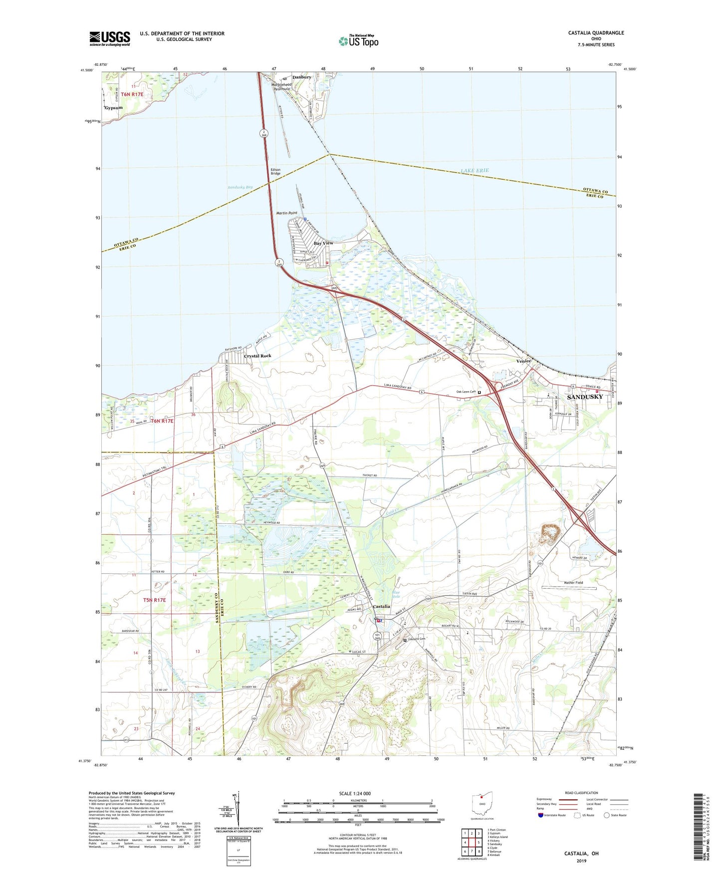
2019 topographic map quadrangle Castalia in the state of Ohio. Scale: 1:24000. Based on the newly updated USGS 7.5' US Topo map series, this map is in the following counties: Erie, Ottawa, Sandusky. The map contains contour data, water features, and other items you are used to seeing on USGS maps, but also has updated roads and other features. This is the next generation of topographic maps. Printed on high-quality waterproof paper with UV fade-resistant inks.
Quads adjacent to this one:
West: Vickery
Northwest: Port Clinton
North: Gypsum
Northeast: Kelleys Island
East: Sandusky
Southeast: Kimball
South: Bellevue
Southwest: Clyde
Contains the following named places: Anchor Mobile Home Park, Bay Bridge, Bay View, Bay View Fire Department, Bay View Post Office, Bay View Village Police Department, Baywater Estates, Blue Hole, Castalia, Castalia Cemetery, Castalia Post Office, Castalia Quarry Reserve, Castalia Trout Club, Castalia Village Police Department, Cold Creek, Crystal Rock, Crystal Rock Census Designated Place, Danbury, Danbury Post Office, Edison Bridge, Grace Lutheran Church, Margaretta Elementary School, Margaretta High School, Margaretta Township Fire Department, Martin Point, Mather Field, Moore Dairy Farms, Oak Lawn Cemetery, Ohio State Highway Patrol - Sandusky Patrol Post, Resthaven Wildlife Area, Sandusky Bay, Sandusky Fire Department Station 7, Teemes, Teemes Post Office, Township of Margaretta, Trinity Lutheran Church, Venice, Venice Heights Elementary School, Venice Post Office, Village of Bay View, Village of Castalia, Wayside Temple, Westview Estates, WGGN-FM (Castalia), WGGN-TV (Sandusky), ZIP Code: 44824