MyTopo
Centerburg Ohio US Topo Map
Couldn't load pickup availability
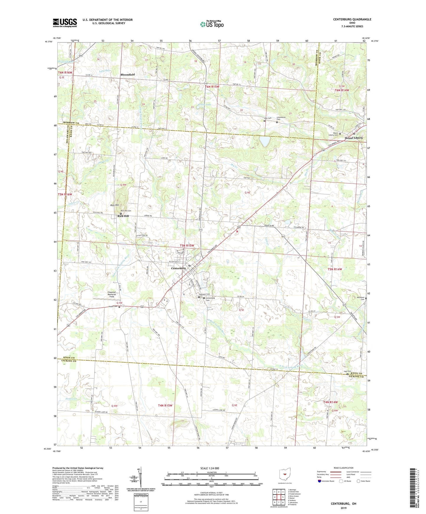
2019 topographic map quadrangle Centerburg in the state of Ohio. Scale: 1:24000. Based on the newly updated USGS 7.5' US Topo map series, this map is in the following counties: Knox, Licking, Morrow, Delaware. The map contains contour data, water features, and other items you are used to seeing on USGS maps, but also has updated roads and other features. This is the next generation of topographic maps. Printed on high-quality waterproof paper with UV fade-resistant inks.
Quads adjacent to this one:
West: Olive Green
Northwest: Marengo
North: Chesterville
Northeast: Fredericktown
East: Homer
Southeast: Fredonia
South: Johnstown
Southwest: Sunbury
Contains the following named places: Bloomfield, Bloomfield Post Office, Bright Side Farm, Centerburg, Centerburg Cemetery, Centerburg Christian Church, Centerburg Elementary School, Centerburg Junction, Centerburg Post Office, Centerburg United Methodist Church, Central Ohio Joint Fire District, Chapman Memorial Field, Eastview Cemetery, Ford Creek, Grace Lutheran Church, Hall Cemetery, Hedington Corners, Houck Cemetery, Jackson School, Kile Cemetery, Lineweaver Cemetery, Lyal School, Memorial Park, Midway School, Milford Church, Moreland Cemetery, Mount Liberty, Mount Liberty Cemetery, Mount Liberty Post Office, Myers Corners, Otter Fork Swine Farm, Rich Hill, Rich Hill Cemetery, Rich Hill Post Office, School Land Church, School Number 1, Table Rock Golf Course, Township of Hilliar, Updike School, Village of Centerburg, Willow Lake, Woodland Hall School, Wyandot Golf Course, ZIP Code: 43011