MyTopo
Cherry Valley Ohio US Topo Map
Couldn't load pickup availability
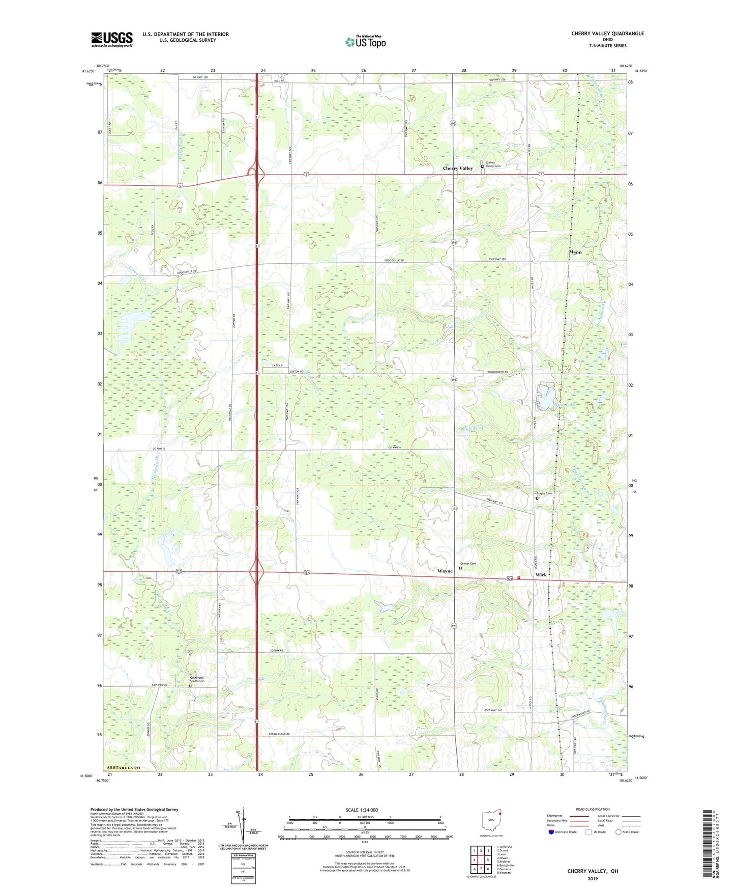
2019 topographic map quadrangle Cherry Valley in the state of Ohio. Scale: 1:24000. Based on the newly updated USGS 7.5' US Topo map series, this map is in the following counties: Ashtabula, Trumbull. The map contains contour data, water features, and other items you are used to seeing on USGS maps, but also has updated roads and other features. This is the next generation of topographic maps. Printed on high-quality waterproof paper with UV fade-resistant inks.
Quads adjacent to this one:
West: Orwell
Northwest: Jefferson
North: Dorset
Northeast: Leon
East: Andover
Southeast: Kinsman
South: Gustavus
Southwest: Bristolville
Contains the following named places: Britton Farms, Campbells Farm, Center Cemetery, Cherry Valley, Cherry Valley Cemetery, Cherry Valley Church of the Nazarene, Cherry Valley United Methodist Church, Colebrook South Cemetery, Coltman Farms, Creekside Farms, Fantasy Lake, Gale Farms, Galicki Pond, Galicki Pond Dam, Grand View Acres, Gruskiewicz Farms, Hayes Cemetery, Jeffco Lake, Jeffco Lake Dam, Kriegs Farms, Limpert Lake, Limpert Lake Dam, Magyar Farms, Mann, Marrison Farms, New Lyme Wildlife Area, R and K Farms, Rutledge Farm, Schafle Dairy Farm, Suchdale Farms, Touch of Class Farm, Township of Cherry Valley, Township of Wayne, Wayne, Wayne Township Volunteer Fire Department, Wick, Wick Post Office