
MyTopo
Chesterland Ohio US Topo Map
Couldn't load pickup availability
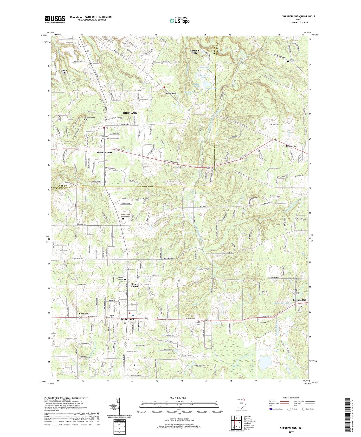
2019 topographic map quadrangle Chesterland in the state of Ohio. Scale: 1:24000. Based on the newly updated USGS 7.5' US Topo map series, this map is in the following counties: Geauga, Lake. The map contains contour data, water features, and other items you are used to seeing on USGS maps, but also has updated roads and other features. This is the next generation of topographic maps. Printed on high-quality waterproof paper with UV fade-resistant inks.
Quads adjacent to this one:
West: Mayfield Heights
Northwest: Eastlake
North: Mentor
Northeast: Painesville
East: Chardon
Southeast: Burton
South: South Russell
Southwest: Chagrin Falls
Contains the following named places: All Souls Cemetery, Blueberry Pond, Brown Cemetery, Center Chardon Cemetery, Chaplin State Forest, Chester Center, Chester Center Cemetery, Chester Elementary School, Chester Town Hall, Chester Township Cemetery, Chester Township Fire Rescue, Chester Township Police Department, Chesterland, Chesterland Baptist Church, Chesterland Census Designated Place, Chesterland Fire and Emergency Medical Services Station 2, Chesterland Post Office, Christ Presbyterian Church, City of Kirtland, Community Church, Corning Lake, Durkalski Industrial Park, Eagle Trailer Park, Eddy Fruit Farm, Foster Pond, Fowlers Mill, Fowlers Mill Post Office, Fowlers Mills Cemetery, Fullertown Station, Gildersleeve Elementary School, Gildersleeve Mountain, Heath Pond, Holden Arboretum, Hourglass Pond, King Street Cemetery, Kirtland Elementary School, Kirtland Fire Department Station 1, Kirtland Fire Department Station 2, Kirtland High School, Kirtland Hills, Kirtland Middle School, Kirtland Mobile Home Park, Kirtland Police Department, Kirtland South Cemetery, Lake Farmpark, Lost Fen, Mitchells Mill, Mulberry Corners, North Munson, Old Settlers Cemetery, Old South Church, Orchard Hills Golf Course, Parks Corner, Patterson Fruit Farm, Pebblebrook Country Club, Pecks Corners, Piersons Knob, Robert C Lindsey Elementary School, Roberts Fruit Farm, Rolling Green Memorial Cemetery, Saint Anselm Church, Saint Anselm School, Sand Hill, Schupp Orchard, Scotland, South Church, Sycamore Lake, Township of Chester, Trinity United Methodist Church, West Geauga High School, West Geauga Middle School, West Geauga Plaza Shopping Center, Wilder Senior Citizen Mobile Home Park North, Wilder Senior Citizen Mobile Home Park South, ZIP Code: 44026


