MyTopo
Clarksfield Ohio US Topo Map
Couldn't load pickup availability
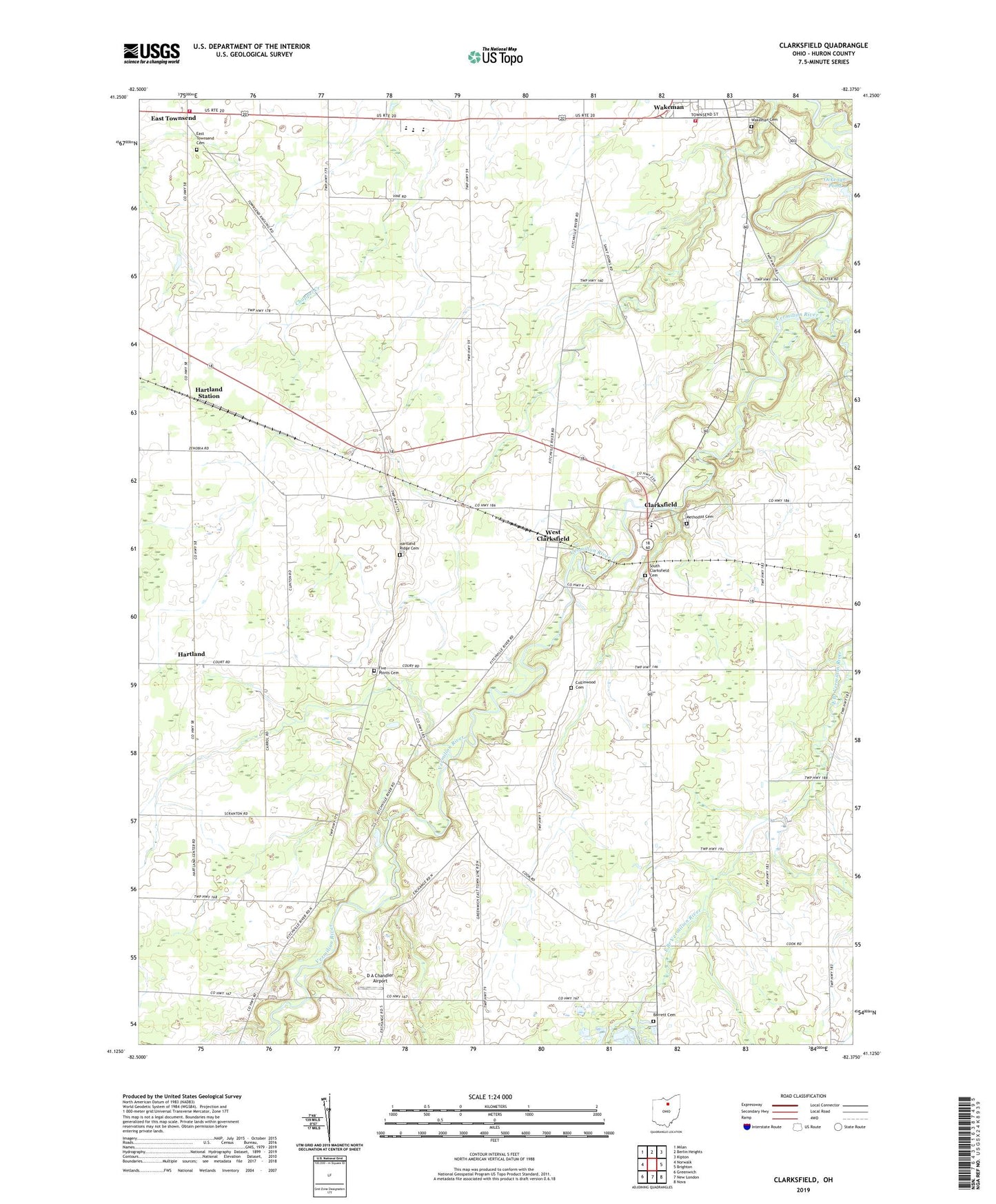
2019 topographic map quadrangle Clarksfield in the state of Ohio. Scale: 1:24000. Based on the newly updated USGS 7.5' US Topo map series, this map is in the following counties: Huron. The map contains contour data, water features, and other items you are used to seeing on USGS maps, but also has updated roads and other features. This is the next generation of topographic maps. Printed on high-quality waterproof paper with UV fade-resistant inks.
Quads adjacent to this one:
West: Norwalk
Northwest: Milan
North: Berlin Heights
Northeast: Kipton
East: Brighton
Southeast: Nova
South: New London
Southwest: Greenwich
Contains the following named places: Barrett Cemetery, Barretts Chapel, Butts Farms, Clarksfield, Clarksfield Post Office, Collinwood Cemetery, D A Chandler Airport, East Branch Vermilion River, East Townsend, East Townsend Cemetery, East Townsend Post Office, Five Points Cemetery, Hartland, Hartland Elementary School, Hartland Post Office, Hartland Ridge Cemetery, Hartland Station, Indian Creek, Methodist Cemetery, Ockenga Pond, Ockenga Pond Dam, South Clarksfield Cemetery, Townsend Township Fire Department, Township of Clarksfield, Township of Hartland, Township of Townsend, Township of Wakeman, Wakeman Cemetery, Wakeman Emergency Medical Services, Wakeman Fire District, West Clarksfield, West Clarksfield Post Office, Western Reserve High School, White Joe School, White Pond, White Pond Dam, ZIP Codes: 44826, 44889