MyTopo
Dunkirk Ohio US Topo Map
Couldn't load pickup availability
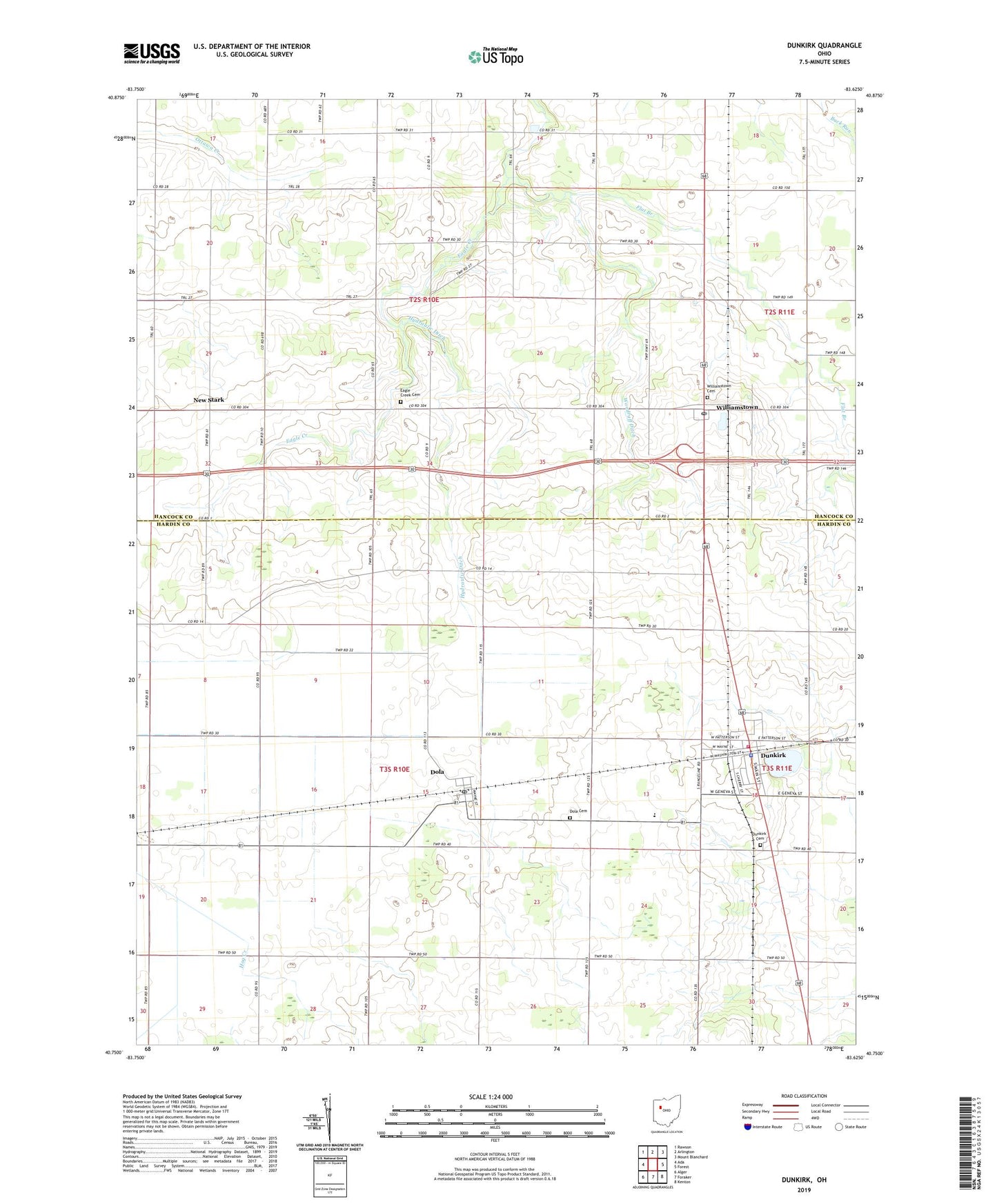
2019 topographic map quadrangle Dunkirk in the state of Ohio. Scale: 1:24000. Based on the newly updated USGS 7.5' US Topo map series, this map is in the following counties: Hardin, Hancock. The map contains contour data, water features, and other items you are used to seeing on USGS maps, but also has updated roads and other features. This is the next generation of topographic maps. Printed on high-quality waterproof paper with UV fade-resistant inks.
Quads adjacent to this one:
West: Ada
Northwest: Rawson
North: Arlington
Northeast: Mount Blanchard
East: Forest
Southeast: Kenton
South: Foraker
Southwest: Alger
Contains the following named places: Blanchard - Dunkirk Joint Ambulance, Dola, Dola Cemetery, Dola Census Designated Place, Dola Post Office, Dunkirk, Dunkirk Cemetery, Dunkirk Post Office, Eagle Creek Cemetery, Eagle Creek Church, Fitzhugh Ditch, Flat Branch, Hardin Northern School, Hog Creek Ditch, Hog Creek Marsh, Hydraulic Ditch, Jones School, New Stark, New Stark Post Office, North Stark Post Office, Northern Hardin County Fire District, Oakgrove Church, Township of Madison, Township of Van Buren, Township of Washington, Village of Dunkirk, West Union, Williamstown, Williamstown Cemetery, Williamstown First Brethren Church, Williamstown Post Office, Woodruff Ditch, ZIP Codes: 45835, 45836, 45841, 45897