MyTopo
Flat Rock Ohio US Topo Map
Couldn't load pickup availability
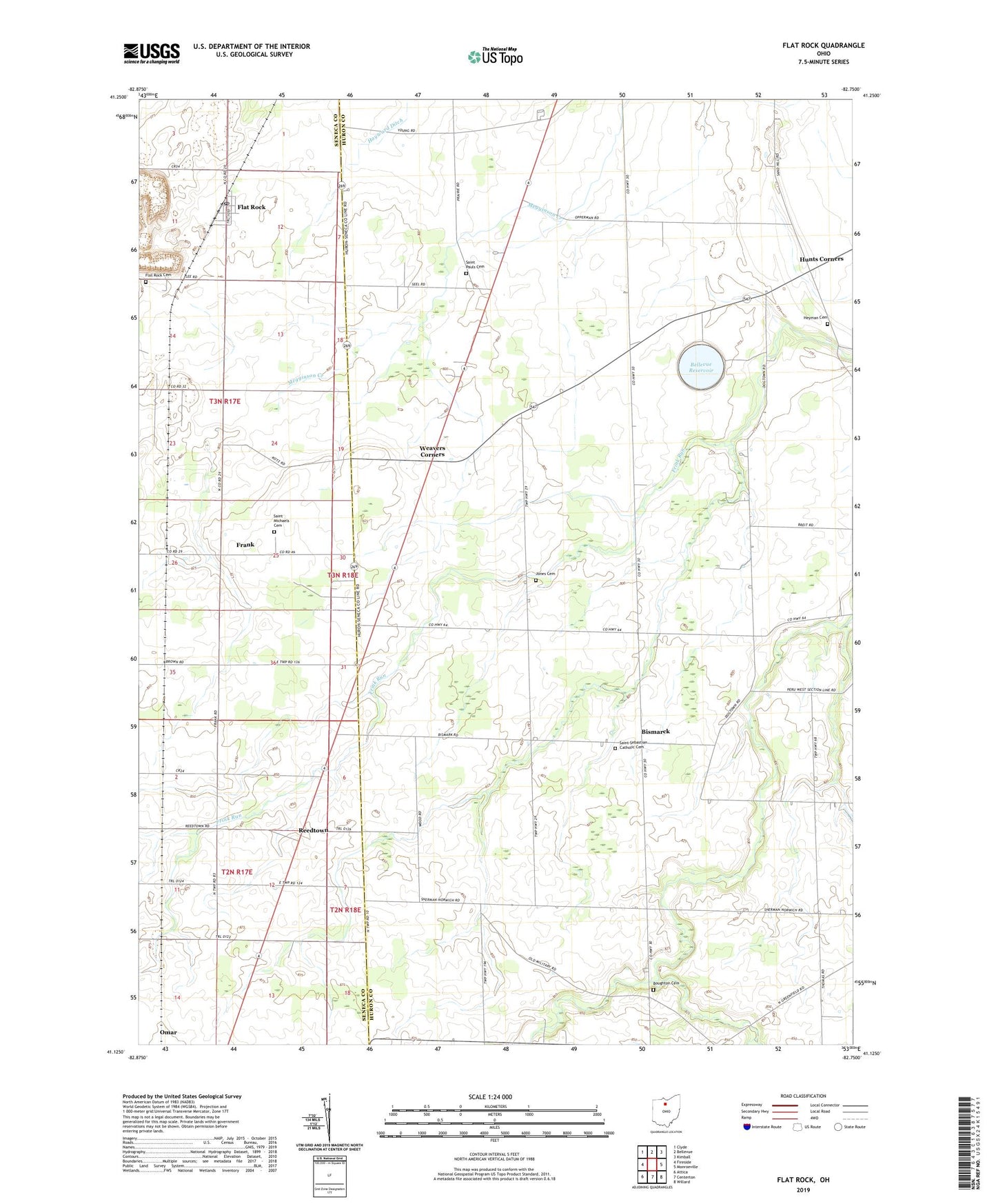
2019 topographic map quadrangle Flat Rock in the state of Ohio. Scale: 1:24000. Based on the newly updated USGS 7.5' US Topo map series, this map is in the following counties: Huron, Seneca. The map contains contour data, water features, and other items you are used to seeing on USGS maps, but also has updated roads and other features. This is the next generation of topographic maps. Printed on high-quality waterproof paper with UV fade-resistant inks.
Quads adjacent to this one:
West: Fireside
Northwest: Clyde
North: Bellevue
Northeast: Kimball
East: Monroeville
Southeast: Willard
South: Centerton
Southwest: Attica
Contains the following named places: Bellevue Reservoir, Bellevue Reservoir Number Five Dam, Bismarck, Bismark Post Office, Bollenbacher School, Bores Farm, Boughton Cemetery, Central School, Dougherty Airport, Ebenezer United Methodist Church, English School, Flat Rock, Flat Rock Cemetery, Flat Rock Census Designated Place, Flat Rock Childrens Center, Flat Rock Post Office, Flat Rock Quarry, Fouthon School, Frank, Frank Post Office, H B Farms, Haas Ditch, Havana Post Office, Hayward Ditch, Heyman Cemetery, Hickory Grove Farms, Hunts Corners, Jones Cemetery, Magers Farms, Mud Run, Reedtown, Reedtown Post Office, Saint Michaels Cemetery, Saint Pauls Cemetery, Saint Sebastian Catholic Cemetery, Saint Sebastian Catholic Church, Schoeffel Ditch, School Number 1, School Number 2, School Number 6, Siesel Farms, Sorrowfull Mother Shrine, Stockmaster Farms, Township of Lyme, Township of Sherman, Tri View Farms, Weavers Corners, Weavers Corners Post Office, Weymouth Post Office, Windfall Post Office, Woodside Farms, Zieber Egg Farm, ZIP Codes: 44811, 44828