MyTopo
Galion Ohio US Topo Map
Couldn't load pickup availability
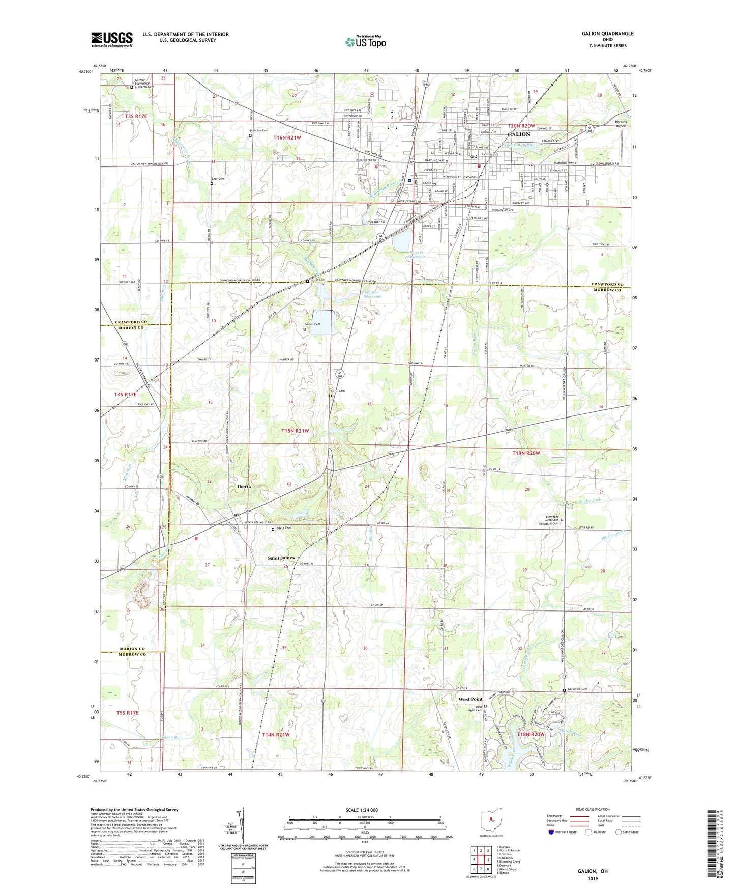
2019 topographic map quadrangle Galion in the state of Ohio. Scale: 1:24000. Based on the newly updated USGS 7.5' US Topo map series, this map is in the following counties: Morrow, Crawford, Marion. The map contains contour data, water features, and other items you are used to seeing on USGS maps, but also has updated roads and other features. This is the next generation of topographic maps. Printed on high-quality waterproof paper with UV fade-resistant inks.
Quads adjacent to this one:
West: Caledonia
Northwest: Bucyrus
North: North Robinson
Northeast: Crestline
East: Blooming Grove
Southeast: Shauck
South: Mount Gilead
Southwest: Denmark
Contains the following named places: Amann Reservoir, Amann Reservoir Dam, Amicks Reservoir, Amicks Upground Reservoir Dam, Autin Cemetery, Beck School, Bunker Hill School, Catholic Cemetery, Christ the King Community Church, Church of Christ, Church of the Nazarene, City of Galion, Clark School, Cobey Park, Country View Mobile Home Park, Crawford County Childrens Home, Dawsett Elementary School, Dice School, East School, Eastside Park, Ebenezer Church, Ebenezer Methodist Episcopal Cemetery, Emanuel Evangelical Lutheran Church, First Assembly of God Church, First Baptist Church, First Church of Christ, First Church of Christ Scientist, First Church of the Open Bible, First Lutheran Church, First Presbyterian Church, First United Church of Christ, First United Methodist Church, Flowers School, Forbes Cemetery, Foursquare Church, Free Methodist Church, Galion, Galion Christian School, Galion City Hall, Galion Community Hospital, Galion Country Club, Galion Fire Department, Galion High School, Galion Middle School, Galion Police Department, Galion Post Office, Galion Public Library, Galion Water Treatment Plant, Galion Water Works, Garverick Cemetery, German Evangelical Lutheran Cemetery, Grace Episcopal Church, Heise Park, Hill Grove School, Horning Airport, Hunters School, Iberia, Iberia Cemetery, Iberia Census Designated Place, Iberia Elementary School, Iberia Landing Strip, Iberia Post Office, Iberia Volunteer Fire Company, Kehrer School, March Run, Market Street Methodist Church, Morrow County Emergency Medical Services, Nelson School, North Elementary School, Northmor High School, Olentangy Estates, Peace Lutheran Church, Pletcher Cemetery, Powers Reservoir, Powers Upground Reservoir Dam, Public Square, Renschville Elementary School, Rocky Fork, Saint James, Saint James Post Office, Saint Joseph Catholic Church, Saint Joseph School, Saint Patricks Roman Catholic Church, Saint Patricks School, Saint Paul United Methodist Church, Seifs School, Seventh Day Adventist Church, South Park, South School, Spring Valley Court, Township of Galion City, Township of Polk, Township of Washington, Trinity Lutheran Church, Tuttle Cemetery, Washington Street Station Mall Shopping Center, Weir Mobile Home Park, West Point, West Point Cemetery, Zoar Cemetery, ZIP Code: 44833