MyTopo
Gratiot Ohio US Topo Map
Couldn't load pickup availability
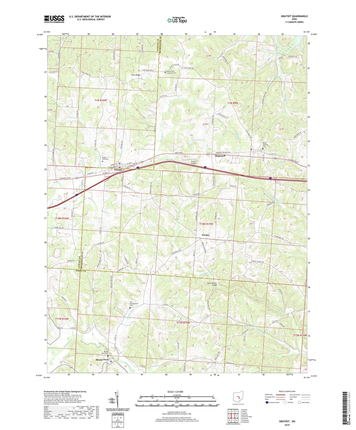
2019 topographic map quadrangle Gratiot in the state of Ohio. Scale: 1:24000. Based on the newly updated USGS 7.5' US Topo map series, this map is in the following counties: Muskingum, Licking, Perry. The map contains contour data, water features, and other items you are used to seeing on USGS maps, but also has updated roads and other features. This is the next generation of topographic maps. Printed on high-quality waterproof paper with UV fade-resistant inks.
Quads adjacent to this one:
West: Glenford
Northwest: Hanover
North: Toboso
Northeast: Dresden
East: Zanesville West
Southeast: Crooksville
South: Fultonham
Southwest: Somerset
Contains the following named places: Asbury Chapel, Asbury School, Berry Run, Brushy Knob School, Church of Christ, Dogwood School, George School, Gratiot, Gratiot Post Office, Gratiot United Methodist Church, Hopewell, Hopewell Elementary School, Hopewell Post Office, Hopewell Union Church, Humphrey School, Ireland School, Jacks Hollow Bridge, Macedonia United Brethren Church, Mount Olive Lutheran Cemetery, Mount Olive United Brethren Church, Mount Perry, Mount Perry Cemetery, Mount Perry Post Office, Mount Sterling, Mount Sterling Cemetery, Mount Sterling Methodist Church, National Trail Volunteer Fire Department, Old Presbyterian Cemetery, Opera, Opera Post Office, Painter Run, Poplar Fork Cemetery, Porter Airport, Porter Lake, Porter Lake Dam, Poverty Run School, Salt Run, Township of Hopewell, Village of Gratiot, Wesley, Wise School, ZIP Codes: 43740, 43746, 43760