MyTopo
Higginsport Ohio US Topo Map
Couldn't load pickup availability
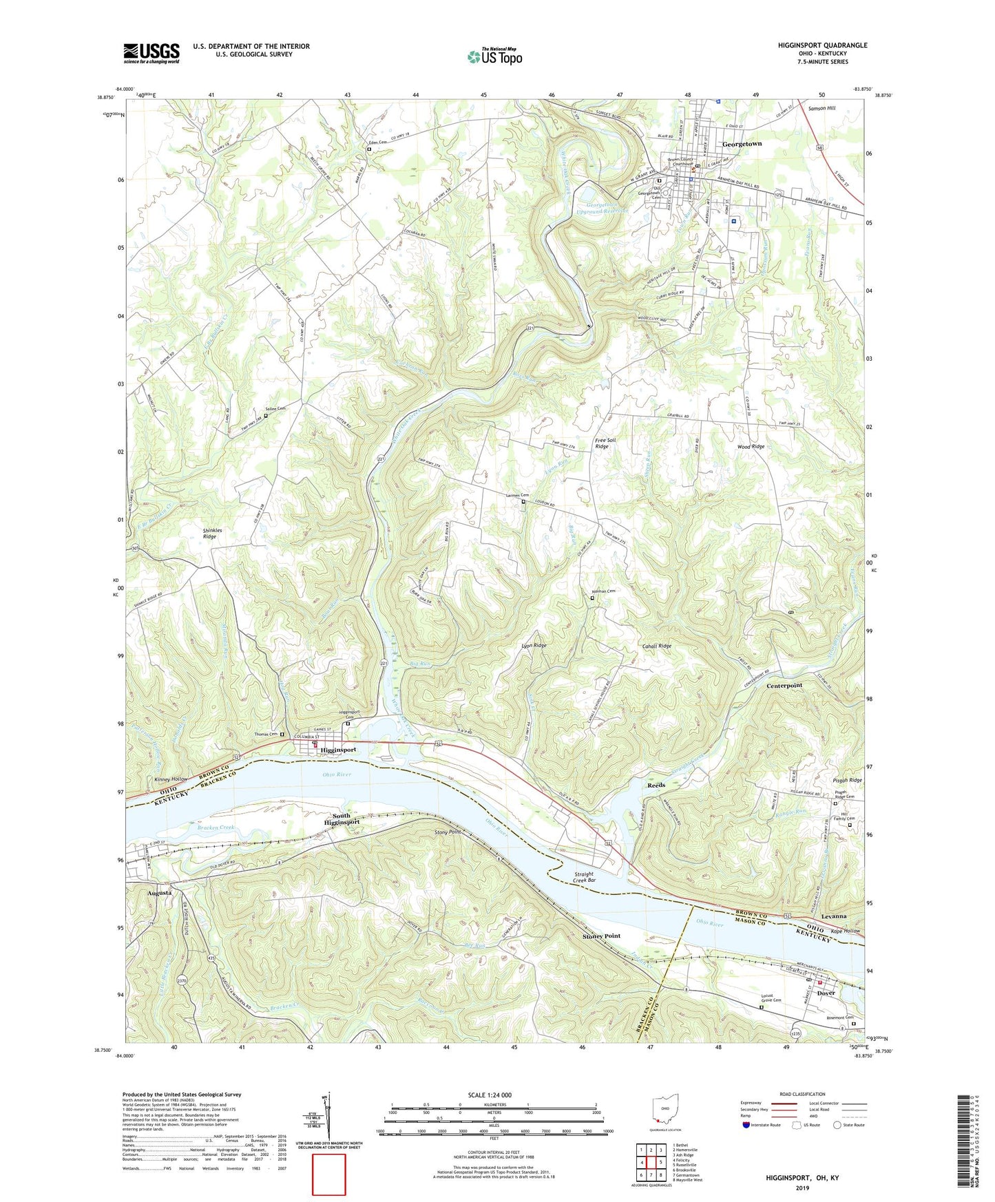
2019 topographic map quadrangle Higginsport in the states of Ohio, Kentucky. Scale: 1:24000. Based on the newly updated USGS 7.5' US Topo map series, this map is in the following counties: Brown, Bracken, Mason. The map contains contour data, water features, and other items you are used to seeing on USGS maps, but also has updated roads and other features. This is the next generation of topographic maps. Printed on high-quality waterproof paper with UV fade-resistant inks.
Quads adjacent to this one:
West: Felicity
Northwest: Bethel
North: Hamersville
Northeast: Ash Ridge
East: Russellville
Southeast: Maysville West
South: Germantown
Southwest: Brooksville
Contains the following named places: Alverda Reed Elementary School, Bee Run, Big Run, Boat Run, Bowers Landing, Bracken Creek, Brown County Fairgrounds, Brown County General Hospital, Brown County Life Squad Association, Brown County Sheriff's Office, Cahall Ridge, Cahall School, Centerpoint, City of Dover, Cochran Run, Donalds Creek, Dover, Dover Covered Bridge Historical Marker, Dover Post Office, Dover Volunteer Fire Department, Eastland Mobile Home Park, Eden Cemetery, Eden Church, Evans Run, Free Soil Ridge, Georgetown, Georgetown Historic District, Georgetown Junior-Senior High School, Georgetown Police Department, Georgetown Post Office, Georgetown Upground Reservoir, Georgetown Upground Reservoir Dam, Hammond Mobile Home Park, Higginsport, Higginsport Cemetery, Higginsport Post Office, Higginsport Railroad Station, Higginsport School, Higginsport Volunteer Fire and Rescue Service, Hill Family Cemetery, Hog Run, Indian Creek, Kinney Hollow, Kope Hollow, Larmen Cemetery, Levanna, Levanna Branch, Little Bracken Creek, Locust Grove Cemetery, Loudon School, Lyon Ridge, Lyon Run, Martin School, Miranda Run, Norman Cemetery, Oak Grove School, Old Georgetown Cemetery, Opossum Run, Patterson Hollow Run, Pisgah Chapel, Pisgah Ridge Cemetery, Raccoon Creek, Rangle Run, Reeds, Rosemont Cemetery, Ross Run, Sallee Cemetery, Samson Hill, School Number One, Sheep Run, Shinkles Ridge, Sink Creek, Sink Creek School, South Higginsport, Stoney Point, Stony Point, Straight Creek, Straight Creek Bar, Thomas Cemetery, Town Run, Township of Lewis, Township of Pleasant, Village of Georgetown, Village of Higginsport, White Oak Creek, White Swan School, Whiteoak School, Wood Ridge, ZIP Codes: 45121, 45131