MyTopo
Kimball Ohio US Topo Map
Couldn't load pickup availability
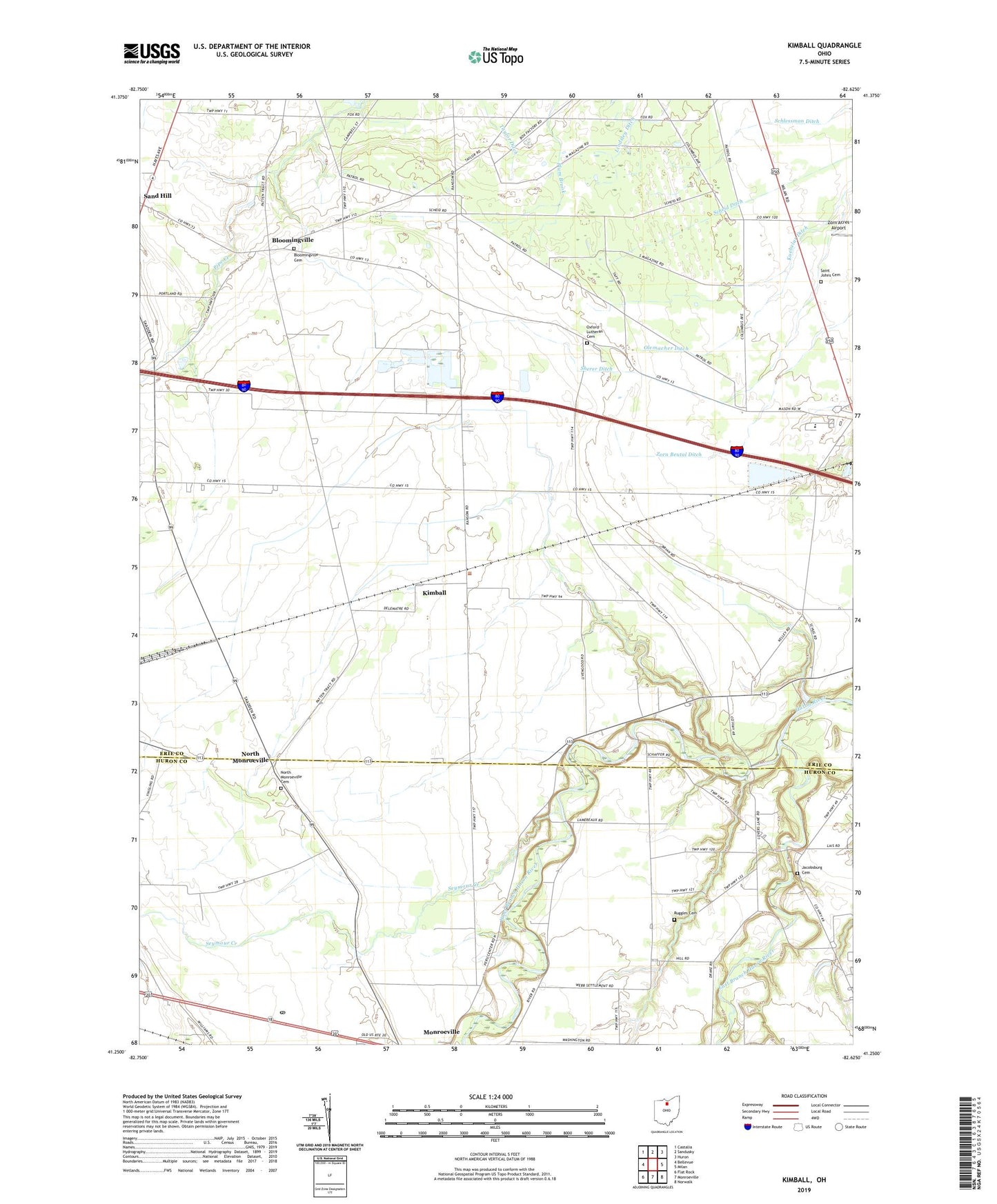
2019 topographic map quadrangle Kimball in the state of Ohio. Scale: 1:24000. Based on the newly updated USGS 7.5' US Topo map series, this map is in the following counties: Erie, Huron. The map contains contour data, water features, and other items you are used to seeing on USGS maps, but also has updated roads and other features. This is the next generation of topographic maps. Printed on high-quality waterproof paper with UV fade-resistant inks.
Quads adjacent to this one:
West: Bellevue
Northwest: Castalia
North: Sandusky
Northeast: Huron
East: Milan
Southeast: Norwalk
South: Monroeville
Southwest: Flat Rock
Contains the following named places: Bloomingville, Bloomingville Cemetery, Bloomingville Census Designated Place, Bloomingville Post Office, Claytondale Farms, Deering Farms, East Branch Huron River, Ehove Joint Vocational School, Erf Family Farms, Erie Sand Barrens Nature Preserve, Fools Gold Farms, Jacobsburg Cemetery, Kimball, Kimball Post Office, Kuebelar Ditch, Miller Farms, North Monroeville, North Monroeville Cemetery, North Monroeville Post Office, Olemacher Ditch, Oxford Lutheran Cemetery, Plum Brook Station, Prout, Prout Post Office, Ruggles Cemetery, Saint John Lutheran Church, Saint Johns Cemetery, Saint Johns Church, Scheid Ditch, Schlessman Ditch, Seymour Creek, Sherer Ditch, Silvertips Farms, Township of Oxford, Township of Ridgefield, Union Corners, Weilnau Farms, West Branch Huron River, WLKR-FM (Norwalk), WVAC-AM (Norwalk), Zorn Acres Airport, Zorn Beutal Ditch