MyTopo
Kimbolton Ohio US Topo Map
Couldn't load pickup availability
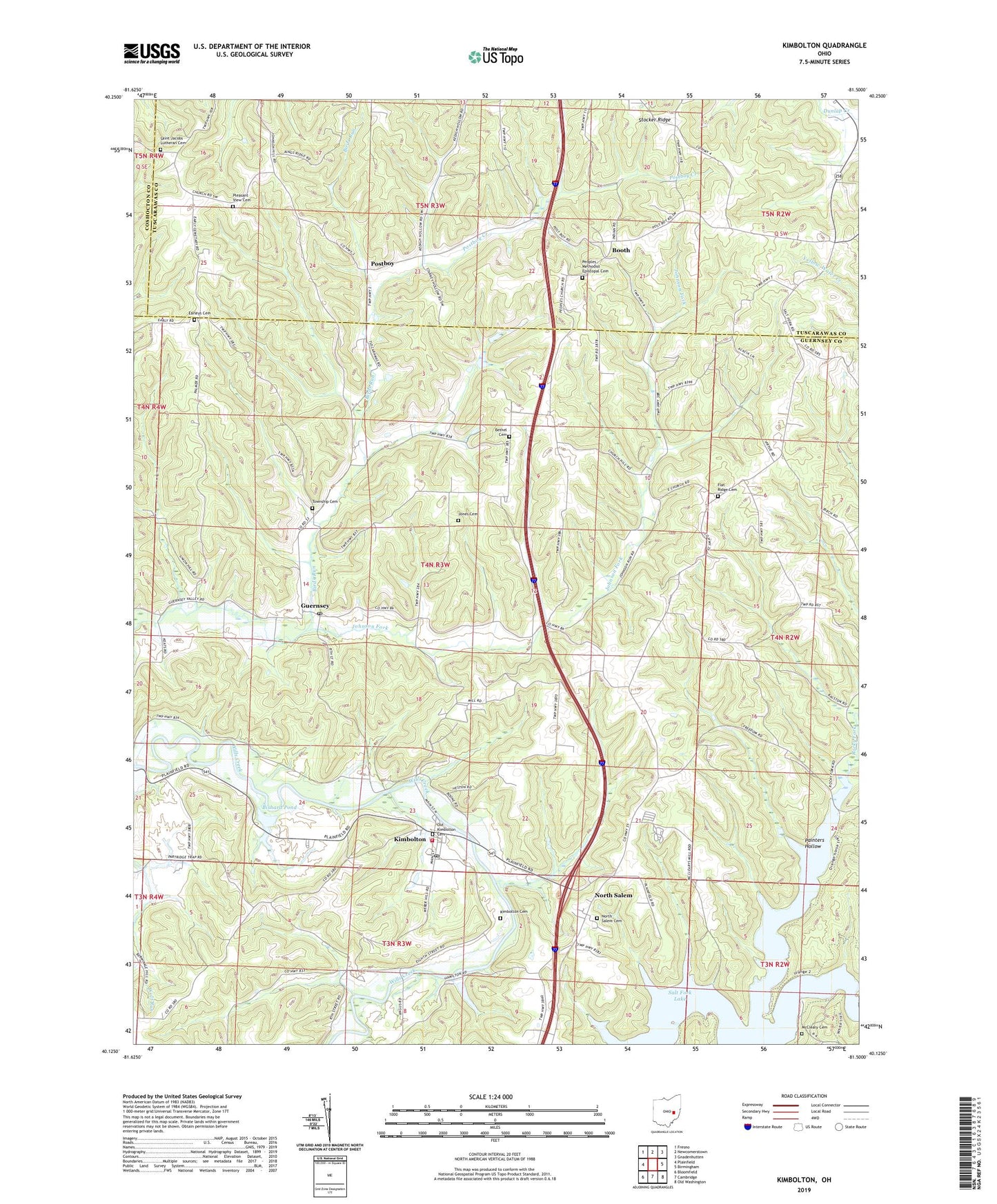
2019 topographic map quadrangle Kimbolton in the state of Ohio. Scale: 1:24000. Based on the newly updated USGS 7.5' US Topo map series, this map is in the following counties: Guernsey, Tuscarawas, Coshocton. The map contains contour data, water features, and other items you are used to seeing on USGS maps, but also has updated roads and other features. This is the next generation of topographic maps. Printed on high-quality waterproof paper with UV fade-resistant inks.
Quads adjacent to this one:
West: Plainfield
Northwest: Fresno
North: Newcomerstown
Northeast: Gnadenhutten
East: Birmingham
Southeast: Old Washington
South: Cambridge
Southwest: Bloomfield
Contains the following named places: Anderson School, Bethel Cemetery, Bethel CHurch, Bishard Pond, Bishard Pond Dam, Booth, Booth Post Office, Earleys Cemetery, Flat Ridge Cemetery, Flat Ridge Church, Full Gospel Temple, Guernsey, Guernsey Community Center, Guernsey Post Office, High Hill School, Johnson Fork, Jones Cemetery, Kimbolton, Kimbolton Cemetery, Kimbolton Census Designated Place, Kimbolton Post Office, Liberty Community Volunteer Fire Department, Liberty Elementary School, McCleary Cemetery, North Salem, North Salem Cemetery, North Salem Community Church, North Salem Post Office, North Salem United Presbyterian Church, Old Kimbolton Cemetery, Painters Hollow, Partridge Trap School, Peoples Church, Peoples Methodist Episcopal Cemetery, Pleasant View Cemetery, Pleasant View Church, Postboy, Postboy Creek, Revival Barn Church, Rocky Fork, Saint Jacobs Lutheran Cemetery, Salt Fork State Park and Wildlife Area, Science Hill School, Seminary School, Township Cemetery, Township of Liberty, Township of Wheeling, Wheeling School, Zion Church, ZIP Code: 43749