MyTopo
Little Hocking Ohio US Topo Map
Couldn't load pickup availability
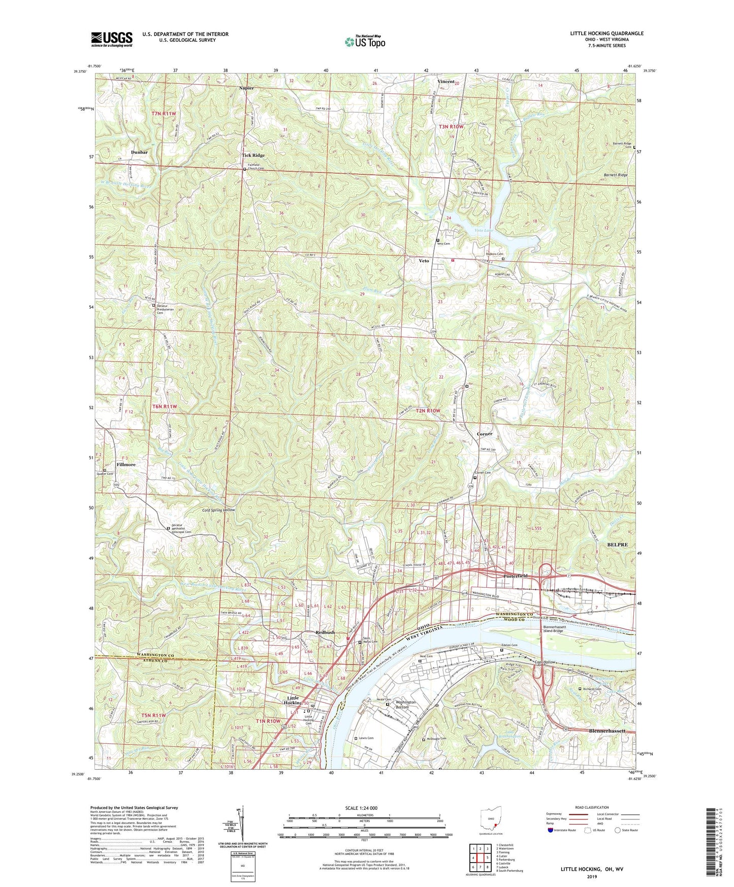
2019 topographic map quadrangle Little Hocking in the states of Ohio, West Virginia. Scale: 1:24000. Based on the newly updated USGS 7.5' US Topo map series, this map is in the following counties: Washington, Wood, Athens. The map contains contour data, water features, and other items you are used to seeing on USGS maps, but also has updated roads and other features. This is the next generation of topographic maps. Printed on high-quality waterproof paper with UV fade-resistant inks.
Quads adjacent to this one:
West: Cutler
Northwest: Chesterhill
North: Watertown
Northeast: Fleming
East: Parkersburg
Southeast: South Parkersburg
South: Lubeck
Southwest: Coolville
Contains the following named places: Barnes Cemetery, Barnett Ridge Cemetery, Big Run, Blennerhassett, Blennerhassett Census Designated Place, Blennerhassett Island, Blennerhassett Island Bridge, Blennerhassett Island Historical State Park, Buffalo Run, Coal Hollow, Cold Spring Hollow, Corner, Corner Cemetery, Davis Creek, Decatur Church, Decatur Methodist Episcopal Cemetery, Decatur Presbyterian Cemetery, Decatur Presbyterian Church, Dunbar, Dunham, Dunham Township Volunteer Fire Department, East Branch Little Hocking River, Edelen Cemetery, Evergreen Memorial Cemetery, Fairchild Church, Fairfield Church Cemetery, Fillmore, Full Gospel Temple, General Electric Plastics Medical Unit, Goodnoughs Landing, Gospel Tabernacle, Grass Run, Highland Lake, Holiday Tree Farm, Hopkins Cemetery, Lake Ron, Lake Washington, Lake Washington Dam, Lewis Cemetery, Lewis Landing, Little Hocking, Little Hocking Cemetery, Little Hocking Census Designated Place, Little Hocking Elementary School, Little Hocking Fire Department, Little Hocking Post Office, Little Hocking River, Little West Branch Little Hocking River, Lock and Dam Number 19, Long Brook, McDougle Cemetery, Mill Branch, Napier, Neal Cemetery, Neale Cemetery, Ohio Power Company Dam Number Three, Ohio Power Pond Number Three, Oxbow Golf Course, Plum Run, Porterfield, Quaker Cemetery, Redbush, Richards Cemetery, Saint Marys Cemetery, Sawyer Run, Short Brook, Tick Ridge, Township of Belpre, Township of Dunham, Tupper Creek, Twin Bridges, Veto, Veto Cemetery, Veto Lake, Veto Lake Dam, Veto Lake Wildlife Area, Veto Presbyterian Church, Vincent Census Designated Place, Washington, Washington Bottom, Washington Post Office, West Branch Little Hocking River, WEYQ-FM (Marietta), WHCM-FM (Parkersburg), Whites Run, ZIP Code: 45742