MyTopo
Loudonville Ohio US Topo Map
Couldn't load pickup availability
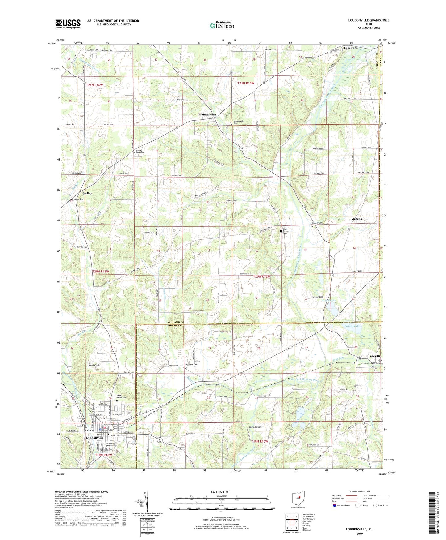
2019 topographic map quadrangle Loudonville in the state of Ohio. Scale: 1:24000. Based on the newly updated USGS 7.5' US Topo map series, this map is in the following counties: Ashland, Holmes, Wayne. The map contains contour data, water features, and other items you are used to seeing on USGS maps, but also has updated roads and other features. This is the next generation of topographic maps. Printed on high-quality waterproof paper with UV fade-resistant inks.
Quads adjacent to this one:
West: Perrysville
Northwest: Ashland South
North: Jeromesville
Northeast: New Pittsburg
East: Shreve
Southeast: Glenmont
South: Greer
Southwest: Jelloway
Contains the following named places: Bald Knob, Big Run School, Blue Ridge School, Bonnett Lake, Budd Elementary School, County Line Cemetery, Crab Run, Emrick School, Kettering Hospital Heliport, Lake Fork, Lakefork Post Office, Lakeville, Lakeville Elementary School, Loudonville, Loudonville Cemetery, Loudonville Church of the Nazarene, Loudonville Fire Department, Loudonville High School, Loudonville Police Department, Loudonville Post Office, McKay, McKay Cemetery, McKay Post Office, McMullen Elementary School, McZena, McZena Post Office, Mohicanville, Mohicanville Cemetery, Mohicanville Dam, Mohicanville Reservoir, Nesta Airport, Old Sixteen Cemetery, Pioneer Cemetery, Plum Run, Plum Run Cemetery, Ridge School, Round Lake, Saint Peters Catholic Church, Saint Peters Cemetery, Synagogue Cemetery, Tea Hills Organic Farm, Township of Lake, Township of Washington, Village of Loudonville, ZIP Codes: 44638, 44842