MyTopo
McConnelsville Ohio US Topo Map
Couldn't load pickup availability
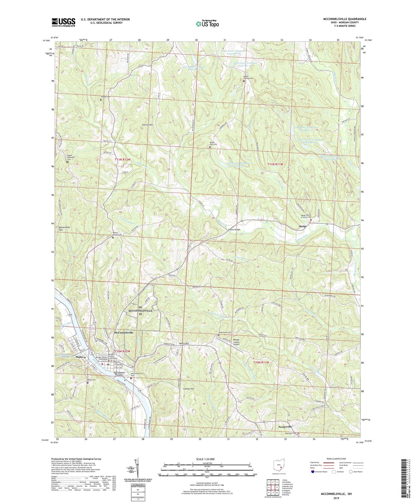
2019 topographic map quadrangle McConnelsville in the state of Ohio. Scale: 1:24000. Based on the newly updated USGS 7.5' US Topo map series, this map is in the following counties: Morgan. The map contains contour data, water features, and other items you are used to seeing on USGS maps, but also has updated roads and other features. This is the next generation of topographic maps. Printed on high-quality waterproof paper with UV fade-resistant inks.
Quads adjacent to this one:
West: Rokeby Lock
Northwest: Philo
North: Ruraldale
Northeast: Cumberland
East: Reinersville
Southeast: Beverly
South: Stockport
Southwest: Ringgold
Contains the following named places: Airington, Bear Run, Bell Creek, Border School, Buttermilk Hill, Carmel Church, Chapel Church, Cherry Hill, Church of the Nazarene, Cloud, Cloud Post Office, Cotton Bridge, Cotton Hill, Ebenezer Cemetery, Ebenezer United Methodist Church, Election School, Gladdens Trailer Court, Grace Methodist Church, Harmony Hill School, Jacklot Cemetery, Kate Love Simpson Library, Little Fourmile Run, M and M Fire and Emergency Medical Services Department, Main Street Christian Church, Malta, Malta Cemetery, Malta Elementary School, Malta Methodist Church, Malta Post Office, Mans Fork, McCarty School, McConnells Island, McConnelsville, McConnelsville Cemetery, McConnelsville Historic District, McConnelsville Post Office, McKendree Cemetery, McKendree United Methodist Church, Meigs, Meigs Church of Christ, Meigs Church of Christ Cemetery, Meigs Post Office, Millers Run, Morgan County Airport, Morgan County Bar Association Library, Morgan County Courthouse, Morgan County Fairgrounds, Morgan County Jail, Morgan County Sheriff's Office, Morgan High School, Mount Carmel Cemetery, Mount Carmel United Methodist Church, Mount Zion Cemetery, Muskingum River Lock and Dam Number, Muskingum River Lock and Dam Number Seven, Muskingum River Parkway State Park, Neelysville, Neelysville Post Office, Neelysville School, Ohio Power Company Pond 9516-010, Ohio Power Company Pond 9516-010 Dam, Ohio Power Company Pond Mb-118, Ohio Power Company Pond Mb-118 Dam, Ohio Power Company Pond Mb-120, Ohio Power Company Pond Mb-120 Dam, Ohio Power Company Pond Mb-133, Ohio Power Company Pond Mb-133 Dam, Ohio Power Company Pond Mb-141, Ohio Power Company Pond Mb-141 Dam, Ohio Power Company Pond Mb-144, Ohio Power Company Pond Mb-144 Dam, Ohio Power Company Pond Mbl-1, Ohio Power Company Pond Mbl-1 Dam, Patterson School, Pisgah Methodist Cemetery, Pisgah United Methodist Church, Reeds School, Rowland, Rowland Post Office, Saint James Roman Catholic Church, Salt Run, Seventh Street Church of Christ, Slemmons Creek, Smith School, Stony Point School, Township of Bloom, Township of Bristol, Township of Meigsville, Township of Morgan, Trinity Methodist Church, Tunnel Hill School, Village of Malta, Village of McConnelsville, Wesley Chapel Cemetery, Willis Hill, Wilson School, Zion Church, ZIP Code: 43756