
MyTopo
Mentor OE N Ohio US Topo Map
Couldn't load pickup availability
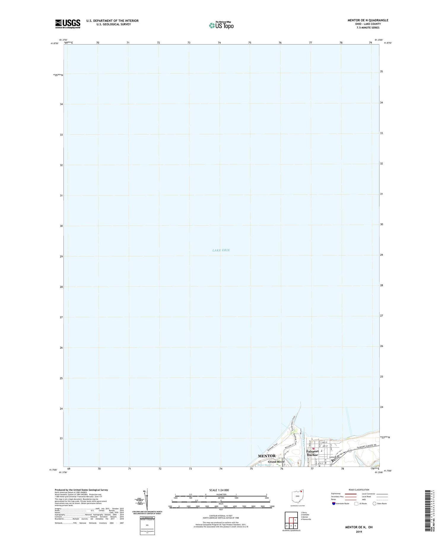
2019 topographic map quadrangle Mentor OE N in the state of Ohio. Scale: 1:24000. Based on the newly updated USGS 7.5' US Topo map series, this map is in the following counties: Lake. The map contains contour data, water features, and other items you are used to seeing on USGS maps, but also has updated roads and other features. This is the next generation of topographic maps. Printed on high-quality waterproof paper with UV fade-resistant inks.
Quads adjacent to this one:
East: Perry
Southeast: Painesville
South: Mentor
Southwest: Eastlake
Contains the following named places: Boat Loader Lights, East Breakwater East End Light, East Breakwater Light, East Pier Light, Fairport Congregational Church, Fairport Harbor, Fairport Harbor Fire Department, Fairport Harbor Police Department, Fairport Harbor Village Hall, Fairport Public Library, Fairport Waterworks, Grand River, Harding High School, Headlands Beach State Park, Headlands Dunes State Nature Preserve, Hungarian Reformed Church, Huntington Park, Immanuel Lutheran Church, Lutheran Cemetery, McKinley High School, Old Lighthouse, Old Lighthouse Museum, Painesville Purification Plant, Saint Anthony of Padua Catholic Church, Saint Anthonys School, Shipman Pond, West Breakwater Extension Ligth, West Breakwater Light, West Pier Light, Zion Lutheran Church


