MyTopo
Middlefield Ohio US Topo Map
Couldn't load pickup availability
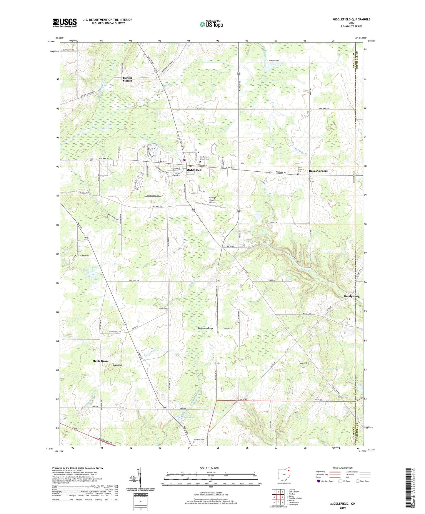
2019 topographic map quadrangle Middlefield in the state of Ohio. Scale: 1:24000. Based on the newly updated USGS 7.5' US Topo map series, this map is in the following counties: Geauga, Trumbull. The map contains contour data, water features, and other items you are used to seeing on USGS maps, but also has updated roads and other features. This is the next generation of topographic maps. Printed on high-quality waterproof paper with UV fade-resistant inks.
Quads adjacent to this one:
West: Burton
Northwest: Chardon
North: East Claridon
Northeast: Windsor
East: West Farmington
Southeast: Southington
South: Garrettsville
Southwest: Mantua
Contains the following named places: A J Jordak Elementary School, Airwolf Heliport, Berkshire Industrial Park, Bonner Industrial Park, Bundysburg, Bundysburg Post Office, Burroughs Cemetery, Burton Industrial Park, Burton Station, Burton Station Post Office, Camp Chickagami, Cardinal High School, Cardinal Middle School, Cornerstone Bible Church, Geauga County Airport, Geauga Industrial Park, Harrington Square Heliport, Hayes Corners, Hayes Corners Cemetery, Hayes Road School, Hosmer Airfield, John's Country Nursery, Lake Estabrook, Larry Peairs Memorial Lake, Larry Peairs Memorial Lake Dam, Maple Grove, Mapleview School, Middlefield, Middlefield Center Cemetery, Middlefield Fire Department Station 1, Middlefield Police Department, Middlefield Post Office, Moss Farm, Northeast Middlefield School, Overlook Cemetery, Parkman School, Pauls Airport, Shrine of Maria-Poch, Sperry Pond, Sugarloaf, Tare Creek, Township of Middlefield, Township of Parkman, Troy Church School, Village of Middlefield, Welshfield Post Office, Wilkum Creek, Yoder Cemetery, Zaylor Farm, ZIP Code: 44062