
MyTopo
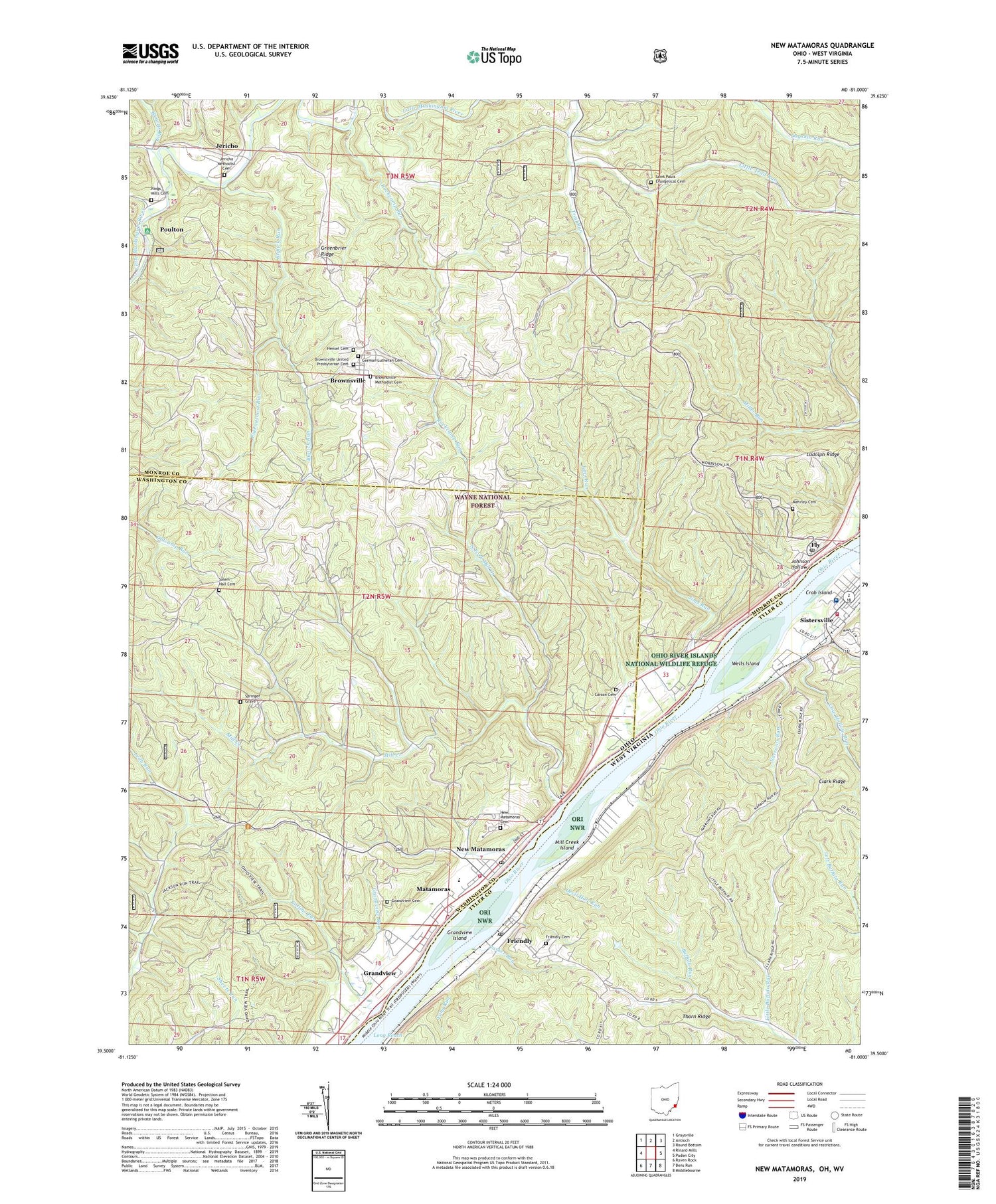
New Matamoras Ohio US Topo Map
Couldn't load pickup availability
2019 topographic map quadrangle New Matamoras in the states of Ohio, West Virginia. Scale: 1:24000. Based on the newly updated USGS 7.5' US Topo map series, this map is in the following counties: Monroe, Washington, Tyler. The map contains contour data, water features, and other items you are used to seeing on USGS maps, but also has updated roads and other features. This is the next generation of topographic maps. Printed on high-quality waterproof paper with UV fade-resistant inks.
Quads adjacent to this one:
West: Rinard Mills
Northwest: Graysville
North: Antioch
Northeast: Round Bottom
East: Paden City
Southeast: Middlebourne
South: Bens Run
Southwest: Raven Rock
Contains the following named places: Biglick Run, Bradfield Landing, Browns Run, Brownsville, Brownsville Methodist Cemetery, Brownsville Methodist Church, Brownsville United Presbyterian Cemetery, Carson Cemetery, Centerview, Central District, City of Matamoras, Clark Ridge, Collins Run, Cow Hollow Run, Crab Island, Devil Hole Run, Excelsior School, First Christian Church, Fly, Fly Ferry, Fly Post Office, Friendly, Friendly Cemetery, Friendly Post Office, Frontier High School, German Lutheran Cemetery, Grandview, Grandview Cemetery, Grandview Island, Grandview Run, Grandview Township Volunteer Fire Department, Greenbrier Ridge, Hensel Cemetery, Jericho, Jericho Methodist Cemetery, Jericho Methodist Church, Jims Run, Johnson Hollow, Little Buffalo Run, Little Trail Run, Ludolph Ridge, Matamoras Elementary School, Mehrley Cemetery, Mill Creek, Mill Creek Island, Mill Creek Landing, Miller Run, Narrows Run, New Matamoras, New Matamoras Cemetery, New Matamoras Emergency Medical Services, New Matamoras Post Office, North Fork Mill Creek, Parker Run, Pigeonroost Run, Poulton, Poulton Post Office, Rings Mill Cemetery, Rockcamp Run, Saint Pauls Evangelical Cemetery, Saint Pauls United Church of Christ, Salem Hall, Salem Hall Cemetery, Sistersville Country Club Golf Course, Sistersville General Hospital, Sistersville General Hospital Ambulance Service, Sistersville High School, Sistersville Junior High School, Sistersville Volunteer Fire Department, Springer Grave, Stringtown, Tanyard Run, Thorn Ridge, Town of Friendly, Township of Benton, Township of Grandview, Township of Jackson, Trail Run, Village of Matamoras, Wahanaker, Washington Hall Church, Wells Island, Witten Fork, Yellow House, Yoho Run, Zion Church


