MyTopo
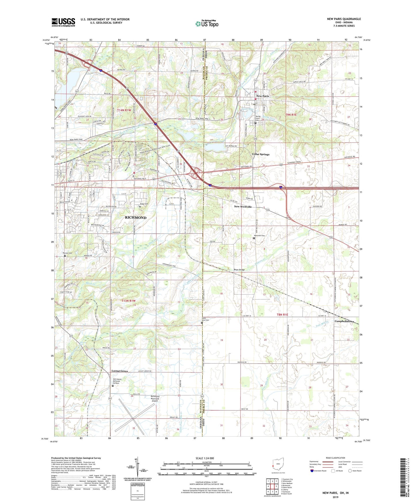
New Paris Ohio US Topo Map
Couldn't load pickup availability
2019 topographic map quadrangle New Paris in the states of Ohio, Indiana. Scale: 1:24000. Based on the newly updated USGS 7.5' US Topo map series, this map is in the following counties: Preble, Wayne. The map contains contour data, water features, and other items you are used to seeing on USGS maps, but also has updated roads and other features. This is the next generation of topographic maps. Printed on high-quality waterproof paper with UV fade-resistant inks.
Quads adjacent to this one:
West: Richmond
Northwest: Fountain City
North: Whitewater
Northeast: New Madison
East: Eaton North
Southeast: Eaton South
South: Fairhaven
Southwest: Liberty
Contains the following named places: Beam Bridge, Belfast, C R Coblentz Elementary School, Campbellstown, Campbellstown Post Office, Campbellstown United Church of Christ, Cedar Springs, Charles Elementary School, Church of Christ, Deaton Farms, Elkhorn Falls, First United Presbyterian Church, Forest Hills Golf Course, France Park, Glen Haven Memorial Gardens, Glenn Miller Park, Jordan Farms, Julia E Test Junior High School, Little Creek, Locust Grove, Middle Fork Reservoir, Middleboro Pit, New Paris, New Paris Post Office, New Westville, New Westville Friends Church, New Westville Post Office, Northwest Fire Department and Ambulance District, Pleasant View Junior High School, Richmond Fire Department Station 3, Richmond Municipal Airport, Ridge Cemetery, Rocky Fork, Saint Paul United Methodist Church, Silver Lake, Spring Lawn Cemetery, State Line Cemetery, Straszheim Farms, Terrebonne Farms, Township of Boston, Township of Jackson, Township of Jefferson, Village of New Paris, Wernle Cemetery, Wesler Orchards, Westville Cemetery, Westville Station