MyTopo
Norwich Ohio US Topo Map
Couldn't load pickup availability
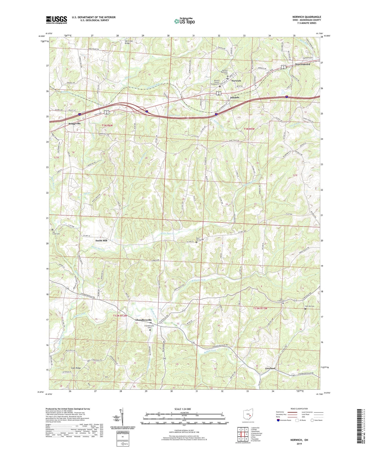
2019 topographic map quadrangle Norwich in the state of Ohio. Scale: 1:24000. Based on the newly updated USGS 7.5' US Topo map series, this map is in the following counties: Muskingum. The map contains contour data, water features, and other items you are used to seeing on USGS maps, but also has updated roads and other features. This is the next generation of topographic maps. Printed on high-quality waterproof paper with UV fade-resistant inks.
Quads adjacent to this one:
West: Zanesville East
Northwest: Adamsville
North: Otsego
Northeast: Bloomfield
East: New Concord
Southeast: Cumberland
South: Ruraldale
Southwest: Philo
Contains the following named places: Bakers Pond, Bakers Pond Dam, Bridgeville, Bridgeville Post Office, Buck Run, Buffalo Fork, Chandlersville, Chandlersville Cemetery, Chandlersville Post Office, Chandlersville Presbyterian Church, Chandlersville School, Chandlersville United Methodist Church, Coon Ridge, Derry Landing Strip Airport, Forestdale School, Franklin School, Freeland, Freeland Post Office, Frog Run, Georges Run, Green Valley School, Lawton, Lawton Post Office, Lepage Run, Little Salt Creek, National Road Museum, Norwich, Norwich Methodist Cemetery, Norwich Post Office, Norwich School, Norwich United Presbyterian Cemetery, Perry Elementary School, Pike School, Pleasant Run, Pleasant Valley School, Rich Hill, Rich Hill Cemetery, Rich Hill Church, Rich Hill Post Office, Rock Spring Cemetery, Salt Creek Baptist Church, Salt Creek Bridge, Salt Creek Cemetery, Salt Creek Church, Seawright, Shuck School, Smith, Smith Mill, Spry School, Sun Dale Post Office, Sundale, Township of Perry, Township of Salt Creek, Township of Union, Village of Norwich, West Union School, White Eyes Creek, Williams Fork