MyTopo
Perryton Ohio US Topo Map
Couldn't load pickup availability
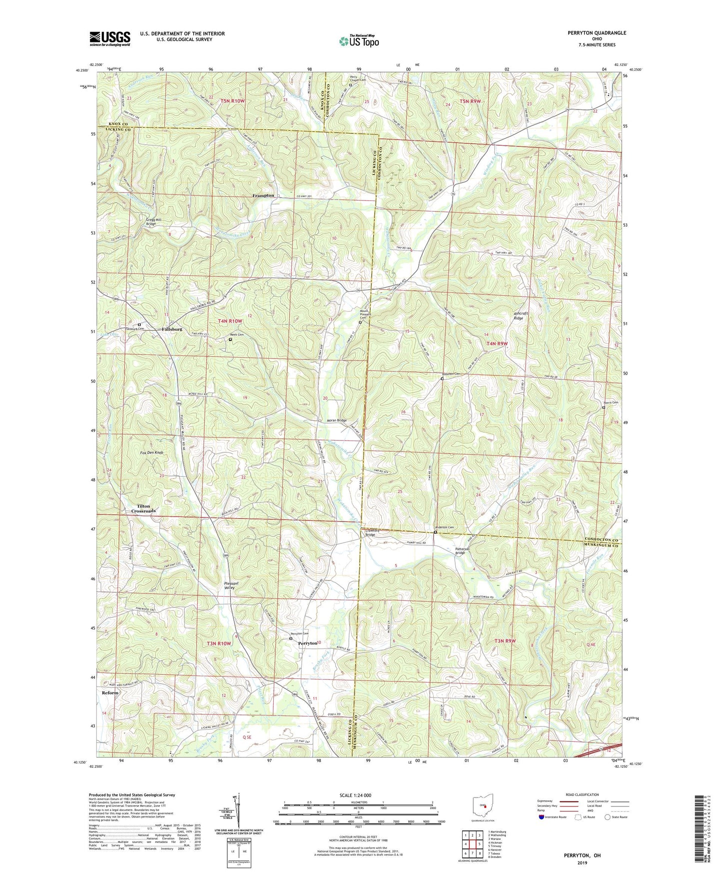
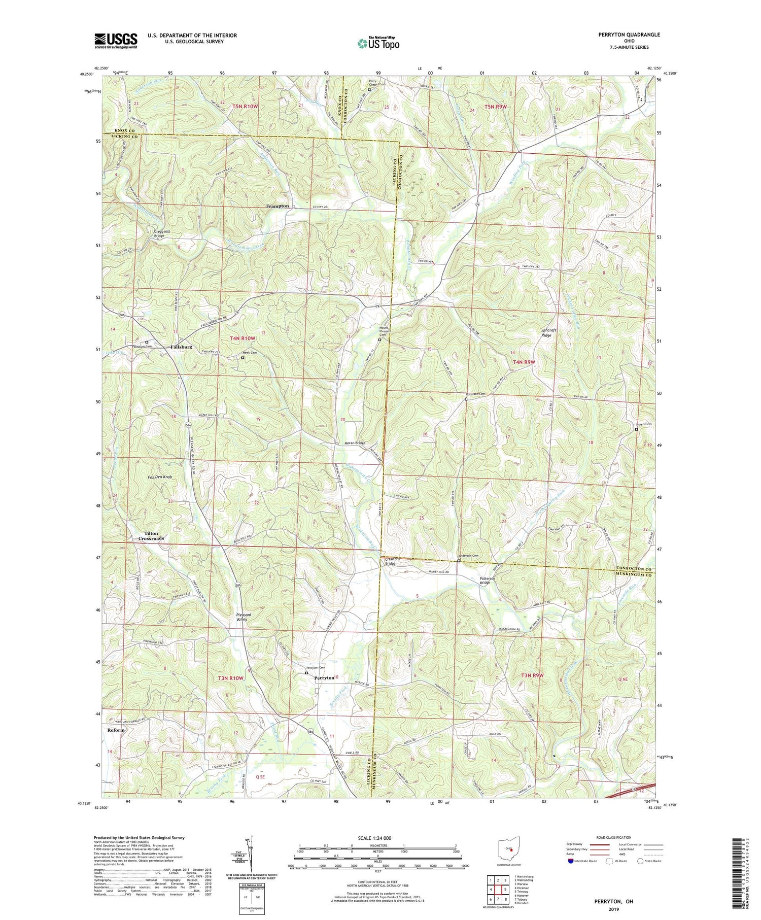
2019 topographic map quadrangle Perryton in the state of Ohio. Scale: 1:24000. Based on the newly updated USGS 7.5' US Topo map series, this map is in the following counties: Licking, Coshocton, Muskingum, Knox. The map contains contour data, water features, and other items you are used to seeing on USGS maps, but also has updated roads and other features. This is the next generation of topographic maps. Printed on high-quality waterproof paper with UV fade-resistant inks.
Quads adjacent to this one:
West: Hickman
Northwest: Martinsburg
North: Walhonding
Northeast: Warsaw
East: Trinway
Southeast: Dresden
South: Toboso
Southwest: Hanover
Contains the following named places: Anderson Cemetery, Anderson Run, Ashcraft Ford, Ashcraft Ridge, Ashcraft School, Brushy Fork, Crawford Bridge, Fairview School, Fallsburg, Fallsburg Cemetery, Fallsburg Post Office, Fivemile Run, Fox Den Knob, Frampton, Frampton Post Office, Framptons Mills, Gardner School, Gregg Mill Bridge, Holmes Mill, Jug Run, Meek Cemetery, Moran Bridge, Mount Pleasant Cemetery, Mount Pleasant Church, Nickel Valley Run, Norris Cemetery, Oxley Run, Patterson Bridge, Perry Chapel, Perry Chapel Cemetery, Perry Elementary School, Perryton, Perryton Cemetery, Perryton Church of Christ, Perryton Post Office, Perryton United Methodist Church, Pisgah School, Pleasant Valley, Priest Run, Rine Corners, Robinson Cemetery, Rocky Run School, Tilton Crossroads, Township of Fallsbury, Township of Jackson, Township of Perry, Township of Pike, Union Elementary School, Winding Fork, ZIP Code: 43822