MyTopo
Plumwood Ohio US Topo Map
Couldn't load pickup availability
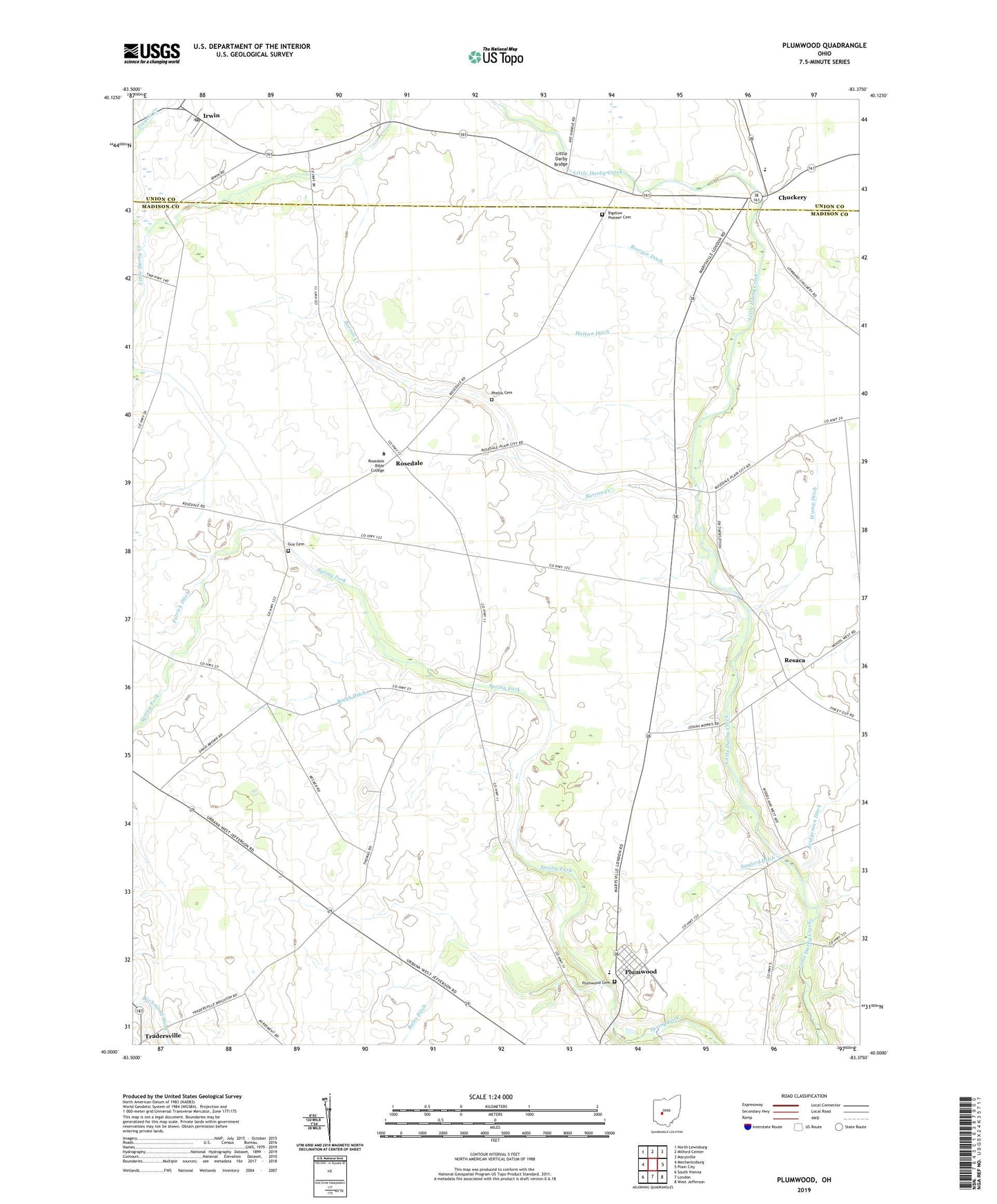
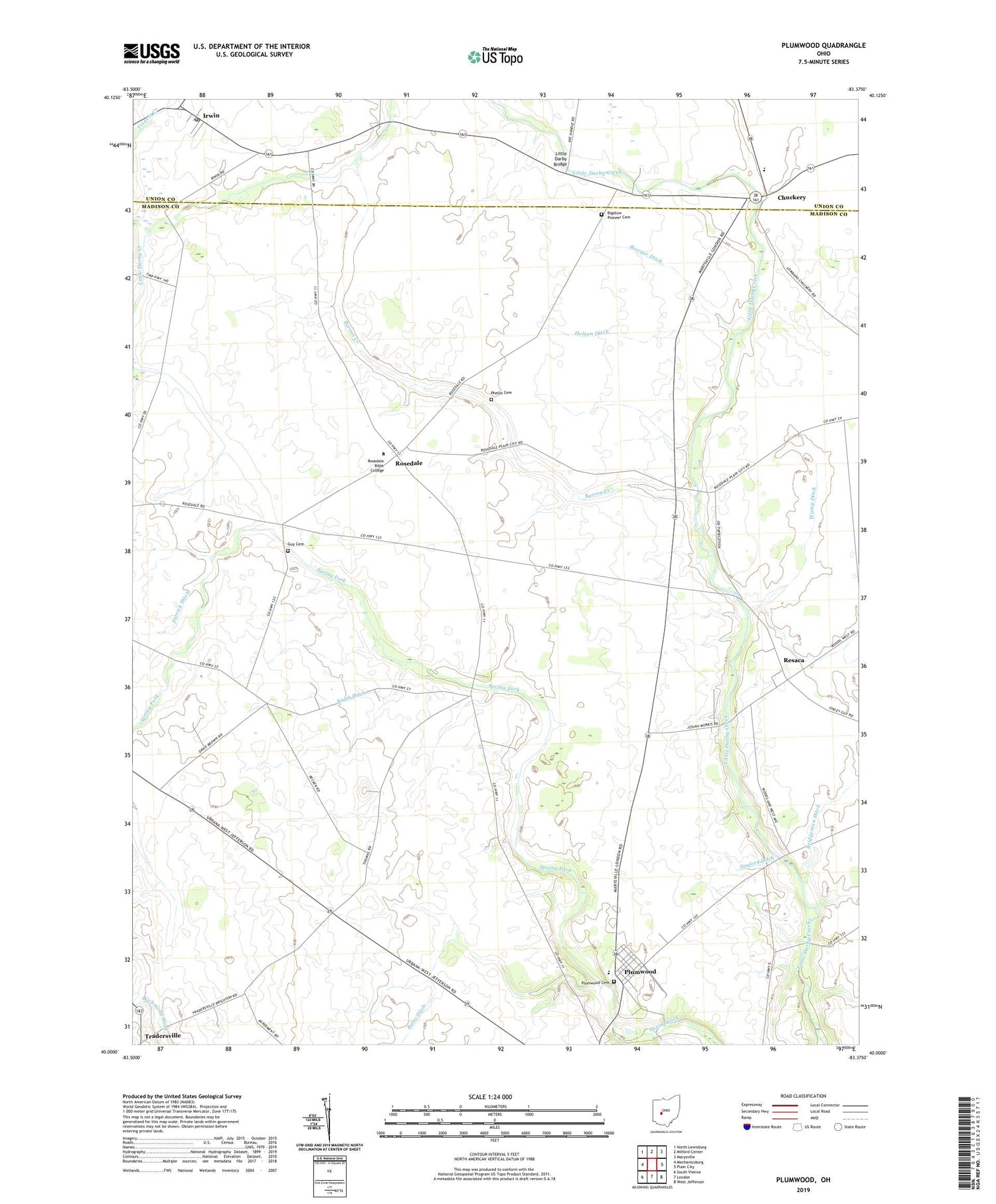
2019 topographic map quadrangle Plumwood in the state of Ohio. Scale: 1:24000. Based on the newly updated USGS 7.5' US Topo map series, this map is in the following counties: Madison, Union. The map contains contour data, water features, and other items you are used to seeing on USGS maps, but also has updated roads and other features. This is the next generation of topographic maps. Printed on high-quality waterproof paper with UV fade-resistant inks.
Quads adjacent to this one:
West: Mechanicsburg
Northwest: North Lewisburg
North: Milford Center
Northeast: Marysville
East: Plain City
Southeast: West Jefferson
South: London
Southwest: South Vienna
Contains the following named places: Ayars Farms, Bales Ditch, Barron Creek, Bigelow Cemetery Prairie, Bigelow Cemetery State Nature Preserve, Bigelow Pioneer Cemetery, Boerger Ditch, Booth Ditch, Bridgeman Ditch, Chuckery, Chuckery Post Office, Cleo Florence Ditch, Guy Cemetery, Holland School, Holton Ditch, Irwin, Irwin Post Office, Little Darby Bridge, Mayer's Fruit Farm, Monroe School, Patrick Ditch, Phellis Cemetery, Plumwood, Plumwood Cemetery, Plumwood Census Designated Place, Plumwood Post Office, Resaca, Resaca Post Office, Rosedale, Rosedale Bible Institute, Rosedale Post Office, Saint Pauls School, Sanford Ditch, Township of Monroe, Township of Pike, Wamp Ditch, Yoder Farms, ZIP Code: 43029