MyTopo
Powell Ohio US Topo Map
Couldn't load pickup availability
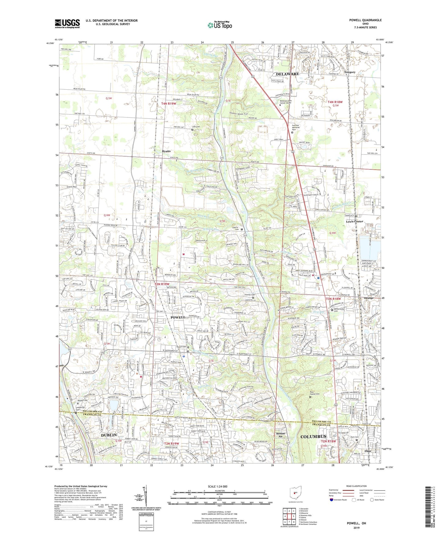
2019 topographic map quadrangle Powell in the state of Ohio. Scale: 1:24000. Based on the newly updated USGS 7.5' US Topo map series, this map is in the following counties: Delaware, Franklin. The map contains contour data, water features, and other items you are used to seeing on USGS maps, but also has updated roads and other features. This is the next generation of topographic maps. Printed on high-quality waterproof paper with UV fade-resistant inks.
Quads adjacent to this one:
West: Shawnee Hills
Northwest: Ostrander
North: Delaware
Northeast: Kilbourne
East: Galena
Southeast: Northeast Columbus
South: Northwest Columbus
Southwest: Hilliard
Contains the following named places: Bartholomew Run, Big Meadows Picnic Area, Big Run, Bluff Run, Braumiller Woods, Bridlespur, Camp Lazarus, Cheshire Crossing, City of Powell, Cole Cemetery, Columbus Zoo, Deep Run, Deer Run, Delaware Country Club, Dornoch Estates, Double Duros Country Club, Edward F Hutchins Nature Preserve, Estates At Braumiller, Fairview Memorial Park, Flint, Flint Cemetery, Flint Post Office, Friends Church, Glen Oak, Glenross, Green Meadows Corporate Center, Gregory, Gregory Post Office, Hidden Springs, High Banks Metropolitan Park, Huffman Industrial Park, Hyatt United Methodist Church, Hyatts, Jacks Run, Leatherlips Cemetery, Lewis Center, Lewis Center Post Office, Liberty Cemetery, Liberty Church, Liberty Run, Liberty Township Community Building, Liberty Township Fire Department Station 321, Liberty Township Fire Department Station 322, Liberty Township Park, Liberty Union School, Lick Run, McKinney Run, Mohawk Run, Mount Air, Nelson Farms, North Orange, Northport Meadows, Northwoods, Oak Coves Picnic Area, Oldfield Estates, Olentangy Crossings, Olentangy Falls, Olentangy Glade, Olentangy High Bluffs, Olentangy High School, Olentangy Meadows, Orange, Orange Township Fire Department Station 361, Pool Family Cemetery, Powell, Powell Cemetery, Powell Community Church, Powell Police Department, Powell Post Office, Powell Village Hall, Reed Run, Rhodes Cemetery, Tanglewood Golf Course, Thomas Cemetery, Township of Liberty, Township of Perry, Trails End, Tylers Run, Village At North Falls, Weeping Rock Creek, Wild Cat Run, Williamsville Cemetery, Wingate Farms, Wingsong Country Club, Wolf Run, Worthington Arms, Worthington Christian Church, Worthington Hills, Worthington Hills Country Club, WRFD-AM (Columbus-Worthington), Wynstone, ZIP Code: 43065