MyTopo
Shade Ohio US Topo Map
Couldn't load pickup availability
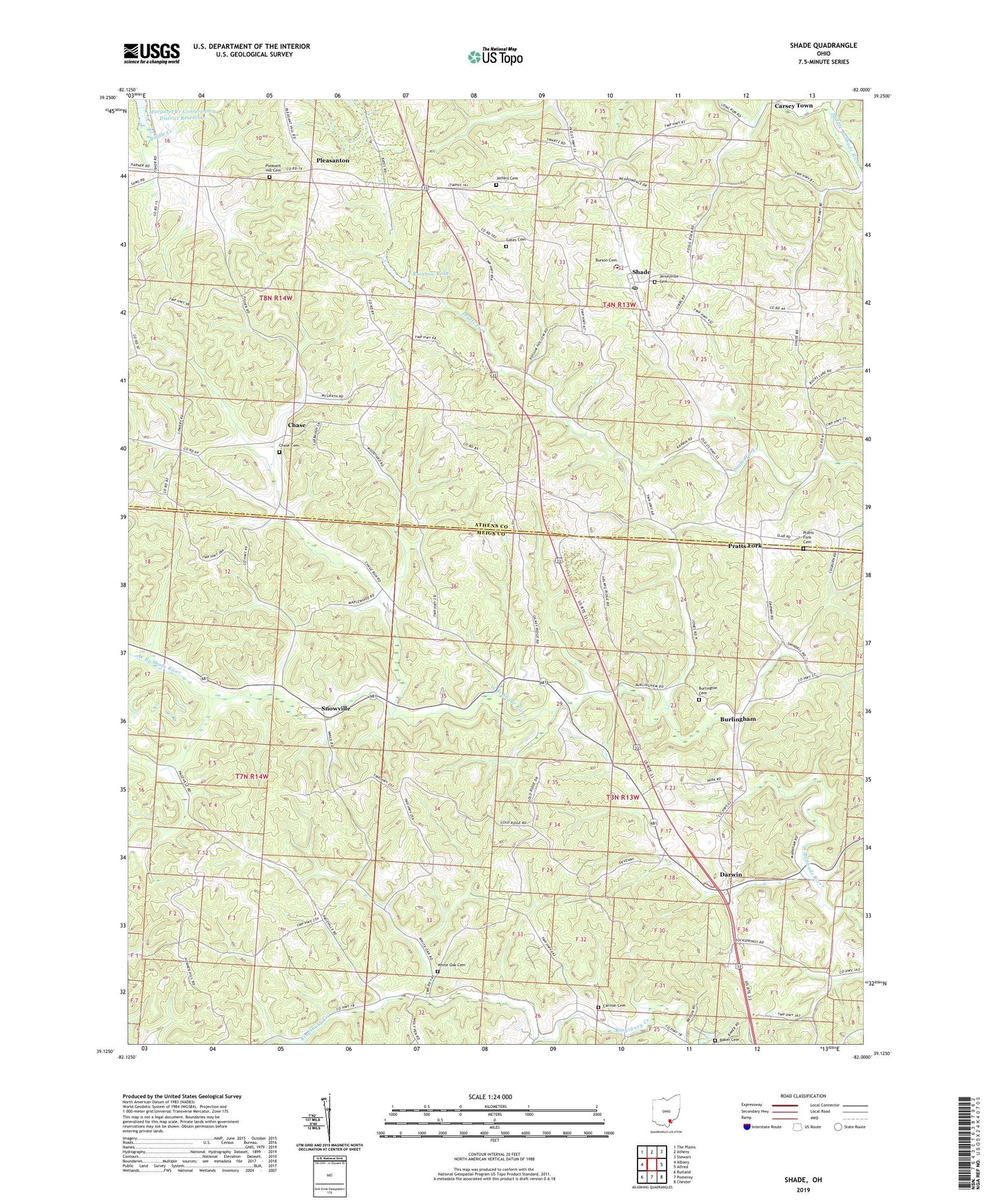
2019 topographic map quadrangle Shade in the state of Ohio. Scale: 1:24000. Based on the newly updated USGS 7.5' US Topo map series, this map is in the following counties: Meigs, Athens. The map contains contour data, water features, and other items you are used to seeing on USGS maps, but also has updated roads and other features. This is the next generation of topographic maps. Printed on high-quality waterproof paper with UV fade-resistant inks.
Quads adjacent to this one:
West: Albany
Northwest: The Plains
North: Athens
Northeast: Stewart
East: Alfred
Southeast: Chester
South: Pomeroy
Southwest: Rutland
Contains the following named places: Alexander Junior High School, Baker Cemetery, Bedford Church, Bedford Elementary School, Burlingham, Burlingham Church, Burlingham Post Office, Burlington Cemetery, Burson Cemetery, Carlton Cemetery, Carlton Church, Chase, Chase Cemetery, Chase Church, Darwin, Darwin Post Office, Duck Run, Free Will Baptist Church, Gates Cemetery, Hanning Church, Jeffers Cemetery, Jerseyville Cemetery, Pleasant Hill Cemetery, Pleasant Hill Church, Pleasanton, Pleasanton Post Office, Pratts Fork, Pratts Fork Cemetery, Pratts Fork Church, Pratts Fork Post Office, Rainbow Lake, Rainbow Lake Dam, Saint James Episcopal Church, Shade, Shade Post Office, Snowville, Snowville Post Office, Township of Bedford, Township of Lodi, White Oak Cemetery, White Oak Methodist Protestant Church, ZIP Code: 45776