MyTopo
Sycamore Ohio US Topo Map
Couldn't load pickup availability
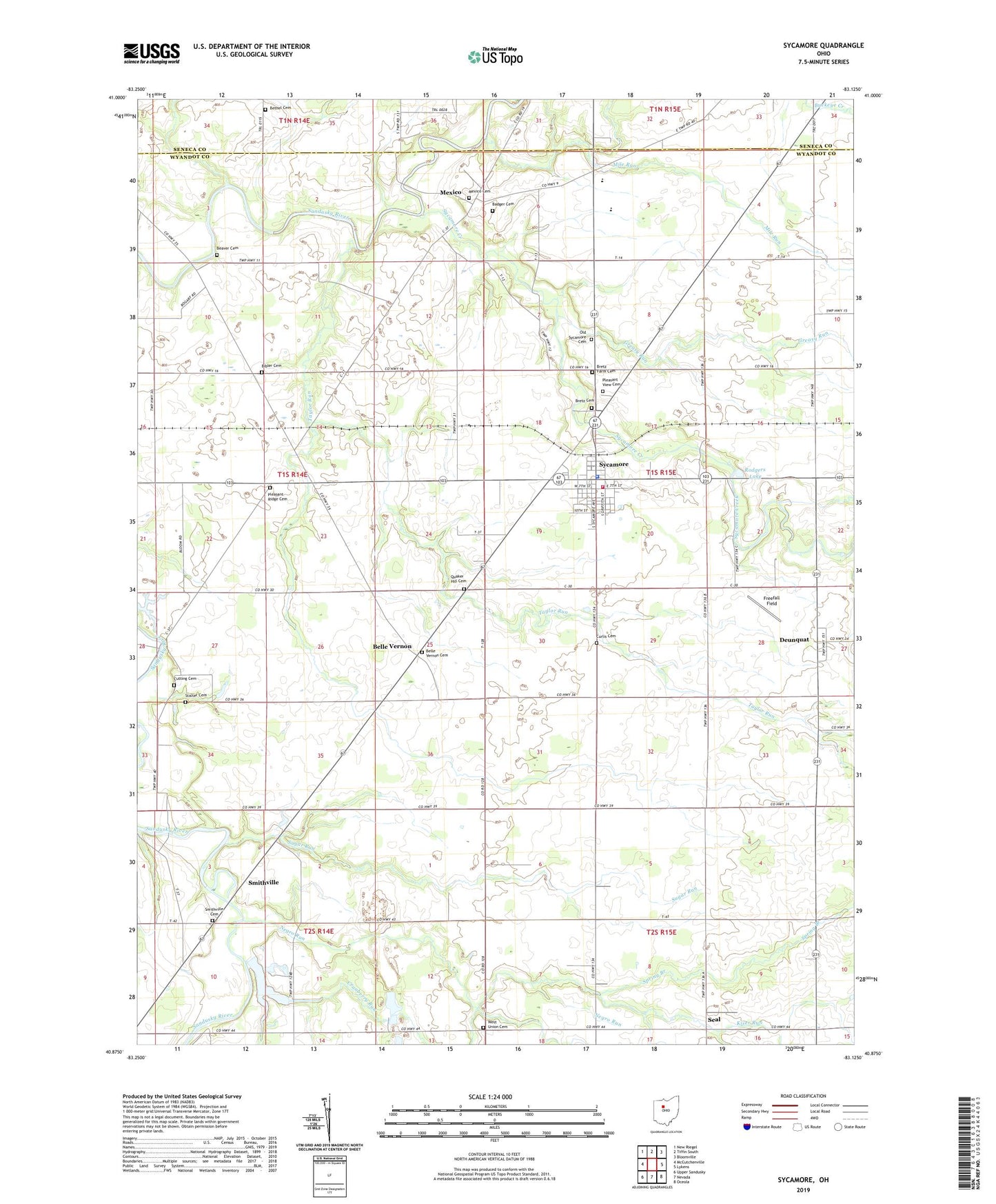
2019 topographic map quadrangle Sycamore in the state of Ohio. Scale: 1:24000. Based on the newly updated USGS 7.5' US Topo map series, this map is in the following counties: Wyandot, Seneca. The map contains contour data, water features, and other items you are used to seeing on USGS maps, but also has updated roads and other features. This is the next generation of topographic maps. Printed on high-quality waterproof paper with UV fade-resistant inks.
Quads adjacent to this one:
West: McCutchenville
Northwest: New Riegel
North: Tiffin South
Northeast: Bloomville
East: Lykens
Southeast: Oceola
South: Nevada
Southwest: Upper Sandusky
Contains the following named places: Badger Cemetery, Beaver Cemetery, Belle Vernon, Belle Vernon Cemetery, Belle Vernon Post Office, Bethel Cemetery, Bibler Cemetery, Bretz Cemetery, Bretz Farm Cemetery, Camp Pittenger, Cranberry Run, Curlis Cemetery, Cutting Cemetery, Deunquat, Deunquat Post Office, Duenquat Lutheran Church, Ellis Lake, Ellis Lake Dam, Freefall Field, Greasy Run, Kiser Run, Ma-chri-ka-be Lake, Mexico, Mexico Cemetery, Mexico Post Office, Mile Run, Mohawk High School, Mount Zion Church, Negro Run, Old Sycamore Cemetery, Pleasant Ridge Cemetery, Pleasant View Cemetery, Porcupine Creek, Quaker Hill Cemetery, Rodgers Lake, Saint Pius Catholic Church, Seal, Smithville, Smithville Cemetery, Spring Branch, Stalter Cemetery, Sugar Run, Sycamore, Sycamore Creek, Sycamore Elementary School, Sycamore Fire Department and Emergency Medical Services, Sycamore Post Office, Sycamore Village Police Department, Taylor Run, Touch of Gold Quarterhorse Farm, Township of Sycamore, Township of Tymochtee, Union Church, Village of Sycamore, West Union Cemetery, ZIP Code: 44882