
MyTopo
Tippecanoe Ohio US Topo Map
Couldn't load pickup availability
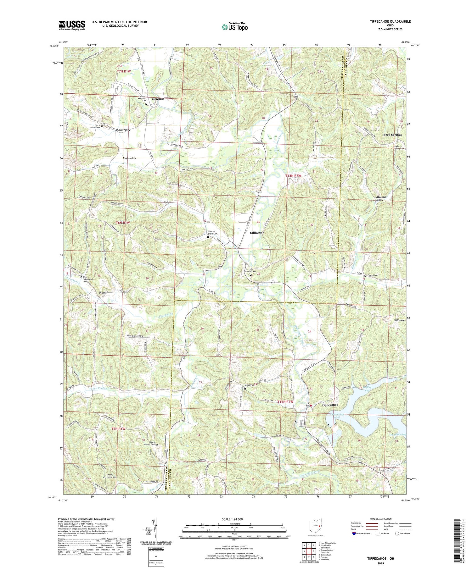
2019 topographic map quadrangle Tippecanoe in the state of Ohio. Scale: 1:24000. Based on the newly updated USGS 7.5' US Topo map series, this map is in the following counties: Tuscarawas, Harrison. The map contains contour data, water features, and other items you are used to seeing on USGS maps, but also has updated roads and other features. This is the next generation of topographic maps. Printed on high-quality waterproof paper with UV fade-resistant inks.
Quads adjacent to this one:
West: Gnadenhutten
Northwest: New Philadelphia
North: Uhrichsville
Northeast: Bowerston
East: Deersville
Southeast: Piedmont
South: Freeport
Southwest: Birmingham
Contains the following named places: Blizzard School, Brushy Fork, Chapel Cemetery, Clendening Dam, Crooked Creek, Crooked Creek Mine, Dutch Valley, Dutch Valley Cemetery, Dutch Valley School, Fallen Timber Creek, Feed Spring Cemetery, Feed Spring Church, Feed Spring Post Office, Feed Springs, Hefling Bay, Hefling Run, Hillside School, Hillview Baptist Church, Hitchcock Mine, Hitchcock Run, Latto School, Laurel Creek, Lima Church, Lima Church Cemetery, Lindon Family Cemetery, Log Cabin Bay, Mayes Cemetery, Mays School, McConnell Bay, Moore School, Mount Carmel Cemetery, Mount Carmel Church, Newport, Newport Methodist Cemetery, Newport Methodist Church, Pleasant Grove Cemetery, Pleasant Grove Church, Rock, Rock Post Office, Ross School, Rush, Rush Community Cemetery, Rush Community Church, Rush Post Office, Stillwater, Tippecanoe, Tippecanoe Census Designated Place, Tippecanoe Elementary School, Tippecanoe Mine, Tippecanoe Post Office, Toad Hollow, Township of Rush, Township of Washington, Utterback Hollow, Washington Township Volunteer Fire Department, Watson Creek, Watson School, Weaver Run, Weaver School, Wills Mountain, ZIP Codes: 44683, 44699


