MyTopo
Vickery Ohio US Topo Map
Couldn't load pickup availability
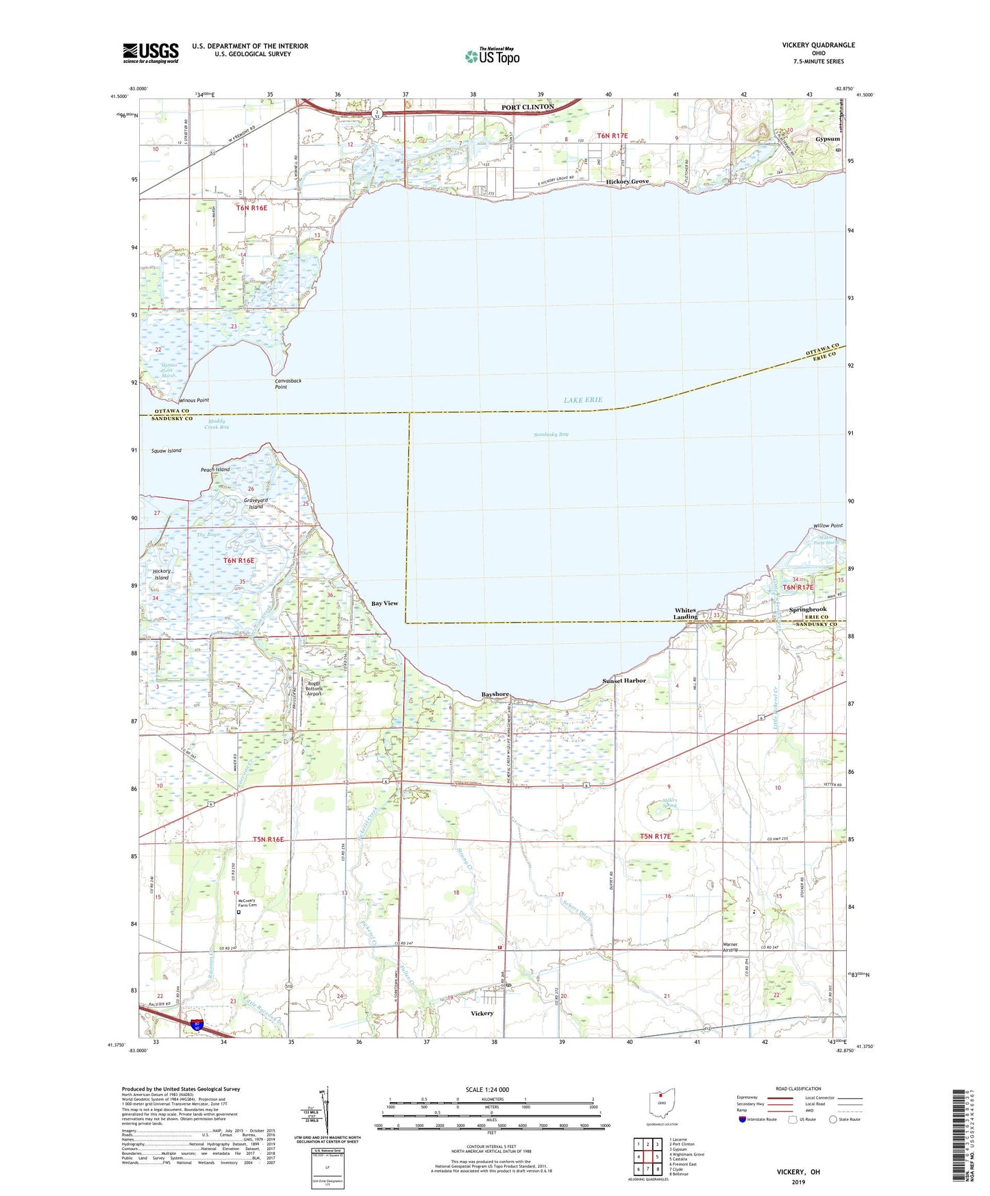
2019 topographic map quadrangle Vickery in the state of Ohio. Scale: 1:24000. Based on the newly updated USGS 7.5' US Topo map series, this map is in the following counties: Sandusky, Ottawa, Erie. The map contains contour data, water features, and other items you are used to seeing on USGS maps, but also has updated roads and other features. This is the next generation of topographic maps. Printed on high-quality waterproof paper with UV fade-resistant inks.
Quads adjacent to this one:
West: Wightmans Grove
Northwest: Lacarne
North: Port Clinton
Northeast: Gypsum
East: Castalia
Southeast: Bellevue
South: Clyde
Southwest: Fremont East
Contains the following named places: Bay Harbor Marina, Bay View, Bayshore, Blue Heron Reserve, Boggy Bottoms Airport, Canvasback Point, Cape Island, Eagle Island, Edgewater Estates, Fuller Creek, Good Shepherd Lutheran Church, Graveyard Island, Gypsum, Gypsum Tabernacle, Hickory Grove, Hickory Island, Little Pickerel Creek, Little Raccoon Creek, McCreary Farm Cemetery, Meggitt Farms, Miller Blue Hole Wildlife Area, Millers Spring, Negro Island, Ohio Agricultural Experimental Station, Peach Island, Pickerel Creek, Pickerel Creek Wildlife Area, Raccoon Creek, Riley Grange, Scherz Ditch, South Creek, Springbrook, Squaw Island, Strong Creek, Sunset Harbor, The Bogs, Townsend School, Townsend Township Volunteer Fire Department, Township of Townsend, Vickery, Vickery Census Designated Place, Vickery Post Office, Warner Airstrip, Whites Landing, Whites Landing Census Designated Place, Whitmore, Whitmore Post Office, Willow Point, Willow Point Marsh, Willow Point Wildlife Area, Winous Point, Winous Point Marsh, Winous Point Shooting Club, ZIP Code: 43464