MyTopo
Watson Ohio US Topo Map
Couldn't load pickup availability
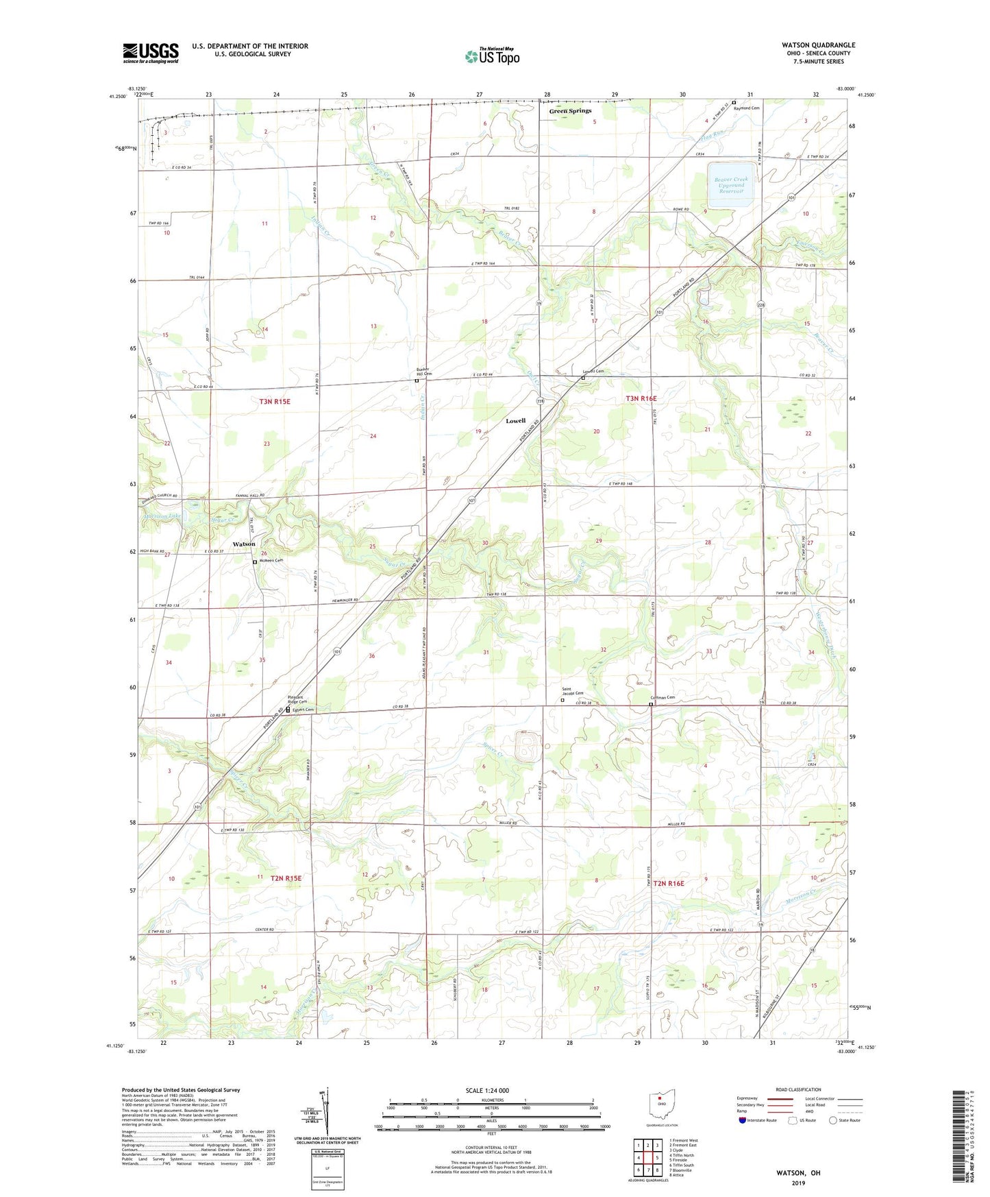
2019 topographic map quadrangle Watson in the state of Ohio. Scale: 1:24000. Based on the newly updated USGS 7.5' US Topo map series, this map is in the following counties: Seneca. The map contains contour data, water features, and other items you are used to seeing on USGS maps, but also has updated roads and other features. This is the next generation of topographic maps. Printed on high-quality waterproof paper with UV fade-resistant inks.
Quads adjacent to this one:
West: Tiffin North
Northwest: Fremont West
North: Fremont East
Northeast: Clyde
East: Fireside
Southeast: Attica
South: Bloomville
Southwest: Tiffin South
Contains the following named places: Beaver Creek, Beaver Creek Upground Reservoir, Beaver Creek Upground Reservoir Dam, Bunker Hill Cemetery, Clinton Heights Golf Course, Clinton Lake Campground, Coffman Cemetery, Egbert Cemetery, Emerson Creek, Lowell, Lowell Cemetery, McMeen Cemetery, Morrison Lake, Owl Creek, Pleasant Ridge Cemetery, Pleasant Ridge Church, Raymond Cemetery, Saint Jacobs Cemetery, Saint Jacobs Church, Township of Adams, Township of Clinton, Township of Scipio, Village of Republic, Watson, Watson Post Office, Weiker Airport, Westerhouse Ditch, ZIP Code: 44836