MyTopo
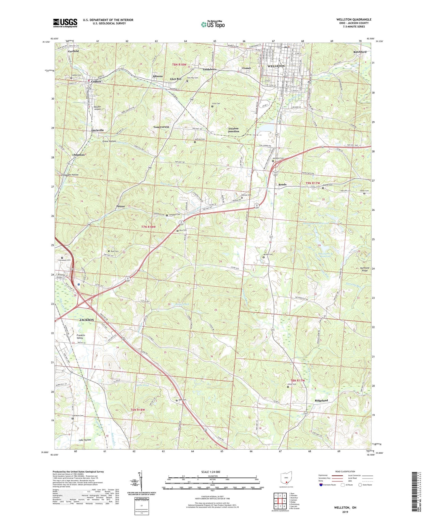
Wellston Ohio US Topo Map
Couldn't load pickup availability
2019 topographic map quadrangle Wellston in the state of Ohio. Scale: 1:24000. Based on the newly updated USGS 7.5' US Topo map series, this map is in the following counties: Jackson. The map contains contour data, water features, and other items you are used to seeing on USGS maps, but also has updated roads and other features. This is the next generation of topographic maps. Printed on high-quality waterproof paper with UV fade-resistant inks.
Quads adjacent to this one:
West: Jackson
Northwest: Byer
North: Hamden
Northeast: McArthur
East: Mulga
Southeast: Rio Grande
South: Oak Hill
Southwest: Petersburg
Contains the following named places: Altoona, Apostolic Tabernacle of Praise, Baisden Airport, Banquet Foods Reservoir, Banquet Foods Reservoir Dam, Baptist Cemetery, Bundy Elementary School, Bunn School, Campbell Cemetery, Central School, Chapman, Chapman Post Office, City of Wellston, Coalton, Coalton Cemetery, Coalton Elementary School, Coalton Post Office, Coalton Volunteer Fire Department, Columbia Chapel, Columbia School, Comet, Cornerstone Word of Life Church, Davisville, Di-Or Pond, Di-Or Pond Dam, Eisnaugle Hollow, Eliza School, Englishville, Fairmount Cemetery, Fairview School, First Baptist Church, Fourmile Creek, Franklin Valley, Garfield, Glen Roy, Glen Roy Cemetery, Glenroy Post Office, Goldsboro, Grace Hollow, Hale Cemetery, Hillside Chapel, Hoganville School, Hope United Methodist Church, Ironton Junction, Jackson County, Jackson County Fairground, Jackson County Home, Kansas School, Keenan Cemetery, Kessinger School, Lake Hollow, Latrobe, Latrobe School, Licks Cemetery, Locust Grove School, Maple Grove, McGee Cemetery, Meadow Run, Morgantown, Nazarene Church, Ohnoname 20 Dam, Ohnoname 20 Reservoir, Ohnoname 21 Dam, Ohnoname 21 Reservoir, Ohnoname 22 Dam, Ohnoname 22 Reservoir, Old Bunn Cemetery, Petrea, Petrea Post Office, Poore School, Poplar Grove School, Ratchford, Ratchford Post Office, Rice Cemetery, Ridgeland, Roads, Ryan Cemetery, Saints Peter and Paul Catholic Church, Saints Peter and Paul School, Salem Cemetery, Salem Church, Sand Run, Sickles Pond, Sickles Pond Dam, South School, Southeast Ohio Emergency Medical Services Station 8, Southeast Ohio Emergency Medical Services Station 9 Jackson, Sullivan Cemetery, Tom Corwin, Township of Coal, Township of Lick, Trinity United Methodist Church, Union Cemetery, Union Chapel, Victory School, Village of Coalton, Walnut Grove School, WCJO-FM (Jackson), Wells School, Wellston, Wellston Church of God, Wellston High School, Wellston Landfill, Wellston Police Department, Wellston Post Office, Wellston Presbyterian Church, Winters Airport, WKOV-AM (Wellston), WKOV-FM (Wellston), WLMJ Radio Tower, WLMJ-AM (Jackson), Woodson Cemetery, ZIP Codes: 45621, 45692